Beauharnois-Salaberry Regional County Municipality
Beauharnois-Salaberry | |
|---|---|
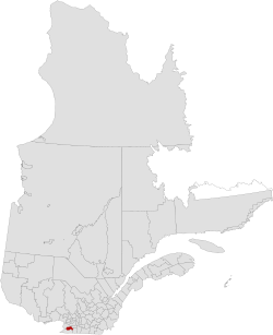 Location in province of Quebec | |
| Coordinates: 45°19′N 73°56′W / 45.32°N 73.93°WCoordinates: 45°19′N 73°56′W / 45.32°N 73.93°W[1] | |
| Country | |
| Province | |
| Region | Montérégie |
| Effective | January 1, 1982 |
| County seat[2] | Beauharnois |
| Government | |
| • Type | Prefecture |
| • Prefect | Yves Daoust |
| Area | |
| • Total | 523.10 km2 (201.97 sq mi) |
| • Land | 471.26 km2 (181.95 sq mi) |
| Population (2016)[3] | |
| • Total | 64,320 |
| • Density | 136.5/km2 (354/sq mi) |
| • Change 2011–2016 | |
| • Dwellings | 30,151 |
| Time zone | UTC−5 (EST) |
| • Summer (DST) | UTC−4 (EDT) |
| Area code(s) | 450 and 579 |
| Website | www |

Beauharnois-Salaberry is a regional county municipality in the Montérégie region of Quebec, Canada. Its seat is Beauharnois.[2]
History[]
The RCM was formed by combining the historic counties of and .
Subdivisions[]
There are 7 subdivisions within the RCM:[2]
- Cities & Towns (2)
- Municipalities (4)
- Parishes (1)
Demographics[]
| Year | Pop. | ±% |
|---|---|---|
| 1991 | 59,785 | — |
| 1996 | 59,769 | −0.0% |
| 2001 | 59,137 | −1.1% |
| 2006 | 60,802 | +2.8% |
| 2011 | 61,950 | +1.9% |
| 2016 | 64,320 | +3.8% |
| [4][5][3] | ||
| hideCanada census – Beauharnois-Salaberry Regional County Municipality community profile | |||
|---|---|---|---|
| 2016 | 2011 | 2006 | |
| Population: | 64,320 (+3.8% from 2011) | 61,950 (+1.9% from 2006) | 60,802 (+2.8% from 2001) |
| Land area: | 471.26 km2 (181.95 sq mi) | 470.68 km2 (181.73 sq mi) | 470.68 km2 (181.73 sq mi) |
| Population density: | 136.5/km2 (354/sq mi) | 131.6/km2 (341/sq mi) | 129.2/km2 (335/sq mi) |
| Median age: | 46.5 (M: 44.7, F: 48.2) | 46.1 (M: 44.6, F: 47.4) | 43.9 (M: 42.6, F: 45.1) |
| Total private dwellings: | 30,151 | 28,829 | 27,158 |
| Median household income: | $54,509 | $48,621 | $43,719 |
| References: 2016[6] 2011[7] 2006[8] earlier[9] | |||
Language[]
| Canada Census Mother Tongue – Beauharnois-Salaberry Regional County Municipality[4][5][3] | ||||||||||||||||||
|---|---|---|---|---|---|---|---|---|---|---|---|---|---|---|---|---|---|---|
| Census | Total | French
|
English
|
French & English
|
Other
| |||||||||||||
| Year | Responses | Count | Trend | Pop % | Count | Trend | Pop % | Count | Trend | Pop % | Count | Trend | Pop % | |||||
2016
|
63,060
|
59,430 | 94.2% | 1,925 | 3.3% | 595 | 0.9% | 985 | 1.6% | |||||||||
2011
|
61,180
|
58,000 | 94.80% | 1,925 | 3.15% | 645 | 1.05% | 610 | 1.00% | |||||||||
2006
|
59,405
|
56,540 | 95.18% | 1,695 | 2.85% | 350 | 0.59% | 820 | 1.38% | |||||||||
2001
|
58,060
|
55,360 | 95.35% | 1,780 | 3.07% | 410 | 0.71% | 510 | 0.88% | |||||||||
1996
|
58,790
|
56,315 | n/a | 64.04% | 1,570 | n/a | 32.24% | 480 | n/a | 1.50% | 425 | n/a | 2.23% | |||||
Transportation[]
Access routes[]
Highways and numbered routes that run through the municipality, including external routes that start or finish at the county border:[10]
- Autoroutes
- Principal Highways
- Secondary Highways
- External Routes
- None
Attractions[]
- Beauharnois Canal
- Beauharnois Hydroelectric Generating Station (Melocheville)
- Deux-Rives Ecomuseum (Salaberry-de-Valleyfield)
- Howick Airport (Saint-Étienne-de-Beauharnois)
- Pointe-du-Bruisson Archaeological Park (Melocheville)
- Valleyfield Airport (Saint-Stanislas-de-Kostka)
Protected areas:
- Îles-de-Paix National Fauna Reserve
- Îles-de-Saint-Timothée Regional Park
See also[]
References[]
- ^ Reference number 141118 of the Commission de toponymie du Québec (in French)
- ^ Jump up to: a b c d e Geographic code 700 in the official Répertoire des municipalités (in French)
- ^ Jump up to: a b c d "Census Profile, 2016 Census: Beauharnois-Salaberry, Municipalité régionale de comté [Census division], Quebec". Statistics Canada. Retrieved November 26, 2019.
- ^ Jump up to: a b Statistics Canada: 1996, 2001, 2006, 2011 census
- ^ Jump up to: a b "(Code 2470) Census Profile". 2011 census. Statistics Canada. 2012.
- ^ "2016 Community Profiles". 2016 Canadian Census. Statistics Canada. February 21, 2017. Retrieved 2019-11-26.
- ^ "2011 Community Profiles". 2011 Canadian Census. Statistics Canada. July 5, 2013. Retrieved 2014-01-27.
- ^ "2006 Community Profiles". 2006 Canadian Census. Statistics Canada. March 30, 2011. Retrieved 2013-05-11.
- ^ "2001 Community Profiles". 2001 Canadian Census. Statistics Canada. February 17, 2012.
- ^ Official Transport Quebec Road Map
External links[]
 Media related to Beauharnois-Salaberry Regional County Municipality at Wikimedia Commons
| show Adjacent Counties & Equivalent Territories |
|---|
| hide | |
|---|---|
| Regional county municipalities and equivalent territories | |
| Municipalities |
|
| Authority control |
|
|---|
Categories:
- Beauharnois-Salaberry Regional County Municipality
- Census divisions of Quebec