Belín
Belín | |
|---|---|
Municipality | |
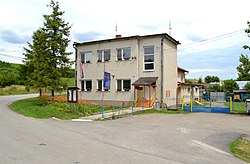 | |
 Belín Location of Belín in the Banská Bystrica Region | |
| Coordinates: 48°21′N 20°07′E / 48.350°N 20.117°ECoordinates: 48°21′N 20°07′E / 48.350°N 20.117°E | |
| Country | |
| Region | Banská Bystrica |
| District | Rimavská Sobota |
| First mentioned | 1349 |
| Area | |
| • Total | 4.196168 km2 (1.620150 sq mi) |
| Elevation | 219 m (719 ft) |
| Population (2011) | |
| • Total | 193 |
| • Density | 46/km2 (120/sq mi) |
| Time zone | UTC+1 (CET) |
| • Summer (DST) | UTC+2 (CEST) |
| Postal code | 980 01 |
| Area code(s) | +421-47 |
| Car plate | RS |
| Website | obecbelin.sk |


Belín is a village and municipality in the Rimavská Sobota District of the Banská Bystrica Region of southern Slovakia.[1] In the village is foodstuff store, public library and football pitch. Important sightseeing is late-classical church.
History[]
The village arose in the late 12th century. In historical records the village was first mentioned in 1349. In 1823 had been in the village 23 houses. Locals were engaged in agriculture and a hand made production of brooms and brushes.
See also[]
References[]
- ^ "Statistical Office of the slovak Republic" (PDF). Výsledky SODB 2011. Štatistický úrad SR. Archived from the original (PDF) on 2013-10-12. Retrieved 9 August 2012.
Genealogical resources[]
The records for genealogical research are available at the state archive "Statny Archiv in Banska Bystrica, Slovakia"
- Roman Catholic church records (births/marriages/deaths): 1768-1878 (parish B)
- Reformated church records (births/marriages/deaths): 1780-1897 (parish B)
External links[]
 Media related to Belín at Wikimedia Commons
- Official website

- https://web.archive.org/web/20070427022352/http://www.statistics.sk/mosmis/eng/run.html
- http://www.e-obce.sk/obec/belin/belin.html
- Surnames of living people in Belin[permanent dead link]
This article about a location in the Rimavská Sobota District of Slovakia is a stub. You can help Wikipedia by . |
Categories:
- Villages and municipalities in Rimavská Sobota District
- Rimavská Sobota District geography stubs