Beldanga
Beldanga
Beldanga | |
|---|---|
Town | |
| Beldanga | |
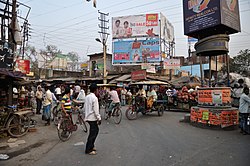 Barua Crossing, Beldanga | |
| Nickname(s): Beldanga | |
 Beldanga Location in West Bengal, India | |
| Coordinates: 23°56′N 88°15′E / 23.93°N 88.25°ECoordinates: 23°56′N 88°15′E / 23.93°N 88.25°E | |
| Country | |
| State | West Bengal |
| District | Murshidabad |
| Government | |
| • Type | Federal democracy |
| • Body | Beldanga Municipality |
| Area | |
| • Total | 3.98 km2 (1.54 sq mi) |
| Elevation | 20 m (70 ft) |
| Population (2011)[1] | |
| • Total | 29,182 |
| • Density | 7,300/km2 (19,000/sq mi) |
| Languages | |
| • Official | Bengali, English |
| Time zone | UTC+5:30 (IST) |
| PIN | 742133, 742189 |
| Lok Sabha constituency | Baharampur |
| Vidhan Sabha constituency | Beldanga |


Beldanga is a municipality town under the Barhampur subdivision of Murshidabad district in the state of West Bengal, India. Beldanga is an important trade centre of this district.
Geography[]
M: municipal town, CT: census town, R: rural/ urban centre, H: historical centres
Owing to space constraints in the small map, the actual locations in a larger map may vary slightly
Location[]
Beldanga is located at 23°56′N 88°15′E / 23.93°N 88.25°E.[2] It has an average elevation of 20 metres (65 feet).
Area overview[]
The area shown in the map alongside, covering Berhampore and Kandi subdivisions, is spread across both the natural physiographic regions of the district, Rarh and Bagri.[3][4]The headquarters of Murshidabad district, Berhampore, is in this area.[5]The ruins of Karnasubarna, the capital of Shashanka, the first important king of ancient Bengal who ruled in the 7th century, is located 9.6 kilometres (6.0 mi) south-west of Berhampore.[6][7][8] The entire area is overwhelmingly rural with over 80% of the population living in the rural areas.[9]
Note: The map alongside presents some of the notable locations in the subdivisions. All places marked in the map are linked in the larger full screen map.
Demographics[]
According to the 2011 Census of India, Beldanga had a total population of 29,205, of which 14,694 (50%) were males and 14,511 (50%) were females. Population in the age range 0-6 years was 3,583. The total number of literate persons in Beldanga was 21,169 (82.62% of the population over 6 years).[10]
As per 2001 Census of India,[11] Beldanga had a population of 25,361. Males constitute 52% of the population and females 48%. Beldanga has an average literacy rate of 67%, higher than the national average of 59.5%; with 55% of the literates being male and 45% being female. 13% of the population is under 6 years of age.
Civic administration[]
Police station[]
Beldanga police station has jurisdiction over Beldanga municipal area and a part of Beldanga I CD Block.[12]
Infrastructure[]
According to the District Census Handbook, Murshidabad, 2011, Beldanga covered an area of 3.98 km2. It had 50.73 km roads with open drains. The protected water-supply involved overhead tank etc. It had 3,713 domestic electric connections, 1,556 road lighting points. Among the medical facilities it had 2 hospitals (with 55 beds), 3 dispensaries/ health centres, 3 family welfare centres, 3 maternity & child welfare centre, 2 nursing homes, 2 charitable hospital/ nursing homes, 66 medicine shops. Among the educational facilities, it had 17 primary schools, 5 middle schools, 5 secondary schools, 3 senior secondary schools, 1 general degree college. It had 5 recognised shorthand, typewriting & vocational training institutes, 14 non-formal education centre (Sarva Shiksha Abhiyan), 2 orphanage home, 1 old age home. Among the social, recreational & cultural facilities it had 2 cinema theatres, 1 auditorium/ community hall, 2 public libraries, 1 reading room. It produced nose pins, sweets, and had facilities for jute bailing. It had the branch offices of 6 nationalised banks, 1 private commercial bank, 1 cooperative bank, 2 agricultural credit societies, 8 non-agricultural credit societies.[13]
Transport[]
Beldanga railway station is well connected with Kolkata via Sealdah-Lalgola Division Railway. National Highway 12 passes through the Barua More, Beldanga town.
Education[]
S.R. Fatepuria College was established at Beldanga in 1965. It is affiliated to the University of Kalyani and offers BSc, BA (Hons) in Bengali and BCom (Hons) courses.[14] There are number of other educational institute
- Beldanga CRGS High School
- Kazisaha High Madrasha
- Beldanga Humayun Kabir Memorial B.Ed College
- Mederdhar Shishu Madrasah
- Mederdhar Primary School
- Hareknagar AM Institution
- Harimati Girl's High School
- Banipith Girl's High School
- Sarat Pally Balika Vidyalay
- Shrish Chandra Vidyapith
- Swami Pranabananda Vidyapith
- Beldanga Path Bhawan
Healthcare[]
Beldanga Rural Hospital functions with 30 beds and Beldanga Block Primary Health Centre functions with 25 beds.[15]
See also[]
- Beldanga I (Community development block)
- Beldanga II (Community development block)
References[]
- ^ a b "Beldanga City".
- ^ Falling Rain Genomics, Inc - Beldanga
- ^ "District Census Handbook: Murshidabad, Series 20 Part XII A" (PDF). Physiography, Page 13. Directorate of Census Operations, West Bengal, 2011. Retrieved 24 July 2017.
- ^ "Murshidabad". Geography. Murshidabad district authorities. Retrieved 24 July 2017.
- ^ "Murshidabad". Murshidabad district authorities. Retrieved 12 September 2017.
- ^ Ray, Nihar Ranjan, Bangalir Itihas Adi Parba, (in Bengali), 1980 edition, pp. 160-161, Paschim Banga Niraksharata Durikaran Samiti
- ^ Sengupta, Nitish, History of the Bengali-speaking People, p.25, UBS Publishers’ Distributors Pvt. Ltd.
- ^ Majumdar, Dr. R.C., History of Ancient Bengal, first published 1971, reprint 2005, pp. 5-6, Tulshi Prakashani, Kolkata, ISBN 81-89118-01-3.
- ^ "District Census Handbook, Murshidabad, Series 20, Part XII B" (PDF). District Primary Census Abstract page 26. Directorate of Census Operations West Bengal. Retrieved 2 July 2021.
- ^ "District Census Handbook, Murshidabad, Series 20, Part XII B" (PDF). Rural PCA-C.D. blocks wise Village Primary Census Abstract, location no. 801661, page 44-45. Directorate of Census Operations West Bengal. Retrieved 5 July 2021.
- ^ "Census of India 2001: Data from the 2001 Census, including cities, villages and towns (Provisional)". Census Commission of India. Archived from the original on 16 June 2004. Retrieved 1 November 2008.
- ^ "District Statistical Handbook 2014 Murshidabad". Table 2.1. Department of Statistics and Programme Implementation, Government of West Bengal. Archived from the original on 29 July 2017. Retrieved 17 May 2017.
- ^ "District Census Handbook Murshidabad, Census of India 2011, Series 20, Part XII A" (PDF). Section II Town Directory, Pages 981-987: Statement I: Growth History, Pages 990-993: Statement III: Civic & Other Amenities, Pages 993-995: Statement IV: Medical Facilities 2009, Pages 995-1001 Section V: Educational, Recreational and Cultural Facilities; Pages 1 001- 1002: Statement VI: Industry & Banking. Directorate of Census Operations, West Bengal. Retrieved 26 June 2021.
- ^ "Sewnarayan Rameswar Fatepuria College". Shiksha. Retrieved 12 September 2017.
- ^ "Health & Family Welfare Department". Health Statistics. Government of West Bengal. Retrieved 19 September 2017.
Cities, towns and locations in Murshidabad district, Malda division | ||||||||||||
|---|---|---|---|---|---|---|---|---|---|---|---|---|
| Cities, municipal and census towns |
|  Divisions of West Bengal | ||||||||||
| Locations other than cities and towns |
| |||||||||||
| Neighbourhoods |
| |||||||||||
| Related topics |
| |||||||||||
Murshidabad district topics | |||||||||||
|---|---|---|---|---|---|---|---|---|---|---|---|
| General |
| Divisions of West Bengal | |||||||||
| History |
| ||||||||||
| Subdivisions |
| ||||||||||
| Municipalities |
| ||||||||||
| Community development blocks |
| ||||||||||
| Rivers |
| ||||||||||
| Transport |
| ||||||||||
| Railway stations |
| ||||||||||
| Institutes of higher learning | |||||||||||
| Lok Sabha constituencies |
| ||||||||||
| Vidhan Sabha constituencies | |||||||||||
| Former Vidhan Sabha constituencies | |||||||||||
| Villages | |||||||||||
| See also |
| ||||||||||
- Cities and towns in Murshidabad district