Bellevue Airfield
Bellevue Airfield | |||||||||||
|---|---|---|---|---|---|---|---|---|---|---|---|
| Summary | |||||||||||
| Airport type | defunct | ||||||||||
| Location | Bellevue, Washington, U.S. | ||||||||||
| Opened | c. 1945 | ||||||||||
| Closed | 1983 | ||||||||||
| Time zone | Pacific (UTC−8) | ||||||||||
| • Summer (DST) | (UTC−7) | ||||||||||
| Elevation AMSL | 345 ft / 105 m | ||||||||||
| Coordinates | 47°34′59″N 122°07′52″W / 47.583°N 122.131°WCoordinates: 47°34′59″N 122°07′52″W / 47.583°N 122.131°W | ||||||||||
| Map | |||||||||||
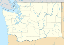 Bellevue Airfield | |||||||||||
| Runways | |||||||||||
| |||||||||||


Bellevue Airfield (BVU) was a private airfield in the northwest United States, located in Bellevue, Washington, a suburb east of Seattle. Closed in 1983, it was situated east of 156th Avenue SE and north of Interstate 90 near Phantom Lake. The 2,300-foot (700 m) asphalt runway's elevation was at 345 feet (105 m) above sea level, and ran southwest to northeast (marked 2/20). Today, the area is an office park.
When the LDS Seattle Washington Temple opened in 1980, the airfield was still in operation and the temple spire included a strobe light.[1]
Remnants of the north end of the old runway could be seen until the construction of the Advanta Office Commons buildings leased by Microsoft.
The only remnants still visible are the red and white lamp posts with two red strobe lights on top still on nearby overpasses.[2]
References[]
- ^ "New Mormon temple won't be run-of-the-mill church". Lewiston Morning Tribune. Associated Press. August 9, 1980. p. 4B.
- ^ Banel, Feliks (May 2, 2018). "Searching for traces of Bellevue's phantom airfield". KIRO Radio. Retrieved October 14, 2019.
External links[]
- History of airfield with photos at the Abandoned & Little-Known Airfields site.
- Aerial photo of airfield in 1969 at Seattle Times Eastside News
- Pictures of the old airstrip and helipad before the Advanta Office Commons buildings leased by Microsoft were constructed
This article about a building or structure in the U.S. state of Washington is a stub. You can help Wikipedia by . |
This article about an airport in the U.S. state of Washington is a stub. You can help Wikipedia by . |
- Airports in King County, Washington
- Washington (state) building and structure stubs
- Western United States airport stubs
- Washington (state) transportation stubs