Bergambacht
Bergambacht | |
|---|---|
Village and former municipality | |
 Windmill Den Arend in Bergambacht | |
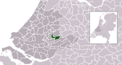 Location in South Holland | |
| Coordinates: 51°56′N 4°47′E / 51.933°N 4.783°ECoordinates: 51°56′N 4°47′E / 51.933°N 4.783°E | |
| Country | Netherlands |
| Province | South Holland |
| Municipality | Krimpenerwaard |
| Area | |
| • Total | 38.06 km2 (14.70 sq mi) |
| • Land | 35.10 km2 (13.55 sq mi) |
| • Water | 2.96 km2 (1.14 sq mi) |
| Elevation | 1 m (3 ft) |
| Population (January 2019)[3] | |
| • Total | 10.016 |
| Time zone | UTC+1 (CET) |
| • Summer (DST) | UTC+2 (CEST) |
| Postcode | 2825, 2860–2861, 2865 |
| Area code | 0182 |
| Website | www |

Bergambacht (Dutch pronunciation: [bɛrxˈ(ʔ)ɑmbɑxt] (![]() listen)) is a village and former municipality in the western Netherlands, in the province of South Holland. Since 2015 it has been a part of the municipality of Krimpenerwaard.
listen)) is a village and former municipality in the western Netherlands, in the province of South Holland. Since 2015 it has been a part of the municipality of Krimpenerwaard.
The former municipality covered an area of 38.06 km2 (14.70 sq mi) of which 2.96 km2 (1.14 sq mi) was water, and had a population of data missing as of 2019. The former municipality included the communities of Ammerstol and Berkenwoude, which were separate municipalities until they merged with Bergambacht in 1985.
Topography[]

Topographic map of the former municipality of Bergambacht, 2013.
Notable people[]
- Meindert Leerling (1936–2021), journalist and politician
References[]
- ^ "Kerncijfers wijken en buurten 2020" [Key figures for neighbourhoods 2020]. StatLine (in Dutch). CBS. 24 July 2020. Retrieved 19 September 2020.
- ^ "Postcodetool for 2861AH". Actueel Hoogtebestand Nederland (in Dutch). Het Waterschapshuis. Retrieved 14 July 2013.
- ^ "Bevolkingsontwikkeling; regio per maand" [Population growth; regions per month]. CBS Statline (in Dutch). CBS. 1 January 2019. Retrieved 1 January 2019.
External links[]
| hide Places adjacent to Bergambacht | ||||||||||
|---|---|---|---|---|---|---|---|---|---|---|
| ||||||||||
This South Holland location article is a stub. You can help Wikipedia by . |
Categories:
- Former municipalities of South Holland
- Populated places in South Holland
- Krimpenerwaard
- South Holland geography stubs