Municipalities of the Netherlands
| Municipalities of the Netherlands Nederlandse gemeenten (Dutch) | |
|---|---|
 Map of municipalities of the Netherlands after the mergers of 1 January 2021 | |
| Category | Municipality |
| Location | Netherlands |
| Found in | Provinces |
| Number | 352 (as of 1 January 2021) |
| Possible types |
|
| Government | |
![Azure, billetty Or a lion with a coronet Or armed and langued Gules holding in his dexter paw a sword Argent hilted Or and in the sinister paw seven arrows Argent pointed and bound together Or. [The seven arrows stand for the seven provinces of the Union of Utrecht.] The shield is crowned with the (Dutch) royal crown and supported by two lions Or armed and langued gules. They stand on a scroll Azure with the text (Or) "Je Maintiendrai" (French for "I will maintain".)](http://upload.wikimedia.org/wikipedia/commons/thumb/8/8f/State_coat_of_arms_of_the_Netherlands.svg/150px-State_coat_of_arms_of_the_Netherlands.svg.png) |
|---|
|
As of January 2021, there are 352 municipalities (Dutch: gemeenten) and three special municipalities (bijzondere gemeenten) in the Netherlands. The latter is the status of three of the six island territories that make up the Dutch Caribbean. Municipalities are the second-level administrative division, or public bodies (openbare lichamen), in the Netherlands and are subdivisions of their respective provinces. Their duties are delegated to them by the central government and they are ruled by a municipal council that is elected every four years. Municipal mergers have reduced the total number of municipalities by two-thirds since the first official boundaries were created in the mid 19th century. Municipalities themselves are informally subdivided into districts and neighbourhoods for administrative and statistical purposes.[1]
These municipalities come in a wide range of sizes, Westervoort is the smallest with a land area of 7.03 km2 (2.71 sq mi) and Súdwest-Fryslân the largest with a land area of 523.01 km2 (201.94 sq mi). Schiermonnikoog is both the least populated and the least densely populated municipality at 23/km2 (60/sq mi). Amsterdam has the highest population with 872,757 residents, whereas The Hague is the most densely populated with a density of 6,620/km2 (17,100/sq mi).
Municipal status[]
As a second level administrative division municipalities are the third tier of public administration in the Netherlands after the central government and the provinces.[2][3] The Netherlands is a decentralized unitary state, which means that the central government is supreme and delegates certain tasks to lower levels of government by law.[4] The different levels do, however, make work agreements, which give municipalities a certain degree of independence in their policy decisions. Municipalities are responsible for a wide variety of public services, which include land-use planning, public housing, management and maintenance of local roads, waste management and social security.[5] After the dissolution of the Netherlands Antilles in 2010 three special municipalities (officially public bodies) were formed. These municipalities function the same as regular municipalities and are grouped together as the Caribbean Netherlands and are not part of a province.[6]
The municipalities are governed by both a board of mayor and aldermen and a municipal council. The municipal council, which is titled island council in the special municipalities, is elected every four years.[7] The number of members in the council ranges from nine members for the smallest municipalities to forty-five members for the largest.[8] It is the highest administrative body in the municipality and controls public policy. The executive power lies with the executive board, which consists of a mayor, titled lieutenant governor in the special municipalities, and multiple aldermen, titled island deputies in the special municipalities. The mayor is appointed for six years at a time by the crown and the alderman are elected by the municipal council, typically after each municipal election.[9] The mayor is responsible for public order and is the first in command during emergencies, all other tasks are distributed freely between mayor and aldermen. The exact portfolio for each person differs between each municipality.[6][10][11]
Official municipal boundaries were first drawn up in 1832 in the Netherlands after a cadastre was formed. The Municipalities Act of 1851, written by prime minister Thorbecke, led to the disappearance of small municipalities. Throughout the years, less populous municipalities have been merged. They were either added to the larger neighbouring cities or multiple smaller municipalities merged into a larger new municipality with a new name. The number of municipalities reduced from 1,209 in 1850 to 537 in 2000; as of 2021 there are 352 municipalities. During this time, multiple mergers occurred simultaneously in large parts of individual provinces; the municipal boundaries were basically redrawn in these regions.[12][1][14] In the 19th and large parts of the 20th century, municipal mergers were forced by the central government. This policy changed in the end of the 20th century; local support for the merger is now a large part of the decision-making process. The larger, merged municipalities are intended to handle an increasing workload because more public services are delegated from higher levels of government to the municipalities. Another reason for municipal mergers is the assumption that larger municipalities are more efficient in performing their tasks than smaller ones.[14][15]
Municipalities have the right to decentralise themselves and form submunicipalities as an additional level of government. This right and the submunicipalities will cease to exist in the near future to reduce the number of levels of government.[16] Only Amsterdam,[17] where the districts are called stadsdelen, as well as Rotterdam,[18] where the districts are called deelgemeenten, consist of such formal subdivisions. The Hague,[19] Almere,[20] Breda, Eindhoven,[21] Enschede, Groningen,[22] Nijmegen,[23] Tilburg[24] and Utrecht have instituted stadsdelen as well, although they do not have the same legal submunicipal status. For administrative use by municipalities and data collection by Statistics Netherlands all municipalities are subdivided into districts (wijken), which in turn are subdivided into neighbourhoods (buurten).[25] These subdivisions have, in contrast to the submunicipalities, no formal status.
Municipalities[]
Regular municipalities[]

| Province | Munici- palities |
|---|---|
| Drenthe | 12 |
| Flevoland | 6 |
| Friesland | 18 |
| Gelderland | 51 |
| Groningen | 10 |
| Limburg | 31 |
| North Brabant | 61 |
| North Holland | 47 |
| Overijssel | 25 |
| South Holland | 52 |
| Utrecht | 26 |
| Zeeland | 13 |
| Total | 352 |
| Municipality[a] | CBS code[1] | Province | Population[b][26] | Population density[c][27] | Land area[d][27] | Map |
|---|---|---|---|---|---|---|
| 1680 | Drenthe | 25,392 | 92/km2 (240/sq mi) | 276.09 km2 (106.60 sq mi) | 
| |
| 0358 | North Holland | 31,986 | 1,584/km2 (4,100/sq mi) | 20.12 km2 (7.77 sq mi) | 
| |
| 0197 | Gelderland | 27,120 | 281/km2 (730/sq mi) | 96.54 km2 (37.27 sq mi) | 
| |
| 0059 | Friesland | 27,900 | 272/km2 (700/sq mi) | 102.23 km2 (39.47 sq mi) | 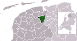
| |
| 0482 | South Holland | 20,126 | 2,297/km2 (5,950/sq mi) | 8.78 km2 (3.39 sq mi) | 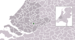
| |
| 0613 | South Holland | 25,799 | 1,180/km2 (3,100/sq mi) | 21.69 km2 (8.37 sq mi) | 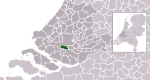
| |
| 0361 | North Holland | 109,897 | 991/km2 (2,570/sq mi) | 110.46 km2 (42.65 sq mi) | 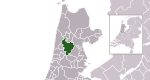
| |
| 0141 | Overijssel | 73,140 | 1,087/km2 (2,820/sq mi) | 67.27 km2 (25.97 sq mi) | 
| |
| 0034 | Flevoland | 214,757 | 1,640/km2 (4,200/sq mi) | 129.19 km2 (49.88 sq mi) | 
| |
| 0484 | South Holland | 112,580 | 886/km2 (2,290/sq mi) | 126.23 km2 (48.74 sq mi) | 
| |
| 1723 | North Brabant | 10,371 | 110/km2 (280/sq mi) | 93.04 km2 (35.92 sq mi) | 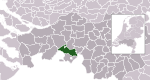
| |
| 1959 | North Brabant | 56,343 | 279/km2 (720/sq mi) | 200.63 km2 (77.46 sq mi) | 
| |
| 0060 | Friesland | 3,747 | 63/km2 (160/sq mi) | 59.11 km2 (22.82 sq mi) | 
| |
| 0307 | Utrecht | 157,438 | 2,512/km2 (6,510/sq mi) | 62.62 km2 (24.18 sq mi) | 
| |
| 0362 | North Holland | 90,746 | 2,229/km2 (5,770/sq mi) | 41.13 km2 (15.88 sq mi) | 
| |
| 0363 | North Holland | 872,922 | 5,273/km2 (13,660/sq mi) | 165.50 km2 (63.90 sq mi) | 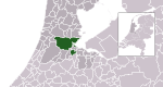
| |
| 0200 | Gelderland | 164,770 | 482/km2 (1,250/sq mi) | 339.89 km2 (131.23 sq mi) | 
| |
| 0202 | Gelderland | 162,477 | 1,649/km2 (4,270/sq mi) | 97.82 km2 (37.77 sq mi) | 
| |
| 0106 | Drenthe | 68,833 | 838/km2 (2,170/sq mi) | 81.89 km2 (31.62 sq mi) | 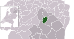
| |
| 0743 | North Brabant | 16,804 | 238/km2 (620/sq mi) | 70.17 km2 (27.09 sq mi) | 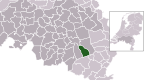
| |
| 0744 | North Brabant | 6,906 | 90/km2 (230/sq mi) | 76.14 km2 (29.40 sq mi) | 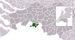
| |
| 0308 | Utrecht | 24,784 | 764/km2 (1,980/sq mi) | 32.54 km2 (12.56 sq mi) | 
| |
| 0489 | South Holland | 48,637 | 2,467/km2 (6,390/sq mi) | 19.75 km2 (7.63 sq mi) | 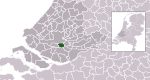
| |
| 0203 | Gelderland | 59,993 | 336/km2 (870/sq mi) | 175.90 km2 (67.92 sq mi) | 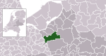
| |
| 0888 | Limburg | 15,883 | 754/km2 (1,950/sq mi) | 21.03 km2 (8.12 sq mi) | 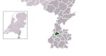
| |
| 1954 | Limburg | 36,057 | 459/km2 (1,190/sq mi) | 78.30 km2 (30.23 sq mi) | 
| |
| 0370 | North Holland | 10,105 | 142/km2 (370/sq mi) | 70.58 km2 (27.25 sq mi) | 
| |
| 0889 | Limburg | 13,448 | 482/km2 (1,250/sq mi) | 27.99 km2 (10.81 sq mi) | 
| |
| 1945 | Gelderland | 35,008 | 405/km2 (1,050/sq mi) | 86.31 km2 (33.32 sq mi) | 
| |
| 1724 | North Brabant | 18,755 | 184/km2 (480/sq mi) | 101.00 km2 (39.00 sq mi) | 
| |
| 0893 | Limburg | 13,111 | 127/km2 (330/sq mi) | 103.24 km2 (39.86 sq mi) | 
| |
| 0373 | North Holland | 29,696 | 302/km2 (780/sq mi) | 98.96 km2 (38.21 sq mi) | 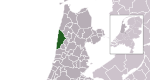
| |
| 0748 | North Brabant | 67,513 | 844/km2 (2,190/sq mi) | 79.96 km2 (30.87 sq mi) | 
| |
| 1859 | Gelderland | 43,846 | 170/km2 (440/sq mi) | 258.06 km2 (99.64 sq mi) | 
| |
| 1721 | North Brabant | 31,464 | 348/km2 (900/sq mi) | 89.73 km2 (34.64 sq mi) | 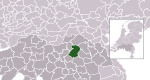
| |
| 0753 | North Brabant | 30,211 | 874/km2 (2,260/sq mi) | 34.30 km2 (13.24 sq mi) | 
| |
| 0209 | Gelderland | 26,165 | 593/km2 (1,540/sq mi) | 43.65 km2 (16.85 sq mi) | 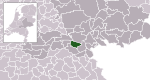
| |
| 0375 | North Holland | 41,853 | 2,262/km2 (5,860/sq mi) | 18.40 km2 (7.10 sq mi) | 
| |
| 1728 | North Brabant | 20,529 | 271/km2 (700/sq mi) | 75.33 km2 (29.09 sq mi) | 
| |
| 0376 | North Holland | 11,953 | 1,038/km2 (2,690/sq mi) | 11.11 km2 (4.29 sq mi) | 
| |
| 0377 | North Holland | 23,478 | 592/km2 (1,530/sq mi) | 39.79 km2 (15.36 sq mi) | 
| |
| 1901 | South Holland | 35,281 | 463/km2 (1,200/sq mi) | 75.38 km2 (29.10 sq mi) | 
| |
| 0755 | North Brabant | 10,959 | 313/km2 (810/sq mi) | 34.51 km2 (13.32 sq mi) | 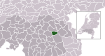
| |
| 1681 | Drenthe | 25,596 | 93/km2 (240/sq mi) | 274.53 km2 (106.00 sq mi) | 
| |
| 0147 | Overijssel | 23,667 | 897/km2 (2,320/sq mi) | 26.00 km2 (10.04 sq mi) | 
| |
| 0654 | Zeeland | 22,818 | 161/km2 (420/sq mi) | 141.57 km2 (54.66 sq mi) | 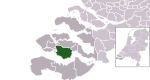
| |
| 0756 | North Brabant | 29,599 | 263/km2 (680/sq mi) | 111.44 km2 (43.03 sq mi) | 
| |
| 0757 | North Brabant | 32,989 | 483/km2 (1,250/sq mi)}[e] | 69.08 km2 (26.67 sq mi) | 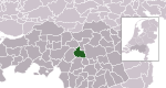
| |
| 0758 | North Brabant | 184,077 | 1,464/km2 (3,790/sq mi) | 125.74 km2 (48.55 sq mi) | 
| |
| 0501 | South Holland | 17,423 | 627/km2 (1,620/sq mi) | 27.55 km2 (10.64 sq mi) | 
| |
| 1876 | Gelderland | 36,083 | 127/km2 (330/sq mi) | 283.50 km2 (109.46 sq mi) | 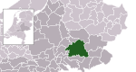
| |
| 0213 | Gelderland | 20,877 | 248/km2 (640/sq mi) | 83.65 km2 (32.30 sq mi) | 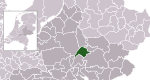
| |
| 0899 | Limburg | 27,682 | 1,613/km2 (4,180/sq mi) | 17.25 km2 (6.66 sq mi) | 
| |
| 0312 | Utrecht | 15,345 | 411/km2 (1,060/sq mi) | 36.97 km2 (14.27 sq mi) | 
| |
| 0313 | Utrecht | 22,024 | 720/km2 (1,900/sq mi) | 30.38 km2 (11.73 sq mi) | 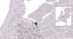
| |
| 0214 | Gelderland | 27,010 | 200/km2 (520/sq mi) | 133.89 km2 (51.70 sq mi) | 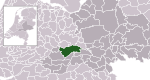
| |
| 0502 | South Holland | 67,315 | 4,747/km2 (12,290/sq mi) | 14.14 km2 (5.46 sq mi) | 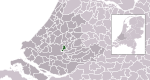
| |
| 0383 | North Holland | 36,084 | 724/km2 (1,880/sq mi) | 49.68 km2 (19.18 sq mi) | 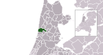
| |
| 0109 | Drenthe | 35,321 | 119/km2 (310/sq mi) | 296.07 km2 (114.31 sq mi) | 
| |
| 1706 | North Brabant | 21,004 | 277/km2 (720/sq mi) | 76.40 km2 (29.50 sq mi) | 
| |
| 1684 | North Brabant | 25,395 | 491/km2 (1,270/sq mi) | 51.16 km2 (19.75 sq mi) | 
| |
| 0216 | Gelderland | 29,129 | 989/km2 (2,560/sq mi) | 29.29 km2 (11.31 sq mi) | 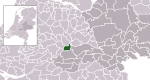
| |
| 0148 | Overijssel | 28,903 | 173/km2 (450/sq mi) | 165.07 km2 (63.73 sq mi) | 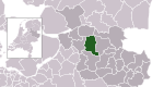
| |
| 1891 | Friesland | 18,943 | 224/km2 (580/sq mi) | 84.66 km2 (32.69 sq mi) | 
| |
| 0310 | Utrecht | 43,368 | 652/km2 (1,690/sq mi) | 66.12 km2 (25.53 sq mi) | 
| |
| 1940 | Friesland | 51,793 | 147/km2 (380/sq mi) | 351.29 km2 (135.63 sq mi) | 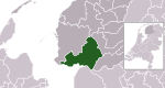
| |
| 0736 | Utrecht | 44,727 | 445/km2 (1,150/sq mi) | 99.92 km2 (38.58 sq mi) | 
| |
| 1690 | Drenthe | 24,374 | 108/km2 (280/sq mi) | 224.55 km2 (86.70 sq mi) | 
| |
| 0503 | South Holland | 103,588 | 4,573/km2 (11,840/sq mi) | 22.65 km2 (8.75 sq mi) | 
| |
| 0400 | North Holland | 56,577 | 1,244/km2 (3,220/sq mi) | 45.25 km2 (17.47 sq mi) | 
| |
| 0762 | North Brabant | 32,432 | 278/km2 (720/sq mi) | 116.93 km2 (45.15 sq mi) | 
| |
| 0150 | Overijssel | 101,227 | 771/km2 (2,000/sq mi) | 130.68 km2 (50.46 sq mi) | 
| |
| 0384 | North Holland | 31,330 | 2,566/km2 (6,650/sq mi) | 11.99 km2 (4.63 sq mi) | 
| |
| 1774 | Overijssel | 26,603 | 151/km2 (390/sq mi) | 175.71 km2 (67.84 sq mi) | 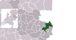
| |
| 0221 | Gelderland | 11,064 | 961/km2 (2,490/sq mi) | 11.53 km2 (4.45 sq mi) | 
| |
| 0222 | Gelderland | 58,263 | 734/km2 (1,900/sq mi) | 79.05 km2 (30.52 sq mi) | 
| |
| 0766 | North Brabant | 26,372 | 897/km2 (2,320/sq mi) | 29.24 km2 (11.29 sq mi) | 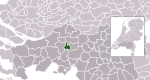
| |
| 0505 | South Holland | 119,111 | 1,519/km2 (3,930/sq mi) | 78.54 km2 (30.32 sq mi) | 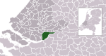
| |
| 0498 | North Holland | 19,835 | 335/km2 (870/sq mi) | 58.89 km2 (22.74 sq mi) | 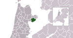
| |
| 1719 | North Brabant | 27,322 | 287/km2 (740/sq mi) | 95.18 km2 (36.75 sq mi) | 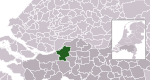
| |
| 0303 | Flevoland | 42,017 | 125/km2 (320/sq mi) | 333.57 km2 (128.79 sq mi) | 
| |
| 0225 | Gelderland | 18,994 | 503/km2 (1,300/sq mi) | 37.64 km2 (14.53 sq mi) | 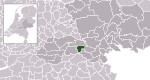
| |
| 0226 | Gelderland | 25,067 | 741/km2 (1,920/sq mi) | 33.90 km2 (13.09 sq mi) | 
| |
| 1711 | Limburg | 31,744 | 307/km2 (800/sq mi) | 103.07 km2 (39.80 sq mi) | 
| |
| 0385 | North Holland | 36,262 | 666/km2 (1,720/sq mi) | 54.33 km2 (20.98 sq mi) | 
| |
| 0228 | Gelderland | 118,538 | 368/km2 (950/sq mi) | 318.18 km2 (122.85 sq mi) | 
| |
| 0317 | Utrecht | 9,361 | 298/km2 (770/sq mi) | 31.04 km2 (11.98 sq mi) | 
| |
| 1979 | Groningen | 45,528 | 171/km2 (440/sq mi)[f] | 267.89 km2 (103.43 sq mi) | 
| |
| 0770 | North Brabant | 19,530 | 234/km2 (610/sq mi) | 82.46 km2 (31.84 sq mi) | 
| |
| 1903 | Limburg | 25,898 | 332/km2 (860/sq mi) | 77.55 km2 (29.94 sq mi) | 
| |
| 0772 | North Brabant | 235,707 | 2,674/km2 (6,930/sq mi) | 87.66 km2 (33.85 sq mi) | 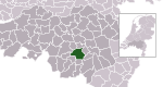
| |
| 0230 | Gelderland | 23,429 | 363/km2 (940/sq mi) | 63.82 km2 (24.64 sq mi) | 
| |
| 0114 | Drenthe | 107,020 | 319/km2 (830/sq mi) | 335.18 km2 (129.41 sq mi) | 
| |
| 0388 | North Holland | 18,632 | 1,466/km2 (3,800/sq mi) | 12.68 km2 (4.90 sq mi) | 
| |
| 0153 | Overijssel | 159,703 | 1,134/km2 (2,940/sq mi) | 140.83 km2 (54.37 sq mi) | 
| |
| 0232 | Gelderland | 33,197 | 213/km2 (550/sq mi) | 156.07 km2 (60.26 sq mi) | 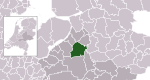
| |
| 0233 | Gelderland | 27,017 | 315/km2 (820/sq mi) | 85.63 km2 (33.06 sq mi) | 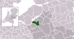
| |
| 0777 | North Brabant | 43,875 | 793/km2 (2,050/sq mi) | 55.30 km2 (21.35 sq mi) | 
| |
| 0779 | North Brabant | 21,779 | 809/km2 (2,100/sq mi) | 26.63 km2 (10.28 sq mi) | 
| |
| 1771 | North Brabant | 40,059 | 1,281/km2 (3,320/sq mi) | 31.01 km2 (11.97 sq mi) | 
| |
| 1652 | North Brabant | 30,766 | 252/km2 (650/sq mi) | 122.14 km2 (47.16 sq mi) | 
| |
| 0907 | Limburg | 17,038 | 355/km2 (920/sq mi) | 47.62 km2 (18.39 sq mi) | 
| |
| 0784 | North Brabant | 26,742 | 404/km2 (1,050/sq mi) | 65.38 km2 (25.24 sq mi) | 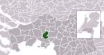
| |
| 1924 | South Holland | 50,588 | 192/km2 (500/sq mi) | 260.48 km2 (100.57 sq mi) | 
| |
| 0664 | Zeeland | 38,594 | 411/km2 (1,060/sq mi) | 92.58 km2 (35.75 sq mi) | 
| |
| 0785 | North Brabant | 23,948 | 556/km2 (1,440/sq mi) | 42.99 km2 (16.60 sq mi) | 
| |
| 1942 | North Holland | 58,520 | 1,396/km2 (3,620/sq mi) | 41.59 km2 (16.06 sq mi) | 
| |
| 0512 | South Holland | 37,416 | 1,966/km2 (5,090/sq mi) | 18.83 km2 (7.27 sq mi) | 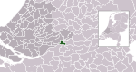
| |
| 0513 | South Holland | 73,678 | 4,449/km2 (11,520/sq mi) | 16.50 km2 (6.37 sq mi) | 
| |
| 0786 | North Brabant | 12,482 | 457/km2 (1,180/sq mi) | 27.18 km2 (10.49 sq mi) | 
| |
| 0014 | Groningen | 233,218 | 1,255/km2 (3,250/sq mi) | 185.60 km2 (71.66 sq mi) | 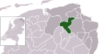
| |
| 1729 | Limburg | 14,204 | 194/km2 (500/sq mi) | 73.18 km2 (28.25 sq mi) | 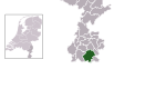
| |
| 0158 | Overijssel | 24,228 | 232/km2 (600/sq mi) | 104.82 km2 (40.47 sq mi) | 
| |
| 0392 | North Holland | 162,549 | 5,585/km2 (14,470/sq mi) | 29.17 km2 (11.26 sq mi) | 
| |
| 0394 | North Holland | 157,778 | 790/km2 (2,000/sq mi) | 197.48 km2 (76.25 sq mi) | 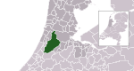
| |
| 1655 | North Brabant | 30,430 | 407/km2 (1,050/sq mi) | 74.47 km2 (28.75 sq mi) | 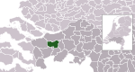
| |
| 0160 | Overijssel | 61,346 | 195/km2 (510/sq mi) | 312.28 km2 (120.57 sq mi) | 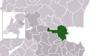
| |
| 0243 | Gelderland | 48,722 | 1,245/km2 (3,220/sq mi) | 38.89 km2 (15.02 sq mi) | 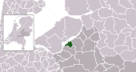
| |
| 0523 | South Holland | 18,410 | 1,082/km2 (2,800/sq mi) | 16.91 km2 (6.53 sq mi) | 
| |
| 0072 | Friesland | 15,804 | 630/km2 (1,600/sq mi) | 24.96 km2 (9.64 sq mi) | 
| |
| 0244 | Gelderland | 12,226 | 529/km2 (1,370/sq mi) | 23.08 km2 (8.91 sq mi) | 
| |
| 0396 | North Holland | 39,206 | 1,433/km2 (3,710/sq mi) | 27.34 km2 (10.56 sq mi) | 
| |
| 0397 | North Holland | 27,531 | 2,968/km2 (7,690/sq mi) | 9.18 km2 (3.54 sq mi) | 
| |
| 0246 | Gelderland | 18,774 | 236/km2 (610/sq mi) | 78.74 km2 (30.40 sq mi) | 
| |
| 0074 | Friesland | 50,649 | 266/km2 (690/sq mi) | 190.09 km2 (73.39 sq mi) | 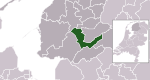
| |
| 0398 | North Holland | 58,389 | 1,507/km2 (3,900/sq mi) | 38.21 km2 (14.75 sq mi) | 
| |
| 0917 | Limburg | 86,935 | 1,938/km2 (5,020/sq mi) | 44.94 km2 (17.35 sq mi) | 
| |
| 1658 | North Brabant | 16,238 | 155/km2 (400/sq mi) | 104.02 km2 (40.16 sq mi) | 
| |
| 0399 | North Holland | 24,146 | 1,282/km2 (3,320/sq mi) | 18.70 km2 (7.22 sq mi) | 
| |
| 0163 | Overijssel | 35,929 | 260/km2 (670/sq mi) | 137.91 km2 (53.25 sq mi) | 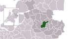
| |
| 0530 | South Holland | 40,296 | 977/km2 (2,530/sq mi) | 41.10 km2 (15.87 sq mi) | 
| |
| 0794 | North Brabant | 92,624 | 1,738/km2 (4,500/sq mi) | 53.18 km2 (20.53 sq mi) | 
| |
| 0531 | South Holland | 31,247 | 2,940/km2 (7,600/sq mi) | 10.61 km2 (4.10 sq mi) | 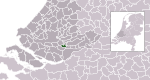
| |
| 0164 | Overijssel | 81,057 | 1,334/km2 (3,460/sq mi) | 60.84 km2 (23.49 sq mi) | 
| |
| 0796 | North Brabant | 155,496 | 1,410/km2 (3,700/sq mi) | 109.99 km2 (42.47 sq mi) | 
| |
| 1966 | Groningen | 47,843 | 99/km2 (260/sq mi) | 482.75 km2 (186.39 sq mi) | 
| |
| 0252 | Gelderland | 16,569 | 414/km2 (1,070/sq mi) | 39.76 km2 (15.35 sq mi) | 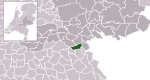
| |
| 0797 | North Brabant | 45,008 | 567/km2 (1,470/sq mi) | 78.88 km2 (30.46 sq mi) | 
| |
| 0534 | South Holland | 22,204 | 1,725/km2 (4,470/sq mi) | 12.87 km2 (4.97 sq mi) | 
| |
| 0798 | North Brabant | 15,698 | 164/km2 (420/sq mi) | 94.85 km2 (36.62 sq mi) | 
| |
| 0402 | North Holland | 91,180 | 1,991/km2 (5,160/sq mi) | 45.61 km2 (17.61 sq mi) | 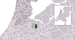
| |
| 1963 | South Holland | 88,024 | 325/km2 (840/sq mi) | 268.93 km2 (103.83 sq mi) | 
| |
| 1735 | Overijssel | 35,035 | 165/km2 (430/sq mi) | 212.56 km2 (82.07 sq mi) | 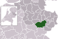
| |
| 1911 | North Holland | 48,576 | 136/km2 (350/sq mi) | 357.34 km2 (137.97 sq mi) | 
| |
| 0118 | Drenthe | 55,600 | 437/km2 (1,130/sq mi) | 127.54 km2 (49.24 sq mi) | 
| |
| 0405 | North Holland | 73,602 | 3,595/km2 (9,310/sq mi) | 20.38 km2 (7.87 sq mi) | 
| |
| 1507 | Limburg | 42,497 | 225/km2 (580/sq mi) | 188.73 km2 (72.87 sq mi) | 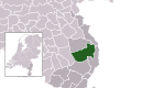
| |
| 0321 | Utrecht | 50,230 | 913/km2 (2,360/sq mi) | 54.94 km2 (21.21 sq mi) | 
| |
| 0406 | North Holland | 41,084 | 2,611/km2 (6,760/sq mi) | 15.81 km2 (6.10 sq mi) | 
| |
| 0677 | Zeeland | 27,574 | 137/km2 (350/sq mi) | 201.71 km2 (77.88 sq mi) | 
| |
| 0353 | Utrecht | 33,812 | 1,619/km2 (4,190/sq mi) | 21.07 km2 (8.14 sq mi) | 
| |
| 1884 | South Holland | 27,547 | 432/km2 (1,120/sq mi) | 63.24 km2 (24.42 sq mi) | 
| |
| 0166 | Overijssel | 54,476 | 382/km2 (990/sq mi) | 142.18 km2 (54.90 sq mi) | 
| |
| 0678 | Zeeland | 12,878 | 342/km2 (890/sq mi) | 37.13 km2 (14.34 sq mi) | 
| |
| 0537 | South Holland | 65,997 | 2,657/km2 (6,880/sq mi) | 24.75 km2 (9.56 sq mi) | 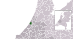
| |
| 0928 | Limburg | 45,468 | 2,088/km2 (5,410/sq mi) | 21.91 km2 (8.46 sq mi) | 
| |
| 1598 | North Holland | 22,938 | 283/km2 (730/sq mi) | 80.32 km2 (31.01 sq mi) | 
| |
| 0542 | South Holland | 29,396 | 3,841/km2 (9,950/sq mi) | 7.69 km2 (2.97 sq mi) | 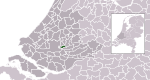
| |
| 1931 | South Holland | 56,606 | 380/km2 (980/sq mi) | 148.40 km2 (57.30 sq mi) | 
| |
| 1659 | North Brabant | 22,800 | 407/km2 (1,050/sq mi) | 55.35 km2 (21.37 sq mi) | 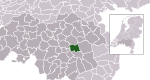
| |
| 1685 | North Brabant | 15,818 | 224/km2 (580/sq mi) | 70.35 km2 (27.16 sq mi) | 
| |
| 0882 | Limburg | 37,261 | 1,523/km2 (3,940/sq mi) | 24.58 km2 (9.49 sq mi) | 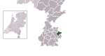
| |
| 0415 | North Holland | 11,568 | 510/km2 (1,300/sq mi) | 22.53 km2 (8.70 sq mi) | 
| |
| 0416 | North Holland | 28,327 | 1,179/km2 (3,050/sq mi) | 23.88 km2 (9.22 sq mi) | 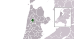
| |
| 1621 | South Holland | 63,338 | 1,168/km2 (3,030/sq mi) | 53.42 km2 (20.63 sq mi) | 
| |
| 0417 | North Holland | 11,399 | 909/km2 (2,350/sq mi) | 12.41 km2 (4.79 sq mi) | 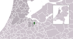
| |
| 0080 | Friesland | 124,499 | 521/km2 (1,350/sq mi) | 238.38 km2 (92.04 sq mi) | 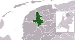
| |
| 0546 | South Holland | 124,077 | 5,710/km2 (14,800/sq mi) | 21.91 km2 (8.46 sq mi) | 
| |
| 0547 | South Holland | 27,385 | 2,337/km2 (6,050/sq mi) | 11.58 km2 (4.47 sq mi) | 
| |
| 1916 | South Holland | 76,417 | 2,351/km2 (6,090/sq mi) | 32.55 km2 (12.57 sq mi) | 
| |
| 0995 | Flevoland | 79,769 | 341/km2 (880/sq mi) | 230.32 km2 (88.93 sq mi) | 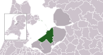
| |
| 1640 | Limburg | 36,046 | 220/km2 (570/sq mi) | 162.73 km2 (62.83 sq mi) | 
| |
| 0327 | Utrecht | 30,540 | 519/km2 (1,340/sq mi) | 58.54 km2 (22.60 sq mi) | 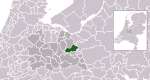
| |
| 1705 | Gelderland | 46,815 | 752/km2 (1,950/sq mi) | 62.00 km2 (23.94 sq mi) | 
| |
| 0553 | South Holland | 22,983 | 1,463/km2 (3,790/sq mi) | 15.69 km2 (6.06 sq mi) | 
| |
| 0262 | Gelderland | 33,944 | 158/km2 (410/sq mi) | 213.03 km2 (82.25 sq mi) | 
| |
| 0809 | North Brabant | 23,504 | 469/km2 (1,210/sq mi) | 49.94 km2 (19.28 sq mi) | 
| |
| 0331 | Utrecht | 14,460 | 191/km2 (490/sq mi) | 75.57 km2 (29.18 sq mi) | 
| |
| 0168 | Overijssel | 22,884 | 230/km2 (600/sq mi) | 98.76 km2 (38.13 sq mi) | 
| |
| 0263 | Gelderland | 25,448 | 379/km2 (980/sq mi) | 66.11 km2 (25.53 sq mi) | 
| |
| 1641 | Limburg | 23,947 | 524/km2 (1,360/sq mi) | 45.71 km2 (17.65 sq mi) | 
| |
| 0556 | South Holland | 33,551 | 3,918/km2 (10,150/sq mi) | 8.48 km2 (3.27 sq mi) | 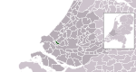
| |
| 0935 | Limburg | 120,182 | 2,172/km2 (5,630/sq mi) | 55.99 km2 (21.62 sq mi) | 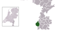
| |
| 0420 | North Holland | 45,178 | 371/km2 (960/sq mi) | 121.42 km2 (46.88 sq mi) | 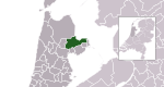
| |
| 0938 | Limburg | 18,651 | 698/km2 (1,810/sq mi) | 26.96 km2 (10.41 sq mi) | 
| |
| 1948 | North Brabant | 81,648 | 441/km2 (1,140/sq mi) | 184.09 km2 (71.08 sq mi) | 
| |
| 0119 | Drenthe | 34,383 | 611/km2 (1,580/sq mi) | 55.53 km2 (21.44 sq mi) | 
| |
| 0687 | Zeeland | 48,977 | 1,008/km2 (2,610/sq mi) | 48.42 km2 (18.70 sq mi) | 
| |
| 1842 | South Holland | 19,409 | 410/km2 (1,100/sq mi) | 47.19 km2 (18.22 sq mi) | 
| |
| 1731 | Drenthe | 33,386 | 97/km2 (250/sq mi) | 340.51 km2 (131.47 sq mi) | 
| |
| 1952 | Groningen | 60,740 | 217/km2 (560/sq mi) | 280.00 km2 (108.11 sq mi) | 
| |
| 0815 | North Brabant | 11,002 | 209/km2 (540/sq mi) | 52.23 km2 (20.17 sq mi) | 
| |
| 1709 | North Brabant | 37,179 | 233/km2 (600/sq mi) | 159.15 km2 (61.45 sq mi) | 
| |
| 1978 | South Holland | 44,135 | 242/km2 (630/sq mi) | 181.73 km2 (70.17 sq mi) | 
| |
| 1955 | Gelderland | 36,038 | 341/km2 (880/sq mi) | 105.70 km2 (40.81 sq mi) | 
| |
| 0335 | Utrecht | 13,889 | 370/km2 (960/sq mi) | 37.57 km2 (14.51 sq mi) | 
| |
| 0944 | Limburg | 7,910 | 451/km2 (1,170/sq mi) | 17.38 km2 (6.71 sq mi) | 
| |
| 1740 | Gelderland | 24,646 | 406/km2 (1,050/sq mi) | 59.98 km2 (23.16 sq mi) | 
| |
| 0946 | Limburg | 17,169 | 170/km2 (440/sq mi) | 99.98 km2 (38.60 sq mi) | 
| |
| 0356 | Utrecht | 63,853 | 2,700/km2 (7,000/sq mi) | 23.51 km2 (9.08 sq mi) | 
| |
| 0569 | South Holland | 29,144 | 369/km2 (960/sq mi) | 78.05 km2 (30.14 sq mi) | 
| |
| 0267 | Gelderland | 43,598 | 623/km2 (1,610/sq mi) | 69.34 km2 (26.77 sq mi) | 
| |
| 0268 | Gelderland | 177,321 | 3,346/km2 (8,670/sq mi) | 53.09 km2 (20.50 sq mi) | 
| |
| 1930 | South Holland | 85,403 | 1,158/km2 (3,000/sq mi) | 73.58 km2 (28.41 sq mi) | 
| |
| 1970 | Friesland | 45,485 | 120/km2 (310/sq mi) | 377.83 km2 (145.88 sq mi) | 
| |
| 1695 | Zeeland | 7,572 | 86/km2 (220/sq mi) | 85.96 km2 (33.19 sq mi) | 
| |
| 1699 | Drenthe | 31,218 | 157/km2 (410/sq mi) | 199.41 km2 (76.99 sq mi) | 
| |
| 0171 | Flevoland | 47,610 | 103/km2 (270/sq mi) | 458.17 km2 (176.90 sq mi) | 
| |
| 0575 | South Holland | 44,055 | 745/km2 (1,930/sq mi) | 58.37 km2 (22.54 sq mi) | 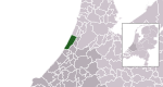
| |
| 0820 | North Brabant | 23,701 | 694/km2 (1,800/sq mi) | 33.71 km2 (13.02 sq mi) | 
| |
| 0302 | Gelderland | 28,029 | 216/km2 (560/sq mi) | 128.74 km2 (49.71 sq mi) | 
| |
| 0579 | South Holland | 25,064 | 3,399/km2 (8,800/sq mi) | 7.31 km2 (2.82 sq mi) | 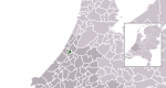
| |
| 0823 | North Brabant | 18,839 | 184/km2 (480/sq mi) | 101.78 km2 (39.30 sq mi) | 
| |
| 0824 | North Brabant | 32,373 | 411/km2 (1,060/sq mi)[e] | 80.11 km2 (30.93 sq mi) | 
| |
| 1895 | Groningen | 38,292 | 169/km2 (440/sq mi) | 226.66 km2 (87.51 sq mi) | 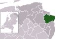
| |
| 0269 | Gelderland | 23,756 | 242/km2 (630/sq mi) | 97.65 km2 (37.70 sq mi) | 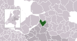
| |
| 0173 | Overijssel | 31,702 | 1,477/km2 (3,830/sq mi) | 21.55 km2 (8.32 sq mi) | 
| |
| 1773 | Overijssel | 18,361 | 160/km2 (410/sq mi) | 113.84 km2 (43.95 sq mi) | 
| |
| 0175 | Overijssel | 18,294 | 100/km2 (260/sq mi) | 179.90 km2 (69.46 sq mi) | 
| |
| 1586 | Gelderland | 29,572 | 270/km2 (700/sq mi) | 109.93 km2 (42.44 sq mi) | 
| |
| 0826 | North Brabant | 56,195 | 783/km2 (2,030/sq mi) | 71.47 km2 (27.59 sq mi) | 
| |
| 0085 | Friesland | 25,463 | 114/km2 (300/sq mi) | 223.42 km2 (86.26 sq mi) | 
| |
| 0431 | North Holland | 9,686 | 845/km2 (2,190/sq mi) | 11.53 km2 (4.45 sq mi) | 
| |
| 0432 | North Holland | 12,005 | 285/km2 (740/sq mi) | 41.50 km2 (16.02 sq mi) | 
| |
| 0086 | Friesland | 29,810 | 132/km2 (340/sq mi) | 224.40 km2 (86.64 sq mi) | 
| |
| 0828 | North Brabant | 92,517 | 563/km2 (1,460/sq mi) | 163.16 km2 (63.00 sq mi) | 
| |
| 1509 | Gelderland | 39,349 | 289/km2 (750/sq mi) | 136.15 km2 (52.57 sq mi) | 
| |
| 0437 | North Holland | 14,127 | 583/km2 (1,510/sq mi) | 24.08 km2 (9.30 sq mi) | 
| |
| 0589 | Utrecht | 10,136 | 263/km2 (680/sq mi) | 38.90 km2 (15.02 sq mi) | 
| |
| 1734 | Gelderland | 48,214 | 439/km2 (1,140/sq mi) | 109.19 km2 (42.16 sq mi) | 
| |
| 0590 | South Holland | 32,164 | 3,414/km2 (8,840/sq mi) | 9.41 km2 (3.63 sq mi) | 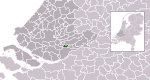
| |
| 1894 | Limburg | 43,658 | 272/km2 (700/sq mi) | 159.37 km2 (61.53 sq mi) | 
| |
| 0765 | Groningen | 12,166 | 249/km2 (640/sq mi) | 49.04 km2 (18.93 sq mi) | 
| |
| 1926 | South Holland | 55,668 | 1,491/km2 (3,860/sq mi) | 37.08 km2 (14.32 sq mi) | 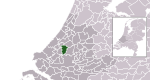
| |
| 0439 | North Holland | 81,676 | 3,509/km2 (9,090/sq mi) | 23.15 km2 (8.94 sq mi) | 
| |
| 0273 | Gelderland | 24,370 | 283/km2 (730/sq mi) | 85.22 km2 (32.90 sq mi) | 
| |
| 0177 | Overijssel | 37,915 | 221/km2 (570/sq mi) | 170.99 km2 (66.02 sq mi) | 
| |
| 0703 | Zeeland | 22,897 | 223/km2 (580/sq mi) | 101.80 km2 (39.31 sq mi) | 
| |
| 0274 | Gelderland | 31,412 | 684/km2 (1,770/sq mi) | 45.95 km2 (17.74 sq mi) | 
| |
| 0339 | Utrecht | 5,557 | 296/km2 (770/sq mi) | 18.40 km2 (7.10 sq mi) | 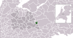
| |
| 1667 | North Brabant | 13,127 | 168/km2 (440/sq mi) | 77.88 km2 (30.07 sq mi) | 
| |
| 0275 | Gelderland | 43,536 | 535/km2 (1,390/sq mi) | 81.74 km2 (31.56 sq mi) | 
| |
| 0340 | Utrecht | 20,203 | 478/km2 (1,240/sq mi) | 42.08 km2 (16.25 sq mi) | 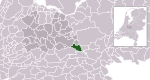
| |
| 0597 | South Holland | 46,665 | 1,948/km2 (5,050/sq mi) | 23.72 km2 (9.16 sq mi) | 
| |
| 1742 | Overijssel | 38,202 | 406/km2 (1,050/sq mi) | 94.13 km2 (36.34 sq mi) | 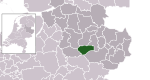
| |
| 0603 | South Holland | 55,205 | 3,901/km2 (10,100/sq mi) | 13.96 km2 (5.39 sq mi) | 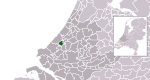
| |
| 1669 | Limburg | 20,602 | 233/km2 (600/sq mi) | 88.21 km2 (34.06 sq mi) | 
| |
| 0957 | Limburg | 58,806 | 958/km2 (2,480/sq mi) | 60.81 km2 (23.48 sq mi) | 
| |
| 1674 | North Brabant | 77,201 | 725/km2 (1,880/sq mi) | 106.50 km2 (41.12 sq mi) | 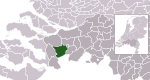
| |
| 0599 | South Holland | 652,541 | 2,993/km2 (7,750/sq mi) | 217.55 km2 (84.00 sq mi) | 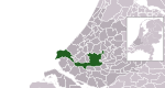
| |
| 0277 | Gelderland | 1,726 | 61/km2 (160/sq mi) | 27.90 km2 (10.77 sq mi) | 
| |
| 0840 | North Brabant | 23,081 | 355/km2 (920/sq mi) | 64.41 km2 (24.87 sq mi) | 
| |
| 0441 | North Holland | 46,528 | 276/km2 (710/sq mi) | 168.25 km2 (64.96 sq mi) | 
| |
| 0279 | Gelderland | 10,129 | 717/km2 (1,860/sq mi) | 13.79 km2 (5.32 sq mi) | 
| |
| 0606 | South Holland | 79,356 | 4,417/km2 (11,440/sq mi) | 17.82 km2 (6.88 sq mi) | 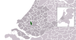
| |
| 0088 | Friesland | 931 | 23/km2 (60/sq mi) | 40.50 km2 (15.64 sq mi) | 
| |
| 1676 | Zeeland | 34,054 | 147/km2 (380/sq mi) | 229.65 km2 (88.67 sq mi) | 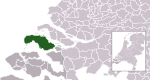
| |
| 0965 | Limburg | 10,481 | 658/km2 (1,700/sq mi) | 16.03 km2 (6.19 sq mi) | 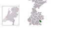
| |
| 1702 | North Brabant | 11,688 | 117/km2 (300/sq mi) | 99.27 km2 (38.33 sq mi) | 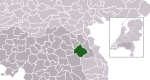
| |
| 0845 | North Brabant | 29,512 | 500/km2 (1,300/sq mi) | 58.38 km2 (22.54 sq mi) | 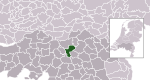
| |
| 1883 | Limburg | 91,724 | 1,170/km2 (3,000/sq mi) | 79.01 km2 (30.51 sq mi) | 
| |
| 0610 | South Holland | 25,589 | 1,965/km2 (5,090/sq mi) | 12.84 km2 (4.96 sq mi) | 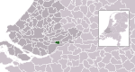
| |
| 1714 | Zeeland | 23,161 | 83/km2 (210/sq mi) | 279.36 km2 (107.86 sq mi) | 
| |
| 0090 | Friesland | 56,047 | 479/km2 (1,240/sq mi) | 117.31 km2 (45.29 sq mi) | 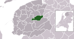
| |
| 0342 | Utrecht | 46,900 | 1,008/km2 (2,610/sq mi) | 46.24 km2 (17.85 sq mi) | 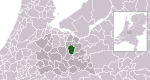
| |
| 0847 | North Brabant | 19,418 | 241/km2 (620/sq mi) | 80.27 km2 (30.99 sq mi) | 
| |
| 0848 | North Brabant | 17,553 | 667/km2 (1,730/sq mi) | 25.95 km2 (10.02 sq mi) | 
| |
| 0037 | Groningen | 31,757 | 269/km2 (700/sq mi) | 117.64 km2 (45.42 sq mi) | 
| |
| 0180 | Overijssel | 17,261 | 128/km2 (330/sq mi) | 133.99 km2 (51.73 sq mi) | 
| |
| 0532 | North Holland | 21,749 | 1,498/km2 (3,880/sq mi) | 14.50 km2 (5.60 sq mi) | 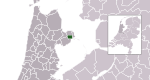
| |
| 0851 | North Brabant | 24,304 | 167/km2 (430/sq mi) | 146.43 km2 (56.54 sq mi) | 
| |
| 1708 | Overijssel | 44,351 | 153/km2 (400/sq mi) | 288.27 km2 (111.30 sq mi) | 
| |
| 0971 | Limburg | 24,876 | 1,186/km2 (3,070/sq mi) | 21.08 km2 (8.14 sq mi) | 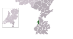
| |
| 1904 | Utrecht | 65,101 | 676/km2 (1,750/sq mi) | 96.10 km2 (37.10 sq mi) | 
| |
| 1900 | Friesland | 89,989 | 172/km2 (450/sq mi) | 523.01 km2 (201.94 sq mi) | 
| |
| 0715 | Zeeland | 54,467 | 217/km2 (560/sq mi) | 250.38 km2 (96.67 sq mi) | 
| |
| 0093 | Friesland | 4,870 | 57/km2 (150/sq mi) | 85.26 km2 (32.92 sq mi) | 
| |
| 0448 | North Holland | 13,657 | 84/km2 (220/sq mi) | 162.00 km2 (62.55 sq mi) | 
| |
| 1525 | South Holland | 37,798 | 1,319/km2 (3,420/sq mi) | 28.38 km2 (10.96 sq mi) | 
| |
| 0518 | South Holland | 547,757 | 6,620/km2 (17,100/sq mi) | 82.45 km2 (31.83 sq mi) | 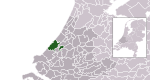
| |
| 0716 | Zeeland | 26,086 | 176/km2 (460/sq mi) | 146.71 km2 (56.65 sq mi) | 
| |
| 0281 | Gelderland | 41,922 | 1,282/km2 (3,320/sq mi) | 32.88 km2 (12.70 sq mi) | 
| |
| 0855 | North Brabant | 221,930 | 1,892/km2 (4,900/sq mi)[e] | 125.96 km2 (48.63 sq mi) | 
| |
| 0183 | Overijssel | 21,311 | 145/km2 (380/sq mi) | 147.00 km2 (56.76 sq mi) | 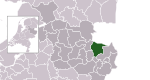
| |
| 1700 | Overijssel | 33,705 | 318/km2 (820/sq mi) | 106.17 km2 (40.99 sq mi) | 
| |
| 1730 | Drenthe | 33,974 | 237/km2 (610/sq mi) | 143.00 km2 (55.21 sq mi) | 
| |
| 0737 | Friesland | 32,056 | 215/km2 (560/sq mi) | 148.86 km2 (57.48 sq mi) | 
| |
| 0856 | North Brabant | 42,293 | 629/km2 (1,630/sq mi) | 67.00 km2 (25.87 sq mi) | 
| |
| 0450 | North Holland | 13,633 | 713/km2 (1,850/sq mi) | 19.16 km2 (7.40 sq mi) | 
| |
| 0451 | North Holland | 30,205 | 1,625/km2 (4,210/sq mi) | 18.14 km2 (7.00 sq mi) | 
| |
| 0184 | Flevoland | 21,225 | 1,599/km2 (4,140/sq mi) | 13.15 km2 (5.08 sq mi) | 
| |
| 0344 | Utrecht | 359,376 | 3,811/km2 (9,870/sq mi) | 93.83 km2 (36.23 sq mi) | 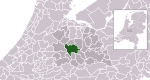
| |
| 1581 | Utrecht | 49,931 | 376/km2 (970/sq mi) | 132.01 km2 (50.97 sq mi) | 
| |
| 0981 | Limburg | 10,082 | 423/km2 (1,100/sq mi) | 23.89 km2 (9.22 sq mi) | 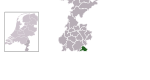
| |
| 0994 | Limburg | 16,364 | 446/km2 (1,160/sq mi) | 36.73 km2 (14.18 sq mi) | 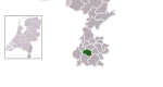
| |
| 0858 | North Brabant | 31,228 | 568/km2 (1,470/sq mi) | 54.92 km2 (21.20 sq mi) | 
| |
| 0047 | Groningen | 27,419 | 360/km2 (930/sq mi) | 76.00 km2 (29.34 sq mi) | 
| |
| 0345 | Utrecht | 66,912 | 3,417/km2 (8,850/sq mi) | 19.46 km2 (7.51 sq mi) | 
| |
| 0717 | Zeeland | 21,950 | 165/km2 (430/sq mi) | 132.56 km2 (51.18 sq mi) | 
| |
| 0861 | North Brabant | 45,500 | 1,435/km2 (3,720/sq mi) | 31.69 km2 (12.24 sq mi) | 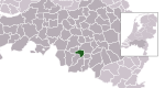
| |
| 0453 | North Holland | 68,607 | 1,519/km2 (3,930/sq mi) | 45.20 km2 (17.45 sq mi) | 
| |
| 0983 | Limburg | 101,984 | 819/km2 (2,120/sq mi) | 124.25 km2 (47.97 sq mi) | 
| |
| 0984 | Limburg | 43,706 | 267/km2 (690/sq mi) | 163.27 km2 (63.04 sq mi) | 
| |
| 1961 | Utrecht | 57,833 | 388/km2 (1,000/sq mi) | 146.41 km2 (56.53 sq mi) | 
| |
| 0622 | South Holland | 73,925 | 3,114/km2 (8,070/sq mi) | 23.57 km2 (9.10 sq mi) | 
| |
| 0096 | Friesland | 1,193 | 30/km2 (78/sq mi) | 39.15 km2 (15.12 sq mi) | 
| |
| 0718 | Zeeland | 44,351 | 1,293/km2 (3,350/sq mi) | 34.31 km2 (13.25 sq mi) | 
| |
| 0986 | Limburg | 12,464 | 396/km2 (1,030/sq mi) | 31.51 km2 (12.17 sq mi) | 
| |
| 0626 | South Holland | 25,645 | 2,297/km2 (5,950/sq mi) | 11.14 km2 (4.30 sq mi) | 
| |
| 0285 | Gelderland | 24,797 | 200/km2 (520/sq mi) | 122.97 km2 (47.48 sq mi) | 
| |
| 0865 | North Brabant | 31,663 | 787/km2 (2,040/sq mi)[e] | 60.05 km2 (23.19 sq mi) | 
| |
| 1949 | Friesland | 46,155 | 162/km2 (420/sq mi) | 284.86 km2 (109.99 sq mi) | 
| |
| 0866 | North Brabant | 17,544 | 780/km2 (2,000/sq mi) | 22.39 km2 (8.64 sq mi) | 
| |
| 0867 | North Brabant | 48,801 | 753/km2 (1,950/sq mi) | 64.58 km2 (24.93 sq mi) | 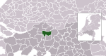
| |
| 0627 | South Holland | 30,485 | 1,055/km2 (2,730/sq mi) | 27.77 km2 (10.72 sq mi) | 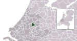
| |
| 0289 | Gelderland | 39,643 | 1,304/km2 (3,380/sq mi) | 30.42 km2 (11.75 sq mi) | 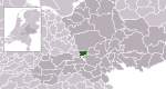
| |
| 0629 | South Holland | 26,939 | 515/km2 (1,330/sq mi) | 51.11 km2 (19.73 sq mi) | 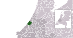
| |
| 0852 | North Holland | 17,306 | 334/km2 (870/sq mi) | 52.11 km2 (20.12 sq mi) | 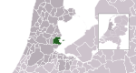
| |
| 0988 | Limburg | 50,017 | 480/km2 (1,200/sq mi) | 104.32 km2 (40.28 sq mi) | 
| |
| 0457 | North Holland | 20,449 | 866/km2 (2,240/sq mi) | 22.79 km2 (8.80 sq mi) | 
| |
| 1960 | Gelderland | 51,493 | 237/km2 (610/sq mi) | 216.12 km2 (83.44 sq mi) | 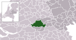
| |
| 0668 | Gelderland | 19,578 | 252/km2 (650/sq mi) | 76.76 km2 (29.64 sq mi) | 
| |
| 1969 | Groningen | 63,660 | 175/km2 (450/sq mi) | 362.69 km2 (140.04 sq mi) | 
| |
| 1701 | Drenthe | 19,663 | 70/km2 (180/sq mi) | 278.35 km2 (107.47 sq mi) | 
| |
| 0293 | Gelderland | 15,011 | 2,130/km2 (5,500/sq mi) | 7.03 km2 (2.71 sq mi) | 
| |
| 1950 | Groningen | 26,190 | 93/km2 (240/sq mi) | 275.67 km2 (106.44 sq mi) | 
| |
| 1783 | South Holland | 111,366 | 1,358/km2 (3,520/sq mi) | 81.27 km2 (31.38 sq mi) | 
| |
| 0098 | Friesland | 26,125 | 118/km2 (310/sq mi) | 220.30 km2 (85.06 sq mi) | 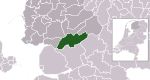
| |
| 0614 | South Holland | 14,903 | 277/km2 (720/sq mi) | 53.18 km2 (20.53 sq mi) | 
| |
| 0189 | Overijssel | 24,534 | 258/km2 (670/sq mi) | 94.63 km2 (36.54 sq mi) | 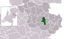
| |
| 0296 | Gelderland | 41,259 | 621/km2 (1,610/sq mi) | 66.18 km2 (25.55 sq mi) | 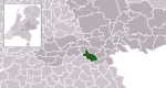
| |
| 1696 | North Holland | 24,464 | 512/km2 (1,330/sq mi) | 47.60 km2 (18.38 sq mi) | 
| |
| 0352 | Utrecht | 23,927 | 502/km2 (1,300/sq mi) | 47.62 km2 (18.39 sq mi) | 
| |
| 0294 | Gelderland | 29,041 | 209/km2 (540/sq mi) | 138.14 km2 (53.34 sq mi) | 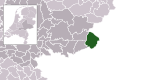
| |
| 0873 | North Brabant | 22,019 | 239/km2 (620/sq mi) | 91.66 km2 (35.39 sq mi) | 
| |
| 0632 | Utrecht | 52,696 | 590/km2 (1,500/sq mi) | 88.57 km2 (34.20 sq mi) | 
| |
| 0880 | North Holland | 16,309 | 422/km2 (1,090/sq mi) | 38.59 km2 (14.90 sq mi) | 
| |
| 0351 | Utrecht | 13,633 | 366/km2 (950/sq mi) | 36.53 km2 (14.10 sq mi) | 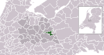
| |
| 0479 | North Holland | 157,013 | 2,123/km2 (5,500/sq mi) | 73.87 km2 (28.52 sq mi) | 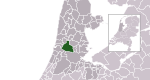
| |
| 0297 | Gelderland | 29,437 | 364/km2 (940/sq mi) | 79.38 km2 (30.65 sq mi) | 
| |
| 0473 | North Holland | 17,165 | 533/km2 (1,380/sq mi) | 32.12 km2 (12.40 sq mi) | 
| |
| 0050 | Flevoland | 22,886 | 92/km2 (240/sq mi) | 247.23 km2 (95.46 sq mi) | 
| |
| 0355 | Utrecht | 65,057 | 1,338/km2 (3,470/sq mi) | 48.51 km2 (18.73 sq mi) | 
| |
| 0299 | Gelderland | 44,099 | 472/km2 (1,220/sq mi) | 92.60 km2 (35.75 sq mi) | 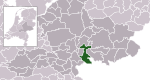
| |
| 0637 | South Holland | 125,265 | 3,637/km2 (9,420/sq mi) | 34.45 km2 (13.30 sq mi) | 
| |
| 0638 | South Holland | 8,838 | 406/km2 (1,050/sq mi) | 21.19 km2 (8.18 sq mi) | 
| |
| 1892 | South Holland | 45,054 | 756/km2 (1,960/sq mi) | 58.02 km2 (22.40 sq mi) | 
| |
| 0879 | North Brabant | 21,988 | 181/km2 (470/sq mi) | 120.65 km2 (46.58 sq mi) | 
| |
| 0301 | Gelderland | 48,099 | 1,170/km2 (3,000/sq mi) | 40.95 km2 (15.81 sq mi) | 
| |
| 1896 | Overijssel | 22,817 | 275/km2 (710/sq mi) | 82.49 km2 (31.85 sq mi) | 
| |
| 0642 | South Holland | 44,780 | 2,204/km2 (5,710/sq mi) | 20.30 km2 (7.84 sq mi) | 
| |
| 0193 | Overijssel | 129,827 | 1,160/km2 (3,000/sq mi) | 111.10 km2 (42.90 sq mi) | 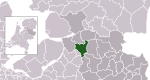
|
Special municipalities[]
| Municipality | Capital | Population[g][28] | Population density[h] | Area[i][29] | Map |
|---|---|---|---|---|---|
| Kralendijk | 20,915 | 73/km2 (190/sq mi) | 288 km2 (111.20 sq mi) | 
| |
| The Bottom | 1,933 | 149/km2 (390/sq mi) | 13 km2 (5.02 sq mi) | 
| |
| Oranjestad | 3,139 | 149/km2 (390/sq mi) | 21 km2 (8.11 sq mi) | 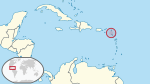
|
See also[]
- Association of Netherlands Municipalities
- Municipal politics in the Netherlands
- List of cities, towns and villages in the Netherlands by province
- List of municipal flags of the Netherlands
Notes[]
- ^ Municipalities as of 1 January 2021 with figures from 1 January 2020.
- ^ Population as of 1 January 2021.
- ^ Population density as of 1 January 2020.
- ^ Land area as of 1 January 2021.
- ^ Jump up to: a b c d Does not include statistics from the former municipality of Haaren that partially merged into this municipality in 2021.
- ^ Derived from the 1 January 2020 figures from the former municipalities of Appingedam, Delfzijl and Loppersum that merged into Eemsdelta.
- ^ Population as of January 2020
- ^ The population density is calculated by dividing the population by the area for each special municipality.
- ^ Area as of 2012
References[]
- ^ Jump up to: a b c "Gemeentelijke indeling op 1 januari 2021" [Municipalities on 1 January 2021]. CBS Classifications (in Dutch). CBS. Retrieved 23 March 2021.
- ^ "Central government, provinces, municipalities and water authorities". government.nl. Government of the Netherlands. Retrieved 3 April 2013.
- ^ OECD E-Government Studies: Netherlands 2007. Paris: OECD Publishing. 28 May 2007. p. 40. ISBN 978-92-64-03029-9. Retrieved 25 April 2013.
- ^ A.H.M. Dölle; D.J. Elzinga; J.W.M. Engels (20 September 2004). "Algemene bevoegdheids- en omgangsbepalingen" [General power and communication clauses]. Handboek van het Nederlandse gemeenterecht [Manual of Dutch municipal law] (in Dutch). Alphen aan den Rijn: Kluwer. pp. 143–170. ISBN 978-90-268-4169-9. Retrieved 25 April 2013.
- ^ Figee, Edward; Eigeman, Jean; Hilterman, Frank (December 2007). "Local Government in The Netherlands" (PDF). VNG. The Hague: Drukkerij Excelsior. Archived from the original (PDF) on 6 June 2013. Retrieved 5 April 2013.
- ^ Jump up to: a b "Wet openbare lichamen Bonaire, Sint Eustatius en Saba" [Public bodies act Bonaire, Sint Eustatius and Saba]. Act No. 345 of 10 October 2010 (in Dutch). Retrieved 5 April 2013.
- ^ Article 129, Constitution of the Netherlands. Retrieved on 24 April 2013.
- ^ "Gemeentewet" [Municipalities Act]. Article 8, Act No. 96 of 14 February 1992 (in Dutch). Retrieved 8 April 2013.
- ^ "Gemeentewet" [Municipalities Act]. Article 61.1 and 35.1, Act No. 96 of 14 February 1992 (in Dutch). Retrieved 8 April 2013.
- ^ A.H.M. Dölle; D.J. Elzinga; J.W.M. Engels (20 September 2004). "De samenstelling van het college" [Members of the board]. Handboek van het Nederlandse gemeenterecht [Manual of Dutch municipal law] (in Dutch). Alphen aan den Rijn: Kluwer. pp. 233–252. ISBN 978-90-268-4169-9. Retrieved 25 April 2013.
- ^ "Municipal government". government.nl. Government of the Netherlands. Retrieved 8 April 2013.
- ^ Jump up to: a b Ekamper, Peter; van der Erf, Rob; van der Gaag, Nicole; Henkes, Kène; van Imhoff, Evert; van Poppel, Frans (2003). "Chapter: Provincies en gemeenten, 1850-2000" [Provinces and municipalities, 1850-2000]. Bevolkingsatlas van Nederland: demografische ontwikkelingen van 1850 tot heden [Population atlas of the Netherlands: demographic developments from 1850 to now] (in Dutch). Rijswijk: Uitgeverij Elmar. pp. 21–27. ISBN 9038913648. Archived from the original (link to PDF) on 3 June 2012. Retrieved 8 April 2013.
- ^ "Gemeentelijke indeling op 1 januari 2019" [Municipalities on 1 January 2019]. CBS Classifications (in Dutch). CBS. 1 January 2019. Retrieved 1 January 2019.
- ^ Jump up to: a b Beeckman, Duncan; van der Bie, Ronald (2005). "Een eeuw gemeentelijke herindelingen" [A century of municipal mergers] (PDF). Bevolkingstrends (in Dutch). Heerlen/Voorburg: CBS. 53 (2): 63–64. ISSN 1571-0998. Archived from the original (PDF) on 2013-05-29. Retrieved 8 April 2013.
- ^ "Gemeentelijke herindeling" [Municipal mergers]. rijksoverheid.nl (in Dutch). Government of the Netherlands. Retrieved 9 April 2013.
- ^ "Wet van 7 februari 2013 tot wijziging van de Gemeentewet en enige andere wetten in verband met het afschaffen van de bevoegdheid van gemeentebesturen om deelgemeenten in te stellen" [Act of 7 February 2013 to change the Municipalities Act and other Act in relation to the dissolution of the power of municipalities to form submunicipalities]. Act No. 76 of 28 February 2013 (in Dutch). Retrieved 10 April 2013.
- ^ "Amsterdam stadsdelen" (in Dutch). Gemeente Amsterdam. Retrieved 5 December 2013.
- ^ "Rotterdam deelgemeenten" (in Dutch). Gemeente Rotterdam. Archived from the original on 3 December 2013. Retrieved 5 December 2013.
- ^ "The Hague stadsdelen" (in Dutch). Gemeente The Hague. Archived from the original on 11 December 2013. Retrieved 5 December 2013.
- ^ "Almere stadsdelen" (in Dutch). Gemeente Almere. Retrieved 5 December 2013.
- ^ "Eindhoven stadsdelen" (in Dutch). Gemeente Eindhoven. Archived from the original on 2 November 2013. Retrieved 5 December 2013.
- ^ "Groningen stadsdelen" (in Dutch). Gemeente Groningen. Archived from the original on 11 December 2013. Retrieved 5 December 2013.
- ^ "Nijmegen stadsdelen" (in Dutch). Website www.nijmegencity.nl. Retrieved 5 December 2013.
- ^ "Statistische gegevens" (in Dutch). Gemeente Tilburg. Retrieved 12 March 2019.
- ^ "Kerncijfers Wijken en Buurten" [Key figures for districts and neighbourhoods]. Methods:Data collection (in Dutch). CBS. Retrieved 10 April 2013.
- ^ "Bevolkingsontwikkeling; regio per maand" [Population development]. CBS Statline (in Dutch). CBS. 10 March 2021. Retrieved 23 March 2021.
- ^ Jump up to: a b "Regionale kerncijfers Nederland" [Regional key figures Netherlands]. CBS Statline (in Dutch). CBS. 10 June 2021. Retrieved 25 June 2021.
- ^ "Population of Dutch Caribbean (1 January); sex, age". CBS Statline. CBS. 15 April 2020. Retrieved 3 November 2020.
- ^ Referentiekader Caribisch Nederland met bijlagen [Reference frame Caribbean Netherlands with appendices] (Technical report) (in Dutch). IdeeVersa. 20 February 2012. pp. 25–27. Archived from the original (PDF) on 5 June 2013. Retrieved 29 March 2013.
External links[]
| Wikimedia Commons has media related to Municipalities in the Netherlands. |
| show Netherlands articles |
|---|

- Municipalities of the Netherlands
- Lists of subdivisions of the Netherlands
- Administrative divisions in Europe
- Second-level administrative divisions by country
- Lists of municipalities
- Netherlands geography-related lists