Berrylands
| Berrylands | |
|---|---|
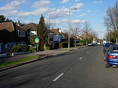 | |
 Berrylands Location within Greater London | |
| Population | 9,437 (2011 Census. Ward)[1] |
| OS grid reference | TQ195675 |
| London borough | |
| Ceremonial county | Greater London |
| Region | |
| Country | England |
| Sovereign state | United Kingdom |
| Post town | Surbiton |
| Postcode district | KT5 |
| Dialling code | 020 |
| Police | Metropolitan |
| Fire | London |
| Ambulance | London |
| UK Parliament | |
| London Assembly | |

Berrylands is a residential neighbourhood in the Surbiton district, originally forming part of the Municipal Borough of Surbiton, and since 1965 part of the Royal Borough of Kingston upon Thames. It is a suburban development situated 10.1 miles (16.3 km) south west of Charing Cross. Nearby places include Surbiton, New Malden, Old Malden, Tolworth and Chessington. Berrylands railway station is 24 minutes from London Waterloo by train.
History[]
Berrylands is a settlement of Anglo-Saxon origin that is close to the Thames. Berrylands originally formed part of the Municipal Borough of Surbiton, however in 1965 it was incorporated as part of the Royal Borough of Kingston upon Thames. Most of the present housing development took place in the 1930s on the former Berrylands Farm.
The Surbiton Lagoon lido opened in 1934, but later closed in 1980, and then demolished at the end of the decade.[2] This area was subsequently transformed into a park now owned and managed by Kingston Council, known as Berrylands Park,[3] with a small area to the south developed into housing, creating Meldone Close.[4]
Etymology[]
Berrylands is a place-name that misleadingly suggests "land where berries grow". It actually means "land on a tumulus or hill", from Old English beorg (modern dialectal "barrow" meaning "hill"), cognate with Old Norse bergr, bjorgr and borgr which mean the same thing, and Old English land ("land"). The name was recorded as Berilendes in 1126, and as Berulind in 1148 (wrongly suggesting Old English lindr "lime-tree" as the second element), and more recently as Barrilands in 1378, which shows the true origin as being from Old English beorg.
In a sense, the name corresponds to the modern English "Hill Farm", a common name for farms (and some new residences) across the United Kingdom.
Housing, shops and transport[]
There are four separate parades of shops, these are Alexandra Drive, Berrylands Road, Chiltern Drive and a smaller parade along Surbiton Hill Park. Chiltern Drive is at the centre of Berrylands, and houses over 22 businesses as well as the Berrylands public house, the Berrylands, known locally as 'The Berry'. The shops were built in the 1930s, and currently consist of a newsagents, doctors surgery, hairdressers, beauty salon, CCTV shop,[5] barbers, coffee shop, printer and bookshop, as well as the Berrylands railway station.
The neighbourhood is primarily residential. It houses a large commuter population using Transport for London travel routes, including two bus routes, the K2 and 665, and the Berrylands, Surbiton or Tolworth links to London Waterloo.
The majority of houses in the neighbourhood were built in the 1930s and have features typically[6] found in housing stock of the inter-war period. Although most houses are semi-detached there are also many detached properties and a small number of flats. On the fork of Grand Avenue and Elmbridge Avenue, there is a cluster of Modernist Art Deco houses, built as part of the Parkside estate[7] in 1934 (developer Bell).
Geography[]
Berrylands Station is the closest station to the sports ground of the London School of Economics and Political Science, which is in New Malden. There is a large water treatment plant on the opposite side of the railway. There are two parks in Berrylands Fishponds and Alexandra Park.
Nature reserve[]
In 2017 The Environment Trust acquired a grant for £168,000 from Thames Water, to support a three-year community project enhancing the river habitat, creating wetland habitat, and improving the undermanaged woodland. In July 2018 a footbridge was opened to create a nature trail into previously inaccessible corners of the nature reserve.
Education[]
There are a two main schools in Berrylands, these being Christ Church Primary School and Grand Avenue Primary School.
Sport[]
The Surbiton Racket and Fitness club on Berrylands was established in 1881 - the Club was founded and was known as the Berrylands Lawn Tennis Club. There were 200 members and 11 grass courts.
Berrylands Festival[]
Each year the local scout group organises a summer festival opposite their scout hut on the site of the old Surbiton Lagoon, now known by Kingston Council as Berrylands Park.
References[]
- ^ "Kingston Ward population 2011". Neighbourhood Statistics. Office for National Statistics. Retrieved 11 October 2016.
- ^ Surbiton Lagoon was built in 1934 closed in 1980, and then demolished in the late 1980s Archived 3 September 2005 at the Wayback Machine]
- ^ Kingston Council - Berrylands Park
- ^ London Gardens Online - Berrylands Park
- ^ Berrylands CCTV website
- ^ BBC – Which era of house do people like best?
- ^ Jensen, Finn, Modernist Semis and Terraces in England, Ashgate Publishing Limited, 2012
| Districts |  | |
|---|---|---|
| Attractions |
| |
| Bridges and tunnels | ||
| Parks and open spaces | ||
| Constituencies | ||
| Rail stations | ||
| Places of worship | ||
| Sport | ||
| Other topics | ||
| ||
- Areas of London
- Districts of the Royal Borough of Kingston upon Thames
- London School of Economics