Bettié
Bettié | |
|---|---|
Town, sub-prefecture, and commune | |
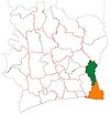
 Bettié Location in Ivory Coast | |
| Coordinates: 6°4′N 3°24′W / 6.067°N 3.400°WCoordinates: 6°4′N 3°24′W / 6.067°N 3.400°W | |
| Country | |
| District | Comoé |
| Region | Indénié-Djuablin |
| Department | Bettié |
| Population (2014)[1] | |
| • Total | 24,983 |
| Time zone | UTC+0 (GMT) |


European dwelling in Bettié, 1892
Bettié is a town in south-eastern Ivory Coast. It is a sub-prefecture of and seat of Bettié Department in Indénié-Djuablin Region, Comoé District. Bettié is also a commune. The town lies on the east bank of the river that forms the boundary between Comoé and Lagunes Districts. In 2014, the population of the sub-prefecture of Bettié was 24,983.[2]
Villages[]
The ten villages of the sub-prefecture of Bettié and their population in 2014 are:[2]
- Bettié (8 455)
- Akreby (2 744)
- Kossonoukro (5 182)
- N'zué Kouadiokro (312)
- Nioupinbeniekro (Saibe) (1 653)
- Abradinou (2 515)
- Aka-Comoekro (2 054)
- Heredougou (1 016)
- Yere-Yere I (394)
- Yere-Yere Ii (658)
References[]
- ^ "Côte d'Ivoire". geohive.com. Retrieved 8 December 2015.
- ^ Jump up to: a b "RGPH 2014, Répertoire des localités, Région Indénié-Djuablin" (PDF). ins.ci. Retrieved 5 August 2019.
| show Authority control |
|---|
This Comoé District location article is a stub. You can help Wikipedia by . |
Categories:
- Sub-prefectures of Indénié-Djuablin
- Communes of Indénié-Djuablin
- Comoé District geography stubs