Agnibilékrou Department
Agnibilékrou Department
Département d'Agnibilékrou | |
|---|---|
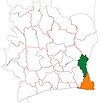
 Location in Ivory Coast. Agnibilékrou Department has retained the same boundaries since its creation in 1995. | |
| Country | |
| District | Comoé |
| Region | Indénié-Djuablin |
| 1995 | Established as a first-level subdivision via a division of Abengourou Dept |
| 1997 | Converted to a second-level subdivision |
| 2011 | Converted to a third-level subdivision |
| Departmental seat | Agnibilékrou |
| Government | |
| • Prefect | Souleymane Bamba |
| Area | |
| • Total | 1,720 km2 (660 sq mi) |
| Population (2014)[2] | |
| • Total | 168,188 |
| • Density | 98/km2 (250/sq mi) |
| Time zone | UTC+0 (GMT) |
Agnibilékrou Department is a department of Indénié-Djuablin Region in Comoé District, Ivory Coast. In 2014, its population was 168,188 and its seat is the settlement of Agnibilékrou. The sub-prefectures of the department are Agnibilékrou, Akoboissué, Damé, Duffrébo, and Tanguélan.
History[]
Agnibilékrou Department was created in 1995 as a first-level subdivision via a split-off from Abengourou Department.[3] It was the final department created prior to the 1997 conversion of departments into the second-level subdivisions of Ivory Coast.
In 1997, regions were introduced as new first-level subdivisions of Ivory Coast; as a result, all departments were converted into second-level subdivisions. Agnibilékrou Department was included in Moyen-Comoé Region.
In 2011, districts were introduced as new first-level subdivisions of Ivory Coast. At the same time, regions were reorganised and became second-level subdivisions and all departments were converted into third-level subdivisions. At this time, Agnibilékrou Department became part of Indénié-Djuablin Region in Comoé District. In 2014, the population of the sub-prefecture of Duffrébo was 42,426.[4]
Villages[]
Notes[]
- ^ "Préfets de Région et de Préfets de Département (Conseil des ministres du mercredi 26 septembre 2012)", abidjan.net, 2 October 2012.
- ^ "Côte d'Ivoire". geohive.com. Archived from the original on 22 November 2015. Retrieved 6 December 2015.
- ^ "Regions of Côte d'Ivoire (Ivory Coast)", statoids.com, accessed 16 February 2016.
- ^ "RGPH 2014, Répertoire des localités, Région Indénié-Djuablin" (PDF). ins.ci. Retrieved 5 August 2019.

| Authority control |
|
|---|
Coordinates: 7°13′N 3°20′W / 7.217°N 3.333°W

This Comoé District location article is a stub. You can help Wikipedia by . |
- Departments of Indénié-Djuablin
- 1995 establishments in Ivory Coast
- States and territories established in 1995
- Comoé District geography stubs