M'Bengué Department
M'Bengué Department
Département de M'Bengué | |
|---|---|
 Location in Ivory Coast. M'Bengué Department has retained the same boundaries since its creation in 2012. | |
| Country | |
| District | Savanes |
| Region | Poro |
| 2012 | Established via a division of Korhogo Dept |
| Departmental seat | M'Bengué |
| Government | |
| • Prefect | Raymond Claude Djiké |
| Area | |
| • Total | 2,600 km2 (1,000 sq mi) |
| Population (2014)[3] | |
| • Total | 87,811 |
| • Density | 34/km2 (87/sq mi) |
| Time zone | UTC+0 (GMT) |
M'Bengué Department is a department of Poro Region in Savanes District, Ivory Coast. In 2014, its population was 87,811 and its seat is the settlement of M'Bengué. The sub-prefectures of the department are Bougou, Katiali, Katogo, and M'Bengué.
History[]
M'Bengué Department was created in 2012 by dividing Korhogo Department.[4][5]
Notes[]
- ^ "Préfets de Région et de Préfets de Département (Conseil des ministres du mercredi 26 septembre 2012)", abidjan.net, 2 October 2012.
- ^ "Monographie du département de M’Bengué", abidjan.net, 28 June 2013.
- ^ "Côte d'Ivoire". geohive.com. Archived from the original on 22 November 2015. Retrieved 5 December 2015.
- ^ "Conseil des Ministres du mercredi 04 Juillet 2012 : De nouvelles entités administratives créées", abidjan.net, 5 July 2012.
- ^ "Le décret n° 2012-611 du 04 juillet 2012 portant création des Départements de Djékanou, Sipilou, Kong, Gbéléban, Taabo, Kouassi-Kouassikro, Méagui, Séguélon, Buyo, M'Bengué, Facobly et Dianra".

Regional seat: Korhogo | ||
| Dikodougou Department | 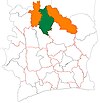 | |
| Korhogo Department | ||
| M'Bengué Department | ||
| Sinématiali Department | ||
* also a commune | ||
Coordinates: 10°0′N 5°54′W / 10.000°N 5.900°W

This Savanes District location article is a stub. You can help Wikipedia by . |
Categories:
- Departments of Poro Region
- States and territories established in 2012
- 2012 establishments in Ivory Coast
- Savanes District geography stubs