Blair Township, Michigan
Blair Township | |
|---|---|
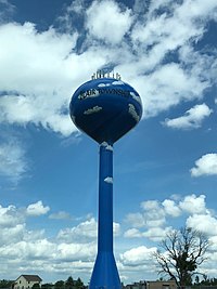 Blair Township Water Tower | |
 Location within Grand Traverse County | |
 Blair Township Location within the state of Michigan | |
| Coordinates: 44°39′18″N 85°38′48″W / 44.65500°N 85.64667°WCoordinates: 44°39′18″N 85°38′48″W / 44.65500°N 85.64667°W | |
| Country | United States |
| State | Michigan |
| County | Grand Traverse |
| Established | 1867 |
| Founded by | William Monroe |
| Government | |
| • Supervisor | Nicole Blonshine |
| Area | |
| • Total | 36.0 sq mi (93.1 km2) |
| • Land | 35.6 sq mi (92.2 km2) |
| • Water | 0.3 sq mi (0.9 km2) |
| Elevation | 892 ft (272 m) |
| Population (2010) | |
| • Total | 8,209 |
| • Density | 181.0/sq mi (69.9/km2) |
| Time zone | UTC-5 (Eastern (EST)) |
| • Summer (DST) | UTC-4 (EDT) |
| ZIP code(s) | 49637, 49649, 49685, 49696 |
| Area code(s) | 231 |
| FIPS code | 26-08880[1] |
| GNIS feature ID | 1625945[2] |


Blair Township is a civil township of Grand Traverse County in the U.S. state of Michigan, and a suburb of Traverse City. As of the 2010 census, the township population was 8,209, a significant increase from 6,448 at the 2000 census. Blair Township is named after Austin Blair, Michigan's governor during the American Civil War.
Geography[]
According to the United States Census Bureau, the township has a total area of 36.0 square miles (93 km2), of which 35.6 square miles (92 km2) is land and 0.3 square miles (0.78 km2) (0.95%) is water.
Adjacent townships[]
- Garfield Township (north)
- East Bay Township (northeast)
- Paradise Township (southeast)
- Mayfield Township (south)
- Grant Township (southwest)
- Green Lake Township (west)
- Long Lake Township (northwest)
Transportation[]
Communities[]
- Beitner is a ghost town at the corner of Beitner Road, Williams Road, and Hoosier Valley Road, just off US 31 at the bottom of Lower Boardman Hill
- Chums Corner is a census-designated place where US 31 meets M-37 and Beitner Road at the top of Upper Boardman Hill.
- Grawn is a census-designated place where US 31 meets Silver Lake Road and CR 633.
- Keystone is a ghost town just east of the Boardman River at Beitner Road, Keystone Road, and River Road, and is also the site of the demolished Keystone Dam.
- Monroe Center is an unincorporated community partially in Green Lake Township at CR 633, East Duck Lake Road, and Hilltop Road.
- Sleights Landing is a settlement on the Boardman River at River Road and Sleights Road
Demographics[]
As of the census[1] of 2000, there were 6,448 people, 2,295 households, and 1,684 families residing in the township. The population density was 181.0 per square mile (69.9/km2). There were 2,482 housing units at an average density of 69.7 per square mile (26.9/km2). The racial makeup of the township was 94.70% White, 0.25% African American, 1.64% Native American, 0.42% Asian, 0.02% Pacific Islander, 1.52% from other races, and 1.46% from two or more races. Hispanic or Latino of any race were 2.48% of the population.
There were 2,295 households, out of which 39.6% had children under the age of 18 living with them, 55.7% were married couples living together, 12.3% had a female householder with no husband present, and 26.6% were non-families. 18.5% of all households were made up of individuals, and 3.5% had someone living alone who was 65 years of age or older. The average household size was 2.80 and the average family size was 3.18.
In the township the population was spread out, with 30.1% under the age of 18, 8.9% from 18 to 24, 35.5% from 25 to 44, 19.0% from 45 to 64, and 6.6% who were 65 years of age or older. The median age was 32 years. For every 100 females, there were 102.0 males. For every 100 females age 18 and over, there were 99.1 males.
The median income for a household in the township was $40,125, and the median income for a family was $42,740. Males had a median income of $30,020 versus $19,885 for females. The per capita income for the township was $14,745. About 7.2% of families and 11.0% of the population were below the poverty line, including 11.4% of those under age 18 and 9.6% of those age 65 or over.
References[]
External links[]
| show Municipalities and communities of Grand Traverse County, Michigan, United States |
|---|

| show Authority control |
|---|
- Townships in Grand Traverse County, Michigan
- Traverse City micropolitan area
- Townships in Michigan