Blockhouse Bay
Blockhouse Bay | |
|---|---|
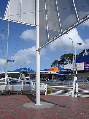 The Blockhouse Bay town centre. | |
 | |
| Country | New Zealand |
| City | Auckland Council |
| Electoral ward | Whau Ward |
| Population (2018) | |
| • Total | 15,747 |
| Avondale | New Windsor | New Windsor |
| New Lynn |
|
Mount Roskill |
| Green Bay | (Manukau Harbour) | Lynfield |
Blockhouse Bay is a residential suburb in the south west of Auckland, in New Zealand's North Island. It is sited on the northern coast of the Manukau Harbour, and is also close to the administrative boundary that existed between Auckland City and Waitakere, two of the former four cities of what was the Auckland conurbation before amalgamation into Auckland Council.
The suburb is located 11 kilometres to the southwest of the city centre, and is surrounded by the more central suburbs of Lynfield and New Windsor, and the Waitakere suburbs of New Lynn and Green Bay.
The Blockhouse Bay Library is located in the town centre,[1] as is the Blockhouse Bay Community Centre, located 200 metres from the library.[2]
History[]
Portage Road is the location of one of the overland routes between the two harbours (and thus the Pacific Ocean and the Tasman Sea), where the Maori would beach their waka (canoes) and drag them overland to the other coast, thus avoiding having to paddle around North Cape. This made the area of immense strategic importance in both pre-European times and during the early years of European occupation.
The earliest European known to have trekked through, and followed the coastline of the Manukau Harbour in an endeavour to find if there was a waterway connecting the two harbours, was the Rev. Samuel Marsden in 1820.
Two missionaries who had arrived in New Zealand on 30 December 1834, William Colenso and R. Wade, walked through the Whau South area in 1838 hoping to find a Māori settlement, but the Pa site on Te Whau point had been abandoned some time before. They remarked that the area was "open and barren heaths, dreary, sterile and wild."
The area was a popular holiday resort in the 1920s for Aucklanders, with families making the journey over rough roads to spend the summer at the beach.
The earliest industry, in 1884, was the Gittos Tannery. The early 1900s saw other industries such as poultry, orchards, potteries, strawberries, flowers, loganberries and small farm holdings.
The building which eventually gave the name to the area was constructed in 1860. At this time the first land war in Taranaki was escalating and there were fears it would spread north and so a defence system for Auckland was actioned. A 12-acre site was chosen, bordered by Esplanade (Endeavour Street), Gilfillan Street, Wynyard Road (Blockhouse Bay Road) and Boylan Street (Wade Street). The actual Whau Blockhouse was located on what is now No. 8 Gilfillan Street.
The site was chosen for two reasons:
- The elevated cleared 12-acre (49,000 m2) site provided an unobstructed view towards the Manukau Heads, the source of possible attack from southern Māori tribes.
- It was close to the Whau Portage which was the route favoured by northern Māori tribes.
Colonel Thomas Mould of the Royal Engineers was charged with planning the location and type of defence system needed. A blockhouse is a purpose-built building with walls thick enough to stop musket ball penetration, with slits in the walls for defensive musket fire, a fence or stockade surrounding the building, with a trench beyond that. The Blockhouse Bay Blockhouse never saw military action. In the 1880s it was rented out to a tenant and was gutted in a fire. It was subsequently demolished. The trenches were apparently still visible in the 1940s but have since been obscured.
Demographics[]
| Year | Pop. | ±% p.a. |
|---|---|---|
| 2006 | 13,347 | — |
| 2013 | 14,370 | +1.06% |
| 2018 | 15,747 | +1.85% |
| Source: [3] | ||
Blockhouse Bay, comprising the statistical areas of Glenavon, Blockhouse Bay North, Blockhouse Bay North East, Blockhouse Bay South and Blockhouse Bay East, had a population of 15,747 at the 2018 New Zealand census, an increase of 1,377 people (9.6%) since the 2013 census, and an increase of 2,400 people (18.0%) since the 2006 census. There were 4,767 households. There were 7,854 males and 7,893 females, giving a sex ratio of 1.0 males per female, with 2,850 people (18.1%) aged under 15 years, 3,525 (22.4%) aged 15 to 29, 7,023 (44.6%) aged 30 to 64, and 2,349 (14.9%) aged 65 or older.
Ethnicities were 34.8% European/Pākehā, 6.6% Māori, 13.2% Pacific peoples, 50.8% Asian, and 4.1% other ethnicities (totals add to more than 100% since people could identify with multiple ethnicities).
The proportion of people born overseas was 52.1%, compared with 27.1% nationally.
Although some people objected to giving their religion, 33.0% had no religion, 35.1% were Christian, and 27.4% had other religions.
Of those at least 15 years old, 3,852 (29.9%) people had a bachelor or higher degree, and 1,788 (13.9%) people had no formal qualifications. The employment status of those at least 15 was that 6,135 (47.6%) people were employed full-time, 1,650 (12.8%) were part-time, and 537 (4.2%) were unemployed.[3]
Education[]
Blockhouse Bay Intermediate is a school for years 7–8 with a roll of 815.[4] The school was established in 1959.[5]
Blockhouse Bay Primary School, Chaucer School, and Glenavon School are primary schools for years 1–6 (years 1–8 for Glenavon) with rolls of 576, 214 and 400 students, respectively.[6][7][8]
St Dominic's Catholic School is a state-integrated contributing primary school for years 1–6 with a roll of 282.[9]
Auckland International College is a private senior secondary school for years 11–13 with a roll of 136.[10] The school was founded in 2003.[11]
All these schools are coeducational. Rolls are as of November 2021.[12]
Local state or state-integrated secondary schools are Lynfield College, Mount Roskill Grammar School, Green Bay High School, and Marcellin College .
Sport and recreation[]
The Bay Roskill Vikings rugby league club are based at Blockhouse Bay reserve.
References[]
- ^ "Blockhouse Bay Library". Retrieved 24 July 2016.
- ^ "Blockhouse Bay Community Centre". Archived from the original on 22 June 2014. Retrieved 24 July 2016.
- ^ a b "Statistical area 1 dataset for 2018 Census". Statistics New Zealand. March 2020. Glenavon (137100), Blockhouse Bay North (137200), Blockhouse Bay North East (138600), Blockhouse Bay South (138900) and Blockhouse Bay East (139500). 2018 Census place summary: Glenavon 2018 Census place summary: Blockhouse Bay North 2018 Census place summary: Blockhouse Bay North East 2018 Census place summary: Blockhouse Bay South 2018 Census place summary: Blockhouse Bay East
- ^ Education Counts: Blockhouse Bay Intermediate
- ^ "About us". Blockhouse Bay Intermediate. Retrieved 10 August 2020.
- ^ Education Counts: Blockhouse Bay Primary School
- ^ Education Counts: Chaucer School
- ^ Education Counts: Glenavon School
- ^ Education Counts: St Dominic's Catholic School
- ^ Education Counts: Auckland International College
- ^ "Welcome to Auckland International College". Auckland International College. Retrieved 10 August 2020.
- ^ "New Zealand Schools Directory". New Zealand Ministry of Education. Retrieved 22 December 2021.
- "Why Blockhouse Bay?" Compiled by Keith G. Rusden for the Blockhouse Bay Historical Society Inc.
External links[]
- Blockhouse Bay Historical Society Inc.
- Photographs of Blockhouse Bay held in Auckland Libraries' heritage collections.
Coordinates: 36°55′00″S 174°42′32″E / 36.9167°S 174.7089°E

- Suburbs of Auckland
- Populated places around the Manukau Harbour
- Bays of the Auckland Region