Mount Roskill
Mount Roskill / Mt Roskill | |
|---|---|
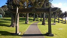
 Mount Roskill from Big King. The Waitākere Ranges in the background. | |
 | |
| Country | New Zealand |
| City | Auckland Council |
| Electoral ward | Albert-Eden-Puketāpapa Ward |
| Population (2018) | |
| • Total | 17,319 |
| Owairaka, Sandringham | Balmoral, Eden Valley | Mount Eden |
| New Windsor, New Zealand, Wesley |
|
Three Kings |
| Lynfield | Waikowhai | Hillsborough |
Mount Roskill is a suburban area in the city of Auckland, New Zealand. It is named for the volcanic peak Puketāpapa (commonly called "Mount Roskill" in English).
Description[]
The suburb, named after the Mount, is located seven kilometres to the south of the city centre, and is surrounded by the neighbouring suburbs of Three Kings, Sandringham, Wesley, Hillsborough and Mount Albert. The Mount Roskill shops are located at the intersection of Mount Albert and Dominion Roads.
In the 1920s, a new subdivision off Dominion Road was established. It was named the Victory Estate after notable First World War personnel.[1]
One of the city's larger suburbs, it was largely farmland until after the Second World War. It was a separate borough from 1947 until local government reorganisation in 1989 amalgamated it with Auckland City.
In the past, Mount Roskill was referred to as the Bible Belt of Auckland,[2] as it contained the highest number of churches per capita in New Zealand.[3] The electorate was one of the last in the country to go "wet", in 1999, having formally been a dry area where the selling of alcohol was prohibited.[4]
Demographics[]
| Year | Pop. | ±% p.a. |
|---|---|---|
| 2006 | 15,336 | — |
| 2013 | 16,131 | +0.72% |
| 2018 | 17,319 | +1.43% |
| Source: [5] | ||
Mount Roskill, comprising the statistical areas of Mount Roskill North, Mount Roskill White Swan, Mount Roskill Central North, Mount Roskill Central South and Mount Roskill South, had a population of 17,319 at the 2018 New Zealand census, an increase of 1,188 people (7.4%) since the 2013 census, and an increase of 1,983 people (12.9%) since the 2006 census. There were 5,187 households. There were 8,754 males and 8,556 females, giving a sex ratio of 1.02 males per female, with 2,853 people (16.5%) aged under 15 years, 4,788 (27.6%) aged 15 to 29, 7,605 (43.9%) aged 30 to 64, and 2,064 (11.9%) aged 65 or older.
Ethnicities were 29.1% European/Pākehā, 5.5% Māori, 15.5% Pacific peoples, 53.5% Asian, and 4.7% other ethnicities (totals add to more than 100% since people could identify with multiple ethnicities).
The proportion of people born overseas was 56.3%, compared with 27.1% nationally.
Although some people objected to giving their religion, 31.5% had no religion, 34.1% were Christian, and 29.9% had other religions.
Of those at least 15 years old, 4,764 (32.9%) people had a bachelor or higher degree, and 1,842 (12.7%) people had no formal qualifications. The employment status of those at least 15 was that 7,014 (48.5%) people were employed full-time, 2,016 (13.9%) were part-time, and 588 (4.1%) were unemployed.[5]
Local government[]
Mount Roskill had a local government like other suburbs of Auckland at the time. The local government was called Mount Roskill Borough Council, which started in 1947 and merged into Auckland City Council in 1989 and then eventually merged into Auckland Council in 2010.
Mayors (1947–1989)[]
During its existence from 1947 to 1989, the borough of Mount Roskill had five mayors:[6]
| Name | Term | |
|---|---|---|
| 1 | Charles McCullough | 1947–1950 |
| 2 | Philip Ernest Potter | 1950–1953 |
| 3 | Keith Hay | 1953–1974 |
| 4 | Dick Fickling | 1974–1987 |
| 5 | David Hay | 1987–1989 |
Library[]
Mt Roskill Library[7] was built and opened to public in August 1977. It was refurbished and the floor area extended in November 2011. Mt Roskill Library has English, Māori, Chinese, Tamil, Arabic and Somali collections.
Sport and recreation[]
, Bay Roskill Vikings, and are based in the suburb.
Education[]
Mount Roskill Grammar School is a secondary school (years 9-13) with a roll of 1870.[8] Mount Roskill Intermediate is an intermediate school (years 7-8) with a roll of 578.[9] Mount Roskill Primary is a contributing primary school (years 1-6) with a roll of 683.[10] These schools are on adjoining sites.
Dominion Road School, Hay Park School and May Road School are contributing primary schools (years 1-6) with rolls of 306, 157 and 200, respectively.[11][12][13]
Monte Cecilia School is a state-integrated Catholic contributing primary school (years 1-6) with a roll of 166.[14]
All these schools are coeducational. Rolls are as of November 2021.[15]
People[]
Mount Roskill has been home to many successful New Zealanders who attended the local schools. Among them are:
- Rugby coach John Hart,
- Billionaire Graeme Hart,
- Evangelist Bill Subritzky
- Rugby union international Doug Howlett,
- Actor and South Sydney Rabbitohs owner Russell Crowe,
- Reserve Bank Governor Alan Bollard,
- Tennis player Brett Steven,
- Labour MP Phil Goff,
- Balmain Tigers, Eastern Suburbs Roosters, Penrith Panthers and Parramatta Eels and New Zealand rugby league international, 1992 Dally M Medallist, former Kiwi coach and commentator Gary Freeman
- Former rugby league international Dane O'Hara
- Former rugby league international and New Zealand Māori representative Bill Burgoyne
- Former New Zealand Warriors, Melbourne Storm, St George-Illawarra Dragons, Parramatta Eels and Cronulla-Sutherland Sharks rugby league international, New Zealand Māori representative and current NRL referee Henry Perenara
- Former Parramatta Eels rugby league player Marcus Perenara
- Manly-Warringah Sea Eagles and New Zealand rugby league international Steve Matai
- New Zealand Warriors captain, rugby league international and professional boxer Monty Betham
- Canterbury-Bankstown Bulldogs and Wests Tigers rugby league international Matt Utai
- New Zealand Warriors and Kiwi rugby league international Evarn Tuimavave
- Parramatta Eels rugby league player Manu Ma'u
- New Zealand Warriors rugby league player Ben Henry
- Canberra Raiders rugby league player Bill Tupou
- Cronulla-Sutherland Sharks rugby league player Sosaia Feki
- New Zealand Warriors rugby league player Sione Lousi
- New Zealand Warriors rugby league player Sam Lousi
- Newcastle Knights rugby league player Paterika Vaivai
- The Hay family (of Keith Hay Homes)
- Professional cricket player Azhar Abbas
- New York Times Best Selling author Nalini Singh
In 2007, the Mount Roskill Community Board commissioned a 176-page book titled Just Passing Through: A History of Mt Roskill (Jade Reidy) which covered the growth of the district from 1840 up until the present time. It identified the significant input of Mount Roskill residents internationally, such as athletics coach Arthur Lydiard in the chapter "How Sport Put Mt Roskill on the World Map."
References[]
- ^ Graves, Joanne. "Mt Roskill's Victory Estate". Heritage et AL. Auckland Libraries.
- ^ "Mt Roskill". New Zealand Ministry for Culture and Heritage. Retrieved 27 November 2016.
- ^ "God and money: Interactive map shows rich suburbs have most atheists". The New Zealand Herald. 13 May 2015. ISSN 1170-0777. Retrieved 15 January 2017.
- ^ "Tawa ditches prohibition a century after banning alcohol - 150 years of news". Stuff.co.nz. Retrieved 10 April 2017.
- ^ a b "Statistical area 1 dataset for 2018 Census". Statistics New Zealand. March 2020. Mount Roskill North (139700), Mount Roskill White Swan (139800), Mount Roskill Central North (140400), Mount Roskill Central South (140700) and Mount Roskill South (141300). 2018 Census place summary: Mount Roskill North 2018 Census place summary: Mount Roskill White Swan 2018 Census place summary: Mount Roskill Central North 2018 Census place summary: Mount Roskill Central South 2018 Census place summary: Mount Roskill South
- ^ "Timeline of Auckland mayors". Auckland Council Archives. Retrieved 9 January 2021.
- ^ "Archived copy". Archived from the original on 28 June 2013. Retrieved 11 April 2013.
{{cite web}}: CS1 maint: archived copy as title (link) - ^ Education Counts: Mount Roskill Grammar
- ^ Education Counts: Mount Roskill Intermediate
- ^ Education Counts: Mount Roskill Primary School
- ^ Education Counts: Dominion Road School
- ^ Education Counts: Hay Park School
- ^ Education Counts: May Road School
- ^ Education Counts: Monte Cecilia School
- ^ "New Zealand Schools Directory". New Zealand Ministry of Education. Retrieved 22 December 2021.
Bibliography[]
- Nicola Legat:"In God We Trust? The Mount Roskillisation of Auckland" Metro 152 (February 1994): 58–67.
- David Craig: "Thin Topsoil: Queer Blokes, Moral Modernity and Real Estate Politics in New Zealand's Biggest Borough" in Ian Carter, David Craig and Steve Matthewman: Almighty Auckland? Palmerston North: Dunmore Press: 2004: ISBN 0-86469-452-0
- Jade Reidy Just Passing Through: The Making of Mt Roskill (c) 2007 Auckland City Council ISBN 978-1-877362-18-7
- City of Volcanoes: A geology of Auckland - Searle, Ernest J.; revised by Mayhill, R.D.; Longman Paul, 1981. First published 1964. ISBN 0-582-71784-1.
- Volcanoes of Auckland: The Essential Guide. Hayward, B.W., Murdoch, G., Maitland, G.; Auckland University Press, 2011.
External links[]
| Wikimedia Commons has media related to Mount Roskill, Auckland. |
- Photographs of Mount Roskill held in Auckland Libraries' heritage collections.
Coordinates: 36°54′45″S 174°44′14″E / 36.912594°S 174.737259°E

- Suburbs of Auckland