Bollebygd Municipality
Bollebygd Municipality
Bollebygds kommun | |
|---|---|
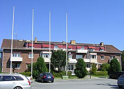 Bollebygd town hall | |
 Coat of arms | |
 | |
| Coordinates: 57°40′N 12°34′E / 57.667°N 12.567°ECoordinates: 57°40′N 12°34′E / 57.667°N 12.567°E | |
| Country | Sweden |
| County | Västra Götaland County |
| Seat | Bollebygd |
| Area | |
| • Total | 282.39 km2 (109.03 sq mi) |
| • Land | 263.19 km2 (101.62 sq mi) |
| • Water | 19.2 km2 (7.4 sq mi) |
| Area as of 1 January 2014. | |
| Population (31 December 2019)[2] | |
| • Total | 9,495 |
| • Density | 34/km2 (87/sq mi) |
| Time zone | UTC+1 (CET) |
| • Summer (DST) | UTC+2 (CEST) |
| ISO 3166 code | SE |
| Province | Västergötland |
| Municipal code | 1443 |
| Website | www.bollebygd.se |
| Density is calculated using land area only. | |

Bollebygd Municipality (Bollebygds kommun) is a municipality in Västra Götaland County in western Sweden. Its seat is located in the town of Bollebygd.
The municipal reform of 1952 united "old" Bollebygd with Töllsjö. The next reform placed Bollebygd within Borås Municipality from 1974. In 1995 Bollebygd was re-established as a municipality in the borders of 1952.
Localities[]
Population as of 2011-12-31:
Politics[]
Result of the 2010 election:
- Moderate Party 33,14%
- Centre party 7,22%
- Liberal People's Party 6,49%
- Christian Democrats 6,55%
- Swedish Social Democratic Party 26,57%
- Left Party 4,66%
- Green Party 6,13%
- Sweden Democrats 8,19%
- Other Parties 1,04%
References[]
- ^ "Statistiska centralbyrån, Kommunarealer den 1 januari 2014" (in Swedish). Statistics Sweden. 2014-01-01. Archived from the original (Microsoft Excel) on 2016-09-27. Retrieved 2014-04-18.
- ^ "Folkmängd i riket, län och kommuner 31 december 2019" (in Swedish). Statistics Sweden. February 20, 2020. Retrieved February 20, 2020.
External links[]
 Media related to Bollebygd Municipality at Wikimedia Commons
- Bollebygd Municipality - Official site
Categories:
- Municipalities of Västra Götaland County
- South Älvsborg
- 1995 establishments in Sweden
- States and territories disestablished in 1995