Bolton, Ontario
Bolton | |
|---|---|
 Queen Street (Highway 50) in Bolton | |
 Bolton | |
| Coordinates: 43°52′50″N 79°44′17″W / 43.88056°N 79.73806°W | |
| Country | Canada |
| Province | Ontario |
| Regional municipality | Peel |
| Town | Caledon |
| Ward | 5 |
| Area | |
| • Land | 20.72 km2 (8.00 sq mi) |
| Population | |
| • Total | 26,378 |
| • Density | 1,273.0/km2 (3,297/sq mi) |
| Time zone | UTC-5 (EST) |
| • Summer (DST) | UTC-4 (EDT) |
| Forward Sortation Area | L7E |
| Area code(s) | 905 and 289 |
| NTS Map | 030M13 |
| GNBC Code | FDJLH |


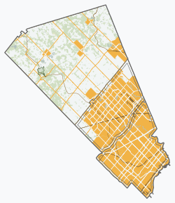
Bolton (2016 population 26,378)[1] is an unincorporated village that is the most populous community in the town of Caledon, Ontario. It is located beside the Humber River in the Region of Peel, approximately 50 kilometres northwest of Toronto. In regional documents, it is referred to as a 'Rural Service Centre'.[2] It has 26,478 residents in 8,721 households.[3] The downtown area that historically defined the village is in a valley, through which flows the Humber River. The village extends on either side of the valley to the north and south.
Geography[]
The conservation lands' forests dominate a large part of the northwest, the north and the east, including along the Humber valley. These conservation lands have created several recreational areas, including parts of the Humber Valley Heritage Trail. Farmland and the protected Oak Ridges Moraine dominate the landscape surrounding the village.
There are two 400-series highways nearby, including Highway 427, about 15 km southeast (by Highway 7), and Highway 400, about 14 km east (exit at King Road).
History[]
The community, formerly known as Bolton Mills, was founded around 1822 when James Bolton helped build a flour mill for his relative George Bolton. By 1857, Bolton was a village with a population of 700 in the Township of Albion in Peel County.
It was established on the Humber River, on the line of the proposed Toronto, Grey and Bruce Railway. There were stages to and from Weston. The average price of land was $40 to $50 per acre.[4]
The suburban housing developments began near King Street, up to 15th Sideroad of Albion (now known as Bolton Heights Road). The urban area did not expand until the late 1970s and early 1980s, which also led to development of an industrial area in the southwest. The urban area up to Columbia Way (the northern boundary) began booming in the late 1980s.
Housing developments continued towards the southern and western parts of the town (about 1 km northwest of the heart of town) in the 1990s and the 15th Sideroad in about 1995, especially to the north. The industrial area began adding buildings to the southwest, up to Simpson Road. The urban areas merged with the southern part in 2000 and the northwest.
Future growth is a subject of debate amongst the village's residents, as well as within the upper- and lower-tier municipal governments.
Demographics[]
As of the 2016 census, the top three ethnic groups in Bolton are Italian (45.5%), Canadian (19.9%), and English (17.2%).[5]
Organizations[]
- Freemasonry
- Kinsmen Club of Bolton, chartered in 1964
Media[]
The 1996 Warner Bros. film Twister and the 2005 film Four Brothers were partially shot here.
Education[]
Bolton is home to several public and Catholic schools:
Public Elementary Institutions:
- Allan Drive Middle School
- Ellwood Memorial Public School
- James Bolton Public School
- Macville Public School (just outside Bolton located in Caledon)
Public Secondary Institutions:
Catholic Elementary Institutions:
- Holy Family Elementary School
- St. John Paul II Elementary School
- St. John the Baptist Elementary School
- St. Nicholas Elementary School
Catholic Secondary Institutions:
- St. Michael Catholic Secondary School
Private Institutions:
- King's College School (Just outside Bolton located in Caledon)
- Creative Children's Montessori School
Notable residents[]
- Lorne Duguid – hockey player
- Keith McCreary – hockey player, former Chairman of the NHL Alumni, politician
- James East – politician
- Todd Elik – hockey player
- Organik (musician) – musician
- Steven Halko – hockey player
- Peter Holland – hockey player
- Andrew Mangiapane – hockey player
- Skye Sweetnam – singer
- Jason Saggo – UFC Fighter
References[]
- ^ Jump up to: a b c Canada, Government of Canada, Statistics. "Census Profile, 2016 Census Bolton [Population centre], Ontario and Ontario [Province]". www12.statcan.gc.ca. Retrieved October 15, 2019.
- ^ "Bolton Residential Expansion Study". Town of Caledon. Retrieved 4 October 2017.
- ^ (Town of Caledon Population Distribution - June 30, 2006 - http://www.town.caledon.on.ca/contentc/townhall/statistics/Caledon_Population_Distribution_30JUN06.pdf Archived 2011-05-27 at the Wayback Machine)
- ^ The province of Ontario gazetteer and directory. H. McEvoy, Editor and Compiler, Toronto. Robertson & Cook, Publishers, 1869.
- ^ Canada, Government of Canada, Statistics. "Census Profile, 2016 Census Bolton [Population centre], Ontario and Ontario [Province]". www12.statcan.gc.ca. Retrieved October 15, 2019.
External links[]
| Wikimedia Commons has media related to Bolton, Ontario. |
| show Places adjacent to Bolton, Ontario |
|---|

| Authority control |
|---|
Coordinates: 43°53′50″N 79°44′17″W / 43.89722°N 79.73806°W
- Neighbourhoods in Caledon, Ontario
- Populated places established in 1794
- 1794 establishments in the British Empire