Bonyhádvarasd
This article needs additional citations for verification. (August 2009) |
Bonyhádvarasd | |
|---|---|
 Coat of arms | |
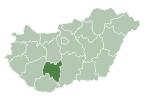
 Bonyhádvarasd Location of Bonyhádvarasd in Hungary | |
| Coordinates: 46°22′06″N 18°28′53″E / 46.36823°N 18.48134°E | |
| Country | Hungary |
| Region | Southern Transdanubia |
| County | Tolna |
| Subregion | Bonyhádi |
| Rank | Village |
| Area | |
| • Total | 10.45 km2 (4.03 sq mi) |
| Population (1 January 2008)[2] | |
| • Total | 424 |
| • Density | 41/km2 (110/sq mi) |
| Time zone | UTC+1 (CET) |
| • Summer (DST) | UTC+2 (CEST) |
| Postal code | 7158 |
| Area code | +36 74 |
| KSH code | 14818[1] |
| Website | https://www.bonyhadvarasd.hu |

Bonyhádvarasd is a village in Tolna County, Hungary.[3]
References[]
- ^ Jump up to: a b Bonyhádvarasd at the Hungarian Central Statistical Office (Hungarian).
- ^ Bonyhádvarasd at the Hungarian Central Statistical Office (Hungarian). 1 January 2008
- ^ "MAGYARORSZÁG HELYSÉGNÉVTÁRA, 2012". ksh.hu. Retrieved 23 October 2015.
Coordinates: 46°22′N 18°29′E / 46.367°N 18.483°E

This Tolna location article is a stub. You can help Wikipedia by . |
Categories:
- Populated places in Tolna County
- Tolna geography stubs