Simontornya
Simontornya | |
|---|---|
 Aerial view | |
 Flag  Coat of arms | |
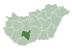
 Simontornya Location of Simontornya | |
| Coordinates: 46°45′15″N 18°32′51″E / 46.75408°N 18.54754°ECoordinates: 46°45′15″N 18°32′51″E / 46.75408°N 18.54754°E | |
| Country | |
| County | Tolna |
| Area | |
| • Total | 33.83 km2 (13.06 sq mi) |
| Population (2015)[1] | |
| • Total | 4,051 |
| • Density | 120/km2 (310/sq mi) |
| Time zone | UTC+1 (CET) |
| • Summer (DST) | UTC+2 (CEST) |
| Postal code | 7081 |
| Area code(s) | 74 |

Simontornya is a town in Tolna County, Hungary.
- Pictures of the town

Simon's Tower at the center of town

See also[]
- Simontornya Castle
External links[]
| Wikimedia Commons has media related to Simontornya. |
- Simontornya's info page
- Street map (in Hungarian)
References[]
- ^ Gazetteer of Hungary, 1st January 2015. Hungarian Central Statistical Office.

| show Authority control |
|---|
This Tolna location article is a stub. You can help Wikipedia by . |
Categories:
- Populated places in Tolna County
- Tolna geography stubs