Borough of Stafford
Borough of Stafford | |
|---|---|
 | |
|
| |
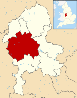 Stafford shown within Staffordshire | |
| Sovereign state | United Kingdom |
| Constituent country | England |
| Region | West Midlands |
| Non-metropolitan county | Staffordshire |
| Status | Non-metropolitan district |
| Admin HQ | Stafford |
| Incorporated | 1 April 1974 |
| Government | |
| • Type | Non-metropolitan district council |
| • Body | Stafford Borough Council |
| • Leadership | Leader & Cabinet (Conservative) |
| • MPs | William Cash Theodora Clarke |
| Area | |
| • Total | 231.0 sq mi (598.2 km2) |
| Area rank | 70th (of 309) |
| Population (mid-2019 est.) | |
| • Total | 137,280 |
| • Rank | 160th (of 309) |
| • Density | 590/sq mi (230/km2) |
| • Ethnicity | 97.4% White 1.0% S.Asian |
| Time zone | UTC0 (GMT) |
| • Summer (DST) | UTC+1 (BST) |
| ONS code | 41UG (ONS) E07000197 (GSS) |
| OS grid reference | SJ9213623094 |
| Website | www |

The Borough of Stafford is a local government district with borough status in Staffordshire in England. It is named after and includes the town of Stafford. It also includes the towns of Stone and Eccleshall, as well as numerous villages.
History[]
The borough was formed on 1 April 1974, under the Local Government Act 1972, as a merger of the municipal borough of Stafford, Stone urban district, Stafford Rural District and Stone Rural District. A new Civic Centre was constructed at Riverside in Stafford and completed in 1978.[1][2]
Most its parishes fell within the Hundred of Pirehill.
Wards[]
It has 26 wards: Barlaston and Oulton, Baswich, Chartley, Church Eaton, Common, Coton, Eccleshall, Forebridge, Fulford, Gnosall and Woodseaves, Haywood and Hixon, Highfield and Western Downs, Holmcroft, Littleworth, Manor, Milford, Milwich, Penkside, Rowley, Seighford, St. Michael's, Stonefield and Christchurch, Swynnerton, Tillington, Walton and Weeping Cross.[3]
Settlements and parishes of Stafford[]
| Settlement | Borough Ward | Parish |
|---|---|---|
| Adbaston | Eccleshall | Adbaston |
| Barlaston | Barlaston and Oulton | Barlaston |
| Berkswich | Milford | Berkswich |
| Bradley | Church Eaton | Bradley |
| Brocton | Milford | Brocton |
| Chebsey | Eccleshall | Chebsey |
| Church Eaton | Church Eaton | Church Eaton |
| Colwich | Haywood and Hixon | Colwich |
| Creswell | Seighford | Creswell |
| Eccleshall | Eccleshall | Eccleshall |
| Ellenhall | Seighford | Ellenhall |
| Forton | Gnosall and Woodseaves | |
| Fradswell | Milwich | |
| Fulford | Fulford | Fulford |
| Gayton | Chartley | |
| Gnosall | Gnosall and Woodseaves | Gnosall |
| Haughton | Church Eaton | Haughton |
| High Offley | Gnosall and Woodseaves | |
| Hixon | Haywood and Hixon | |
| Hilderstone | Milwich | Hilderstone |
| Coton | ||
| Hyde Lea | Seighford | Hyde Lea |
| Ingestre | Milford | |
| Knightley | Gnosall and Woodseaves | |
| Marston | Seighford | |
| Milwich | Milwich | |
| Norbury | Gnosall and Woodseaves | |
| Ranton | Seighford | |
| Salt and Enson | Chartley | |
| Sandon and Burston | Walton | |
| Seighford | Seighford | |
| Standon | Eccleshall | |
| Stone | Stonefield and Christchurch | |
| Milwich | ||
| Stowe-by-Chartley | Chartley | |
| Swynnerton | Swynnerton | Swynnerton |
| Tixall | Milford | |
| Weston | Chartley | |
| Whitgreave | Seighford | |
| Woodseaves | Gnosall and Woodseaves |
References[]
- ^ "Construction Site for Stafford Borough Council Offices, Riverside, Stafford". Staffordshire Past Track. Retrieved 13 February 2021.
- ^ "No. 47702". The London Gazette. 1 December 1948. p. 14484.
- ^ "List of wards". Stafford Borough Council.

Coordinates: 52°48′18.05″N 2°6′59.99″W / 52.8050139°N 2.1166639°W
- Borough of Stafford
- Non-metropolitan districts of Staffordshire