Borxleben
Borxleben | |
|---|---|
Location of Borxleben within Kyffhäuserkreis district 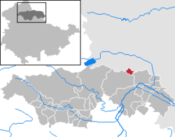 | |
 Borxleben  Borxleben | |
| Coordinates: 51°23′48″N 11°13′42″E / 51.39667°N 11.22833°ECoordinates: 51°23′48″N 11°13′42″E / 51.39667°N 11.22833°E | |
| Country | Germany |
| State | Thuringia |
| District | Kyffhäuserkreis |
| Government | |
| • Mayor (2016–22) | Jochen Franke[1] |
| Area | |
| • Total | 5.33 km2 (2.06 sq mi) |
| Elevation | 134 m (440 ft) |
| Population (2020-12-31)[2] | |
| • Total | 280 |
| • Density | 53/km2 (140/sq mi) |
| Time zone | UTC+01:00 (CET) |
| • Summer (DST) | UTC+02:00 (CEST) |
| Postal codes | 06556 |
| Dialling codes | 0 34 66 |
| Vehicle registration | KYF |
Borxleben is a village in the district Kyffhäuserkreis, in Thuringia, Germany.
History[]
Between 30 June 1994 and 1 January 2019, Borxleben was part of the Mittelzentrum Artern collective municipality.
Historical Population[]
As of 31 December each year:
|
|
|
|
- Source: Thuringian State Statistical Bureau

Borxleben Chapel

War Monument in Borxleben


References[]
- ^ Gewählte Bürgermeister - aktuelle Landesübersicht, Freistaat Thüringen, accessed 13 July 2021.
- ^ "Bevölkerung der Gemeinden, erfüllenden Gemeinden und Verwaltungsgemeinschaften in Thüringen Gebietsstand: 31.12.2020". Thüringer Landesamt für Statistik (in German). June 2021.
Authority control | |
|---|---|
| General | |
| Other |
|
This Kyffhäuserkreis location article is a stub. You can help Wikipedia by . |
Categories:
- Municipalities in Thuringia
- Kyffhäuserkreis
- Schwarzburg-Rudolstadt
- Bezirk Halle
- Thuringia geography stubs