Boulouparis
Boulouparis | |
|---|---|
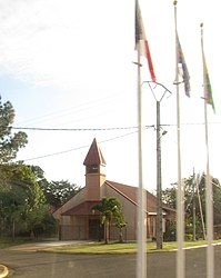 The church of Bouloupari | |
 Location of the commune (in red) within New Caledonia | |
show Location of Boulouparis | |
| Coordinates: 21°52′02″S 166°02′39″E / 21.8672°S 166.0442°ECoordinates: 21°52′02″S 166°02′39″E / 21.8672°S 166.0442°E | |
| Country | France |
| Sui generis collectivity | New Caledonia |
| Province | South Province |
| Government | |
| • Mayor (2020–2026) | Pascal Vittori |
| Area 1 | 865.6 km2 (334.2 sq mi) |
| Population (2019 census)[1] | 3,315 |
| • Density | 3.8/km2 (9.9/sq mi) |
| Ethnic distribution | |
| • 2019 census | Kanaks 30.17% Europeans 27.66% Wallisians and Futunans 2.23% Mixed 16.08% Other 23.86% |
| Time zone | UTC+11:00 |
| INSEE/Postal code | 98802 /98812 |
| Elevation | 0–1,441 m (0–4,728 ft) (avg. 20 m or 66 ft) |
| 1 New Caledonia Land Register (DITTT) data, which exclude lakes and ponds larger than 1 km² (0.386 sq mi or 247 acres) as well as the estuaries of rivers. | |


Boulouparis is a commune in the South Province of New Caledonia, an overseas territory of France in the Pacific Ocean.
Twin towns – sister cities[]
Boulouparis is twinned with:[2]
References[]
- ^ Population, ménages et logement par commune, en 2019, Institut de la statistique et des études économiques Nouvelle-Calédonie
- ^ "Jumelage". boulouparis.nc (in French). Boulouparis. Retrieved 2020-07-20.
| Wikimedia Commons has media related to Boulouparis. |
This New Caledonian location article is a stub. You can help Wikipedia by . |
Categories:
- Communes of New Caledonia
- New Caledonia geography stubs