Bowling Green, Maryland
Bowling Green, Maryland | |
|---|---|
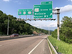 I-68/US 40 in Bowling Green | |
 Location within the State of Maryland | |
| Coordinates: 39°37′28″N 78°48′20″W / 39.62444°N 78.80556°WCoordinates: 39°37′28″N 78°48′20″W / 39.62444°N 78.80556°W | |
| Country | |
| State | |
| County | |
| Area | |
| • Total | 1.0 sq mi (2.5 km2) |
| • Land | 1.0 sq mi (2.5 km2) |
| • Water | 0 sq mi (0 km2) |
| Elevation | 690 ft (210 m) |
| Population (2010) | |
| • Total | 1,077 |
| • Density | 1,120/sq mi (432.3/km2) |
| Time zone | UTC−5 (Eastern (EST)) |
| • Summer (DST) | UTC−4 (EDT) |
| FIPS code | 24-08850 |
| GNIS feature ID | 2583587 |


Bowling Green is an unincorporated community and census-designated place (CDP) in Allegany County, Maryland, United States. As of the 2010 census it had a population of 1,077.[1]
It is located along U.S. Route 220 (McMullen Highway), directly southwest of the city of Cumberland and includes the former community of Roberts. The CDP of Potomac Park borders Bowling Green to the south, the Potomac River is to the east and Haystack Mountain is to the west. For many years, the community was mostly farmland but was later divided into building lots by the Buchanan, Roberts and Long families. CSX Transportation railroad tracks skirt the community along the river; in earlier years, a predecessor maintained the Roberts train station, which has since been closed.
The Upper Potomac Industrial Park is located in the northern part of the community, close to Cumberland.
References[]
- ^ "Geographic Identifiers: 2010 Demographic Profile Data (G001): Bowling Green CDP, Maryland". U.S. Census Bureau, American Factfinder. Archived from the original on February 12, 2020. Retrieved May 23, 2013.
External links[]
Municipalities and communities of Allegany County, Maryland, United States | ||
|---|---|---|
| Cities |  | |
| Towns | ||
| CDPs |
| |
| Other communities | ||
| ||
- Census-designated places in Allegany County, Maryland
- Populated places in the Cumberland, MD-WV MSA
- Census-designated places in Maryland
- Cumberland, MD-WV MSA
- Populated places on the North Branch Potomac River
- Allegany County, Maryland geography stubs