Bowman, Tennessee
Bowman, Tennessee | |
|---|---|
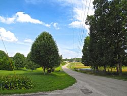 Bowman Loop Road in Bowman | |
 Bowman | |
| Coordinates: 36°03′40″N 85°01′42″W / 36.06111°N 85.02833°WCoordinates: 36°03′40″N 85°01′42″W / 36.06111°N 85.02833°W | |
| Country | United States |
| State | Tennessee |
| County | Cumberland |
| Area | |
| • Total | 2.290 sq mi (5.93 km2) |
| • Land | 2.288 sq mi (5.93 km2) |
| • Water | 0.002 sq mi (0.005 km2) |
| Elevation | 1,811 ft (552 m) |
| Population | |
| • Total | 302 |
| • Density | 130/sq mi (51/km2) |
| Time zone | UTC-6 (Central (CST)) |
| • Summer (DST) | UTC-5 (CDT) |
| Area code(s) | 931 |
| GNIS feature ID | 1646854[3] |

Bowman is a census-designated place and unincorporated community in Cumberland County, Tennessee, United States. It is located off U.S. Route 127 north of Crossville, south of Clarkrange, and west of the Catoosa Wildlife Management Area. Its population was 302 as of the 2010 census.[2]
The community was named for Nathaniel Bowman, a pioneer settler.[4]
References[]
- ^ "US Gazetteer files: 2010, 2000, and 1990". United States Census Bureau. 2011-02-12. Retrieved 2011-04-23.
- ^ a b "U.S. Census website". United States Census Bureau. Retrieved 2011-05-14.
- ^ "Bowman". Geographic Names Information System. United States Geological Survey.
- ^ Miller, Larry L. (2001). Tennessee Place-names. Indiana University Press. p. 27. ISBN 0-253-21478-5.
Municipalities and communities of Cumberland County, Tennessee, United States | ||
|---|---|---|
| Cities | ||
| Town | ||
| CDPs |
| |
| Other communities | ||
| ||
This Cumberland County, Tennessee geography–related article is a stub. You can help Wikipedia by . |
Categories:
- Census-designated places in Cumberland County, Tennessee
- Census-designated places in Tennessee
- Unincorporated communities in Tennessee
- East Tennessee geography stubs