Boyne Valley, Queensland
| Boyne Valley Queensland | |||||||||||||||
|---|---|---|---|---|---|---|---|---|---|---|---|---|---|---|---|
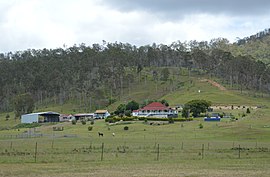 A homestead in the Boyne Valley, 2017 | |||||||||||||||
 Boyne Valley | |||||||||||||||
| Coordinates | 24°27′13″S 151°17′34″E / 24.4536°S 151.2927°ECoordinates: 24°27′13″S 151°17′34″E / 24.4536°S 151.2927°E | ||||||||||||||
| Population | 358 (2016 census)[1] | ||||||||||||||
| • Density | 0.2741/km2 (0.7100/sq mi) | ||||||||||||||
| Postcode(s) | 4680 | ||||||||||||||
| Area | 1,306.0 km2 (504.2 sq mi) | ||||||||||||||
| LGA(s) | Gladstone Region | ||||||||||||||
| State electorate(s) | Callide | ||||||||||||||
| Federal division(s) | Flynn | ||||||||||||||
| |||||||||||||||

The Boyne Valley is a rural locality in Gladstone Region, Queensland, Australia.[2] The locality contains four small towns: Nagoorin, Ubobo, Builyan, and Many Peaks. In the 2016 census, Boyne Valley had a population of 358 people.[1]
Geography[]
It is in the valley of the Boyne River, in Central Queensland, approximately 500 km north of Brisbane and 70 km south west of Gladstone. "The Valley" as locals call it, is part of Gladstone's hinterland. Formerly within the Shire of Calliope, in 2008 it became part of Gladstone Region. It is in close proximity to Kroombit Tops National Park.
Road infrastructure[]
The Gladstone–Monto Road runs through from north to south-west.[3]
History[]
Nagoorin State School opened on 18 October 1915.[4]
Builyan State School opened on 4 December 1922.[4]
Ubobo State School opened on 23 March 1927.[4]
At the 2006 census, Boyne Valley had a population of 646.[5]
In the 2011 census, Boyne Valley had a population of 379 people.[6]
Heritage listings[]
Boyne Valley has a number of heritage-listed sites, including:
- Gladstone-Monto Road, Ubobo: Soldier Settler House[7]
- Norton Road, Nagoorin: Norton Goldfield[8]
- 5 Railway Terrace, Ubobo: Ububo QCWA[9]
Education[]
Ubobo State School is a government primary (Prep-6) school for boys and girls at Cedarvale Road (24°24′24″S 151°19′18″E / 24.4067°S 151.3217°E).[10][11] In 2017, the school had an enrolment of 12 students with 3 teachers (2 full-time equivalent) and 4 non-teaching staff (2 full-time equivalent).[12] The school was temporarily closed in late 2019 due to a lack of enrolments, and remains closed as of October 2021.
Builyan State School is a government primary (Prep-6) school for boys and girls at Gladstone Road (24°31′45″S 151°23′07″E / 24.5293°S 151.3854°E).[13] In 2017, the school had an enrolment of 8 students with 2 teachers (1 full-time equivalent) and 4 non-teaching staff (2 full-time equivalent).[12]
Nagoorin State School is a government primary (Prep-6) school for boys and girls at 2 Ubobo Street (24°21′06″S 151°18′00″E / 24.3516°S 151.2999°E).[14] In 2017, the school had an enrolment of 12 students with 2 teachers (1 full-time equivalent) and 4 non-teaching staff (2 full-time equivalent).[12]
The three schools get together on a regular basis, providing students with the opportunity to learn and socialise with children of a similar age.
There are no secondary schools in Boyne Valley. The nearest is Miriam Vale State School which offers secondary schooling to Year 10. For Years 11 and 12, the nearest schools are Gladstone State High School, Rosedale State School and Monto State High School.[15]
See also[]
- Beautiful Betsy
- Castle Tower National Park
- Kroombit Tops National Park
- Lake Awoonga
- List of valleys of Australia
References[]
- ^ a b Australian Bureau of Statistics (27 June 2017). "Boyne Valley (SSC)". 2016 Census QuickStats. Retrieved 20 October 2018.

- ^ "Boyne Valley (entry 46593)". Queensland Place Names. Queensland Government. Retrieved 20 November 2016.
- ^ Boyne Valley, Queensland (Map). Google Maps. Retrieved 29 October 2021.
- ^ a b c "Opening and closing dates of Queensland Schools". Queensland Government. Retrieved 18 April 2019.
- ^ Australian Bureau of Statistics (25 October 2007). "Boyne Valley (Calliope Shire)". 2006 Census QuickStats. Retrieved 30 July 2007.
- ^ Australian Bureau of Statistics (31 October 2012). "Boyne Valley (SSC)". 2011 Census QuickStats. Retrieved 20 November 2016.
- ^ "Soldier Settler House (entry 602229)". Queensland Heritage Register. Queensland Heritage Council. Retrieved 8 July 2013.
- ^ "Norton Goldfield (entry 602491)". Queensland Heritage Register. Queensland Heritage Council. Retrieved 8 July 2013.
- ^ "Ubobo QCWA". Gladstone Heritage Register. Gladstone Regional Council. Archived from the original on 1 January 2019. Retrieved 1 January 2019.
- ^ "State and non-state school details". Queensland Government. 9 July 2018. Archived from the original on 21 November 2018. Retrieved 21 November 2018.
- ^ "Ubobo State School". Archived from the original on 2 May 2012. Retrieved 21 November 2018.
- ^ a b c "ACARA School Profile 2017". Archived from the original on 22 November 2018. Retrieved 22 November 2018.
- ^ "Builyan State School". Archived from the original on 26 March 2012. Retrieved 21 November 2018.
- ^ "Nagoorin State School". Archived from the original on 26 March 2012. Retrieved 21 November 2018.
- ^ "Queensland Globe". State of Queensland. Retrieved 1 January 2019.
External links[]
| Wikimedia Commons has media related to Boyne Valley, Queensland. |
- Valleys of Queensland
- Gladstone Region
- Localities in Queensland