Brûlé Lake (Romaine)
| Brûlé Lake | |
|---|---|
| Lac Brûlé | |
 Satellite view | |
 Brûlé Lake | |
| Location | Southern Labrador / Lac-Jérôme, Quebec |
| Coordinates | 52°15′N 63°48′W / 52.25°N 63.80°WCoordinates: 52°15′N 63°48′W / 52.25°N 63.80°W |
| Native name | Upuapuhkau Nipi (Innu) |
| Primary inflows | Romaine River |
| Primary outflows | Romaine River |
| Basin countries | Canada |
| Max. length | 34 kilometers (21 mi) |
| Max. width | 5.7 kilometers (3.5 mi) |
| Surface area | 89 square kilometres (34 sq mi) |
| Surface elevation | 485 meters (1,591 ft) |

Brûlé Lake (French: Lac Brûlé: Burnt Lake) is a lake in southern Labrador (the mainland portion of the province of Newfoundland and Labrador), Canada, overlapping the border with Quebec.
Location[]
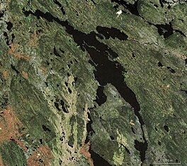
Brûlé Lake is in the unorganized territory of Lac-Jérôme in the Minganie Regional County Municipality.[1] The lake lies at an elevation of 485 meters (1,591 ft).[citation needed] Brûlé Lake is a widening of the Romaine River, which flows south into the Jacques-Cartier Strait west of Havre-Saint-Pierre. The lake is 34 kilometres (21 mi) long and 6 kilometres (3.7 mi) wide. It covers an area of nearly 89 square kilometres (34 sq mi). At this point the Romaine River defines the border between Quebec and Labrador.[2] A map of the ecological regions of Quebec shows the lake in the sub-region 7c-T of the east spruce/lichen subdomain.[3]
Name[]
The Innu call the lake Upuapuhkau Nipi or Upuâpûhkâu Nipi, meaning "lake whose perimeter burned in the past". It is also called Apuabushkau or Apuabushkash. In the 19th century it was called Lacs Brûlés, referring to the connected Brûlé, Lavoie and Anderson lakes. On maps of 1898 and 1907 it is shown as "L. Brulé", then on a map of 1911 as "Burnt Lakes", and in 1924 as "Lac Brulé". There are ninety lakes called Lac Brûlé, Brûlés or Brûlée in Quebec.[2]
Notes[]
Sources[]
- Lac Brûlé (in French), Commission de toponymie du Québec, retrieved 2019-10-20
- Lac Brûlé (in French), Ressources naturelles Canada, retrieved 2019-10-20
- Saucier, J.-P.; Robitaille, A.; Grondin, P.; Bergeron, J.-F.; Gosselin, J. (2011), Les régions écologiques du Québec méridional (PDF) (map), 4 (in French), Ministère des Ressources naturelles et de la Faune, retrieved 2019-09-26
| hide | |||||
|---|---|---|---|---|---|
| Administrative units |
| ||||
| Protected areas | |||||
| Major river basins | |||||
| Significant lakes | |||||
| Transport infrastructure | |||||
| |||||
This Labrador location article is a stub. You can help Wikipedia by . |
This Quebec location article is a stub. You can help Wikipedia by . |
- Lakes of Côte-Nord
- Labrador
- Lakes of Newfoundland and Labrador
- Labrador geography stubs
- Quebec geography stubs