Division No. 10, Newfoundland and Labrador
Division No. 10 | |
|---|---|
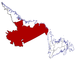 Location of Division No. 10 in Newfoundland and Labrador | |
| Coordinates: 52°57′N 66°55′W / 52.950°N 66.917°WCoordinates: 52°57′N 66°55′W / 52.950°N 66.917°W | |
| Country | Canada |
| Province | Newfoundland and Labrador |
| Area | |
| • Total | 199,703.36 km2 (77,105.90 sq mi) |
| As of 2016 | |
| Population (2016)[1] | |
| • Total | 24,639 |
| • Density | 0.12/km2 (0.32/sq mi) |

Census Division No. 10 of Newfoundland and Labrador is composed of the Labrador region of the province, excluding Nunatsiavut. It has a land area of 199,703 km² (77,105.8 sq mi) and at the 2016 census had a population of 24,639,[1] up from 24,111 in 2011.[2] Its two major population centres are the towns of Happy Valley-Goose Bay and Labrador City.
Towns[]
- Cartwright
- Charlottetown
- Forteau
- Happy Valley-Goose Bay
- Labrador City
- L'Anse-au-Clair
- L'Anse-au-Loup
- Mary's Harbour
- North West River
- Pinware
- Port Hope Simpson
- Red Bay
- St. Lewis
- Wabush
- West St. Modeste
Unorganized subdivisions[]
- Subdivision A (Includes: L'Anse-Amour, Capstan Island)
- Subdivision B (Includes: Lodge Bay, Paradise River, Black Tickle, Norman Bay, Pinsent's Arm, William's Harbour)
- Subdivision C (Includes: Sheshatshiu, Mud Lake)
- (Includes: Churchill Falls)
- (Includes: Natuashish)
References[]
- ^ a b c "Census Profile, 2016 Census: Division No. 10, Census division [Census division], Newfoundland and Labrador". Statistics Canada. Retrieved October 13, 2019.
- ^ "Census Profile - Division No. 10, Census division". Statistics Canada. Retrieved 2 March 2012.
Sources[]
- "(Code 1010) Census Profile". 2011 census. Statistics Canada. 2012.
Places adjacent to Division No. 10, Newfoundland and Labrador | |
|---|---|
| Subdivisions and statistical units |
|
|---|---|
| Communities |
|
| Cities | |
| |
Categories:
- Census divisions of Newfoundland and Labrador
- Labrador