Brandy Camp, Pennsylvania
Brandy Camp, Pennsylvania | |
|---|---|
 Brandy Camp Location within the state of Pennsylvania | |
| Coordinates: 41°19′15″N 78°41′15″W / 41.32083°N 78.68750°WCoordinates: 41°19′15″N 78°41′15″W / 41.32083°N 78.68750°W | |
| Country | United States |
| State | Pennsylvania |
| County | Elk |
| Township | Horton |
| Elevation | 1,549 ft (472 m) |
| Time zone | UTC-5 (Eastern (EST)) |
| • Summer (DST) | UTC-4 (EDT) |
| ZIP codes | 15822 |
| GNIS feature ID | 1170161[1] |

Brandy Camp is an unincorporated community and coal town in Elk County, Pennsylvania, United States. Their post office closed in 2005.[2]
References[]
- ^ U.S. Geological Survey Geographic Names Information System: Brandy Camp, Pennsylvania
- ^ http://webpmt.usps.gov/pmt007.cfm. Retrieved 2012-07-30. Missing or empty
|title=(help)[dead link]
Municipalities and communities of Elk County, Pennsylvania, United States | ||
|---|---|---|
| City | 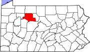 | |
| Boroughs | ||
| Townships | ||
| CDPs | ||
| Unincorporated communities | ||
| ||
This Elk County, Pennsylvania state location article is a stub. You can help Wikipedia by . |
Categories:
- Unincorporated communities in Elk County, Pennsylvania
- Coal towns in Pennsylvania
- Unincorporated communities in Pennsylvania
- Western Pennsylvania geography stubs