Brazlândia
This article includes a list of general references, but it remains largely unverified because it lacks sufficient corresponding inline citations. (July 2013) |
Brazlândia | |
|---|---|
| Região Administrativa de Brazlândia Administrative Region of Brazlândia | |
 Flag | |
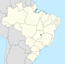
 Localization of Brazlândia in Federal District | |
| Coordinates: 15°40′30″S 48°12′03″W / 15.67500°S 48.20083°W | |
| Country | |
| Region | Central-West |
| State | |
| Founded | December 10, 1964 |
| Government | |
| • | Devanir Gonçalves de Oliveira[1] |
| Area | |
| • Total | 474.83 km2 (183.33 sq mi) |
| Population (2010)[2] | |
| • Total | 53.874 |
| Time zone | UTC−3 (BRT) |
| Postal Code (CEP) | 72700-000 |
| Area code(s) | +55 61 |
| Website | www.brazlandia.df.gov.br |

Brazlândia is an administrative region in the Federal District in Brazil.
See also[]
- List of administrative regions of the Federal District
References[]
- ^ "Perfil do administrador" (in Portuguese). Administração Regional de Brazlândia, DF. Retrieved 2015-01-01.
- ^ "Pesquisa Distrital por Amostra de Domicílios - 2010/2011" (PDF) (in Portuguese). Codeplan. Retrieved 2013-04-09.
External links[]
| Wikimedia Commons has media related to Brazlândia. |
Seat of government: Brasília | ||||||||
|  | |||||||
This Federal District, Brazil geography article is a stub. You can help Wikipedia by . |
Categories:
- Administrative regions of Federal District (Brazil)
- Populated places established in 1964
- 1964 establishments in Brazil
- Federal District (Brazil) geography stubs