Núcleo Bandeirante
This article includes a list of general references, but it remains largely unverified because it lacks sufficient corresponding inline citations. (July 2013) |
Núcleo Bandeirante | |
|---|---|
| Região Administrativa do Núcleo Bandeirante Administrative Region of Núcleo Bandeirante | |
 Flag | |
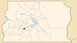
 Localization of Núcleo Bandeirante in Federal District | |
| Coordinates: 15°52′12″S 47°58′04″W / 15.87000°S 47.96778°W | |
| Country | |
| Region | Central-West |
| State | |
| Founded | December 19, 1956 |
| Government | |
| • | Roosevelt Vilela |
| Area | |
| • Total | 80.43 km2 (31.05 sq mi) |
| Population (2010)[1] | |
| • Total | 26.089 |
| Time zone | UTC−3 (BRT) |
| Postal Code (CEP) | 71700-000 |
| Area code(s) | +55 61 |
| Website | www.bandeirante.df.gov.br |
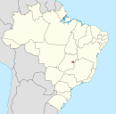
Núcleo Bandeirante is an administrative region in the Federal District in Brazil.
See also[]
- List of administrative regions of the Federal District
References[]
- ^ "Pesquisa Distrital por Amostra de Domicílios - 2010/2011" (PDF) (in Portuguese). Codeplan. Retrieved 2013-04-12.
External links[]
| Wikimedia Commons has media related to Núcleo Bandeirante. |
Categories:
- Administrative regions of Federal District (Brazil)
- Populated places established in 1964
- 1964 establishments in Brazil
- Federal District (Brazil) geography stubs

