Brentwood, Calgary
Brentwood | |
|---|---|
Neighbourhood | |
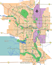 Brentwood Location of Brentwood in Calgary | |
| Coordinates: 51°05′55″N 114°08′04″W / 51.09861°N 114.13444°WCoordinates: 51°05′55″N 114°08′04″W / 51.09861°N 114.13444°W | |
| Country | |
| Province | |
| City | |
| Quadrant | NW |
| Ward | 7 |
| Established | 1960 |
| Government | |
| • Mayor | Jyoti Gondek |
| • Administrative body | Calgary City Council |
| • Councillor | Terry Wong |
| Elevation | 1,115 m (3,658 ft) |
| Population (2006)[2] | |
| • Total | 6,255 |
| • Average Income | $56,305 |
| Website | Brentwood Community Association |

Brentwood is a neighbourhood in the northwest quadrant of Calgary, Alberta. It is bounded by John Laurie Boulevard to the north, Crowchild Trail to the south, Shaganappi Trail to the west, and Brisbois Drive & Charleswood Drive on the east. Nose Hill Park lies to the north of John Laurie Boulevard and is not part of Brentwood.
Brentwood was established in 1960. It is represented in the Calgary City Council by the Ward 7 councillor.[1]
It is served by the Brentwood station of the C-Train LRT system. The Northland Village shopping center is located in the western extremity of the neighbourhood.
History[]
Brentwood was scene to the 2014 Calgary stabbings.[3]
Demographics[]
In the City of Calgary's 2012 municipal census, Brentwood had a population of 6,059 living in 2,595 dwellings, a 0.2% increase from its 2011 population of 6,049.[4] With a land area of 2.9 km2 (1.1 sq mi), it had a population density of 2,090/km2 (5,410/sq mi) in 2012.[4][5]
Residents in this community had a median household income of $56,305 in 2000, and there were 14.3% low income residents living in the neighbourhood.[6] As of 2000, 22.7% of the residents were immigrants. A proportion of 15.7% of the buildings were condominiums or apartments, and 27.3% were used for renting.[2]
Education[]
The following schools are located in Brentwood:
- Brentwood Elementary School
- Captain John Palliser Elementary
- Dr. E. W. Coffin Elementary
- Simon Fraser Junior High
- Sir Winston Churchill Senior High
- Ecole St. Luke Bilingual Elementary (Catholic)
- Brebeuf Junior High
- Rocky Mountain College
The University of Calgary grounds border the community to the southwest, and the Southern Alberta Institute of Technology is also located close to the neighbourhood.
See also[]
References[]
- ^ a b "Calgary Elections". City of Calgary. 2017. Retrieved November 12, 2017.
- ^ a b City of Calgary (2006). "Brentwood Community Statistics" (PDF). Archived from the original (PDF) on 2006-10-06. Retrieved 2007-05-08.
- ^ "Five Stabbed to Death at College House Party in Calgary". NBC News. Retrieved 2020-02-24.
- ^ a b "2012 Civic Census Results" (PDF). City of Calgary. 2012. Retrieved February 4, 2013.
- ^ "Community Boundaries" (Esri shapefile). City of Calgary. Retrieved February 5, 2013.
- ^ City of Calgary (2004). "Ward 11 Profile" (PDF). Archived from the original (PDF) on 2007-08-09. Retrieved 2007-05-08.
External links[]
Places adjacent to Brentwood, Calgary | ||||||||||||||||
|---|---|---|---|---|---|---|---|---|---|---|---|---|---|---|---|---|
| ||||||||||||||||
- Neighbourhoods in Calgary