Brielle
Brielle
Brill | |
|---|---|
Municipality | |
 Historic city centre | |
 Flag  Coat of arms | |
 Location in South Holland | |
| Coordinates: 51°54′N 4°10′E / 51.900°N 4.167°ECoordinates: 51°54′N 4°10′E / 51.900°N 4.167°E | |
| Country | Netherlands |
| Province | South Holland |
| Government | |
| • Body | Municipal council |
| • Mayor | (PvdA) |
| Area | |
| • Total | 31.14 km2 (12.02 sq mi) |
| • Land | 27.55 km2 (10.64 sq mi) |
| • Water | 3.59 km2 (1.39 sq mi) |
| Elevation | 2 m (7 ft) |
| Population (January 2019)[4] | |
| • Total | 17,182 |
| • Density | 624/km2 (1,620/sq mi) |
| Demonym(s) | Briellenaar |
| Time zone | UTC+1 (CET) |
| • Summer (DST) | UTC+2 (CEST) |
| Postcode | 3230–3232 |
| Area code | 0181 |
| Website | www |


Brielle (pronounced [ˈbrilə] (![]() listen)), also called Den Briel in Dutch and Brill in English, is a town, municipality and historic seaport in the western Netherlands, in the province of South Holland, on the north side of the island of Voorne-Putten, at the mouth of the New Maas. The municipality covers an area of 31.14 km2 (12.02 sq mi) of which 3.59 km2 (1.39 sq mi) is water. In 2019 its population was 17,182.
listen)), also called Den Briel in Dutch and Brill in English, is a town, municipality and historic seaport in the western Netherlands, in the province of South Holland, on the north side of the island of Voorne-Putten, at the mouth of the New Maas. The municipality covers an area of 31.14 km2 (12.02 sq mi) of which 3.59 km2 (1.39 sq mi) is water. In 2019 its population was 17,182.
The municipality of Brielle also includes the communities Vierpolders and Zwartewaal.
History[]
This section does not cite any sources. (March 2014) |
Brielle is a very old, fortified city. Its name is derived from the Celtic word brogilo (meaning "closed area" or "hunting grounds"). The oldest writings about Brielle indicate that the current location is the "new" Brielle. Den ouden Briel (Old Brill) must have been situated somewhere else on the Voorne-Putten Island. It received city rights in 1306. The city was for a long time the seat of the Count of Voorne, until this fiefdom was added to Holland in 1371. It had its own harbour and traded with the countries around the Baltic Sea. Brielle even had its own trading colony in Sweden.
During the Eighty Years' War between the Netherlands and Spain, the Capture of Brielle on April 1, 1572, by Protestant rebels, the Watergeuzen, marked a turning point in the conflict, as many towns in Holland then began to support William of Orange against the Spanish Duke Fernando Álvarez de Toledo, 3rd Duke of Alba who was sent to pacify The Netherlands. This event is still celebrated each year on April 1 and the night before (known as Chalk Night (kalknacht) when the city is defaced with chalk - and now also white paint). Dutch students are taught a short rhyme to remember this fact, which rhyme refers to April Fools' Day:
Op 1 april verloor Alva zijn bril.
Op April zes verloor Alva zijn fles
On April 1st, Alva lost his glasses
On April 6th Alva lost his bottle
In Dutch, "bril" is the word for "glasses," and it closely rhymes with Briel; as does "Fles" which stands for the town of Vlissingen, and was the next town to be captured by the Dutch rebels.
After the capture of Brielle the Protestant rebels tortured and murdered the Catholic Martyrs of Gorkum and Brielle has become a pilgrimage location since then.
In August 1585, Brielle was one of the three Dutch towns that became an English possession by the Treaty of Nonsuch when Queen Elizabeth I received it as security of payment for 5000 soldiers (led by the Earl of Leicester) and used by the Dutch in their struggle against the Spanish. The first English governor of Brielle was Thomas Cecil, 1st Earl of Exeter, succeeded by Edward Conway, 1st Viscount Conway who named his daughter Brilliana in honour of the city. English garrisons were stationed here and at Flushing.[5] In 1617, these cities returned to the Netherlands.
Twin cities[]
Brielle is twinned with:
|
Notable people[]

- Anneke Esaiasdochter (1509 in Brielle – 1539) a Dutch Anabaptist executed as a heretic, a Protestant martyr.
- Willem Bloys van Treslong (1529–1594) a nobleman, lead the Sea Beggars and the Capture of Brielle in 1572.
- Maarten Tromp (1598 in Brielle – 1653) a Dutch army general and admiral in the Dutch navy
- Witte de With (1599 in Hoogendijk – 1658) a Dutch naval officer during the Eighty Years War and the First Anglo-Dutch war
- Ludowyk Smits (1635 in Zwartewaal – 1707) a Dutch Golden Age painter
- Philips van Almonde (1644 in Den Briel – 1711) a Dutch Lieutenant Admiral
- Constantijn van Daalen (1884 in Brielle – 1931) a Dutch gymnast who competed in the 1908 Summer Olympics
- Toon Tellegen (born 1941 in Brielle) a Dutch writer and poet, known for children's books and a physician
See also[]
Gallery[]

Brielle, church: de Sint Catharijne kerk

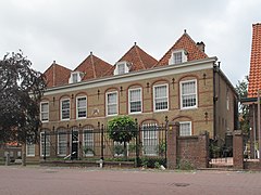
Brielle, monumental houses at the Wellerondom

Briele - panoramio
Brielle, former orphanage

Brielle, monumental houses Vischstraat


References[]
- ^ "College van B & W" [Board of mayor and aldermen]. Bestuur, organisatie en beleid (in Dutch). Gemeente Brielle. Archived from the original on 17 May 2013. Retrieved 16 July 2013.
- ^ "Kerncijfers wijken en buurten 2020" [Key figures for neighbourhoods 2020]. StatLine (in Dutch). CBS. 24 July 2020. Retrieved 19 September 2020.
- ^ "Postcodetool for 3231AP". Actueel Hoogtebestand Nederland (in Dutch). Het Waterschapshuis. Retrieved 16 July 2013.
- ^ "Bevolkingsontwikkeling; regio per maand" [Population growth; regions per month]. CBS Statline (in Dutch). CBS. 1 January 2019. Retrieved 1 January 2019.
- ^ Garrett Mattingly (1959), The Armada, Boston: Houghton Mifflin, Ch. V, "Plans of Operations", p. 44.
External links[]
| Wikisource has the text of the 1911 Encyclopædia Britannica article Brielle. |
| Wikimedia Commons has media related to Brielle. |
| Wikivoyage has a travel guide for Brielle. |
- Official website (some pages in English)
- http://www.catharijnekerk.nl Website of St Catharijnekerk
| show Places adjacent to Brielle |
|---|
| show Municipalities of South Holland |
|---|

| show Authority control |
|---|
- Brielle
- Municipalities of South Holland
- Populated places in South Holland