Brimstone Creek
| Brimstone Creek | |
|---|---|
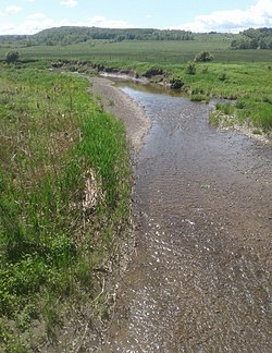 Brimstone Creek west of the Village of Ames. Budd Hill is in the background. | |
 Location of the mouth within New York | |
| Location | |
| Country | United States |
| State | New York |
| Region | Central New York Region |
| Counties | Schoharie, Montgomery |
| Towns | Sharon, Canajoharie |
| Physical characteristics | |
| Source | |
| • location | East of Sharon Springs |
| • coordinates | 42°47′47″N 74°34′19″W / 42.7963889°N 74.5719444°W |
| Mouth | Canajoharie Creek |
• location | North-northwest of Ames |
• coordinates | 42°50′48″N 74°36′28″W / 42.8467403°N 74.6076415°WCoordinates: 42°50′48″N 74°36′28″W / 42.8467403°N 74.6076415°W[1] |
• elevation | 676 ft (206 m) |
| Basin size | 14.9 sq mi (39 km2)[2] |


Brimstone Creek is a river in Schoharie County and Montgomery County in New York. It begins east of the Village of Sharon Springs and flows mostly in a northwest direction before flowing into Canajoharie Creek north-northwest of the Village of Ames.
References[]
- ^ "Brimstone Creek". Geographic Names Information System. United States Geological Survey. Retrieved 2018-05-23.
- ^ "USGS 0134909505 BRIMSTONE CREEK AT MOUTH AT AMES NY". waterdata.usgs.gov. waterdata.usgs.gov. May 23, 2019. Retrieved 23 May 2019.
data
This article about a location in Montgomery County, New York is a stub. You can help Wikipedia by . |
Categories:
- Rivers of New York (state)
- Rivers of Montgomery County, New York
- Mohawk River
- Central New York geography stubs