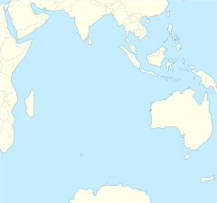
Broken Ridge
Coordinates: 31°S 95°E / 31°S 95°E


The Broken Ridge or Broken Plateau is an oceanic plateau in the south-eastern Indian Ocean. The Broken Ridge once formed a large igneous province (LIP) together with the Kerguelen Plateau. When Australia and Antarctica started to separate, the Broken Ridge and the Kerguelen Plateau got separated by the Southeast Indian Ridge.[1] Alkalic basalt from the Broken Ridge has been dated to 95 Ma.[2]
The Broken Ridge stretches 1,200 km (750 mi) from the southern end of the Ninety East Ridge towards the south-western corner of Australia. It is up to 400 km (250 mi) wide and reaches 1,000 m (3,300 ft) below sea level. It is separated from the Diamantina Fracture Zone on its southern side by a 3,000 m (9,800 ft) escarpment, while on the northern side the ridge slopes gently towards the abyssal Wharton Basin. The sediment cover on the ridge reaches 800 m (2,600 ft) and the Moho is found at about 20 km (12 mi).[1] It is separated from the Naturaliste Plateau by the .
The Kerguelen LIP covered 2.3×10⁶ km2 (0.89×10⁶ sq mi) making it the second largest LIP on Earth (after the Ontong Java Plateau in the Pacific).[3] Both these enormous LIPs reaches 2–4 km (1.2–2.5 mi) above the surrounding ocean floor and have a crustal thickness of 20–40 km (12–25 mi) (compared to oceanic crust typically around 7 km (4.3 mi) thick.)[4] The Broken Ridge and Kerguelen Plateau are now separated by 1,800 km (1,100 mi). When they broke-up, the southern flank of Broken Ridge was uplifted some 2,000 m (6,600 ft) and reached above sea level.[4]
The Kerguelen LIP has a long and complicated history, however, and is probably the least "typical" of all LIPs.[3] Rocks from both the Broken Ridge and the Kerguelen Plateau contain a continental component or "fingerprint". In the Early Cretaceous, the Kerguelen hotspot was split into several diapirs of various sizes, composition, and ascent rates. These separate diapirs created the , the Southern Kerguelen Plateau, the Rajmahal Traps/Indian lamprophyres, Antarctic lamprophyres, and the Central Kerguelen Plateau/Broken Ridge. In the late Cretaceous, activity in the mantle slowed and the Kerguelen hotspot was reduced to a single plume which created the Ninety East Ridge.[2] 120-95 Ma when the Southern and Central Kerguelen Plateau formed together with the Broken Ridge, the Kerguelen hotspot produced 1 km3 (0.24 cu mi)/year, but 95-25 Ma the output decreased to 0.1 km3 (0.024 cu mi).[5]
References[]
Notes[]
- ^ Jump up to: a b Schlich 2013, pp. 79–80
- ^ Jump up to: a b Frey et al. 2003, Mantle sources, plume-lithosphere interactions, and plume models, pp. 15-17
- ^ Jump up to: a b Ingle 2007
- ^ Jump up to: a b Frey et al. 2000, Introduction, pp. 74–77
- ^ Frey et al. 2003, p. 18
Sources[]
- Frey, F. A.; et al. (2000). "Origin and evolution of a submarine large igneous province: the Kerguelen Plateau and Broken Ridge, southern Indian Ocean" (PDF). Earth and Planetary Science Letters. 175 (1): 73–89. CiteSeerX 10.1.1.504.4746. doi:10.1016/S0012-821X(99)00315-5. Retrieved 30 August 2015.
- Frey, F. A.; et al. (2003). "Leg 183 Summary: Kerguelen Plateau-Broken Ridge—A Large Igneous Province" (PDF). Proceedings of the Ocean Drilling Program. 183: 1–48. Retrieved 30 August 2015.
- Ingle, S. (2007). "April 2007 LIP of the Month: The Kerguelen Large Igneous Province". Large Igneous Provinces Commission. Retrieved 27 September 2015.
- Schlich, R. (2013). "The Indian Ocean: Aseismic Ridges, Spreading Centers, and Oceanic Basins". In Nairn, A. E. M. (ed.). The Ocean Basins and Margins: The Indian Ocean. Springer. pp. 51–84. ISBN 9781461580386. Retrieved 27 September 2015.
- Large igneous provinces
- Plateaus of the Indian Ocean
- Cretaceous volcanism
