Brownsmead, Oregon
Brownsmead, Oregon | |
|---|---|
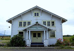 Grange hall | |
 Brownsmead Location within the state of Oregon | |
| Coordinates: 46°13′3″N 123°32′29″W / 46.21750°N 123.54139°WCoordinates: 46°13′3″N 123°32′29″W / 46.21750°N 123.54139°W | |
| Country | United States |
| State | Oregon |
| County | Clatsop |
| Time zone | UTC-8 (Pacific (PST)) |
| • Summer (DST) | UTC-7 (PDT) |
| ZIP code | 97103 |
| Area code(s) | 503 and 971 |


Brownsmead is an unincorporated community, on a distributary of the Columbia River called Saspal Slough, in Clatsop County, Oregon, United States. Previously known as Brody, it was named after W.G. Brown, a Portland engineer involved in land reclamation in the area. There was a post office in Brownsmead from 1919 to 1975,[1] located in the Brownsmead General Store.
Historic photos of the Brownsmead fish station, located where Davis Creek feeds into Blind Slough, reveal docked gillnetting boats. One such boat is shown in the boat hoist, resting above the water by several feet on the dock.[2]
Brownsmead is the northernmost settlement in the state of Oregon.[citation needed]
References[]
- ^ McArthur, Lewis A.; McArthur, Lewis L. (2003) [1928]. Oregon Geographic Names (7th ed.). Portland, Oregon: Oregon Historical Society Press. p. 118. ISBN 978-0875952772.
- ^ Historic Photographs of Brownsmead salmon station[permanent dead link]
| hide Municipalities and communities of Clatsop County, Oregon, United States | ||
|---|---|---|
| Cities |  | |
| CDPs |
| |
| Other communities | ||
| ||
This Clatsop County, Oregon state location article is a stub. You can help Wikipedia by . |
- Unincorporated communities in Clatsop County, Oregon
- 1919 establishments in Oregon
- Unincorporated communities in Oregon
- Oregon geography stubs