Brule River State Forest
| Brule River State Forest | |
|---|---|
IUCN category V (protected landscape/seascape) | |
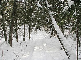 The North Country Trail passes through the Brule Bog near the southern boundary of the forest | |
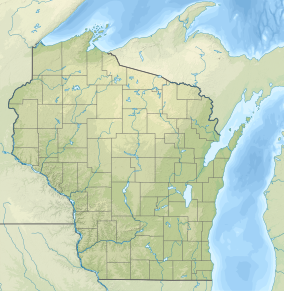 | |
| Location | Douglas, Wisconsin, United States |
| Coordinates | 46°32′31″N 91°35′9″W / 46.54194°N 91.58583°WCoordinates: 46°32′31″N 91°35′9″W / 46.54194°N 91.58583°W |
| Area | 40,882 acres (165.44 km2) |
| Established | 1907 |
| Governing body | Wisconsin Department of Natural Resources |


Brule River State Forest is a state forest located in Douglas County, Wisconsin, U.S.A. that encompasses the Bois Brule River for most of its length from its headwaters to Lake Superior. It is administered by the Wisconsin Department of Natural Resources and is nearly 47,000 acres (190 km2) in size, making it the fourth-largest state park in Wisconsin. It was founded in 1907 and is the second oldest state park after Interstate.
The Cedar Island Lodge, or "the Summer White House," where multiple American presidents and generals have vacationed, is located here. The state forest is popular with canoeists, and cross-country skiers.
External links[]
| Authority control |
|
|---|
This article about a location in Douglas County, Wisconsin is a stub. You can help Wikipedia by . |
Categories:
- IUCN Category V
- Protected areas of Douglas County, Wisconsin
- Wisconsin state forests
- Protected areas established in 1907
- 1907 establishments in Wisconsin
- Northern Wisconsin geography stubs
- Wisconsin geography stubs
- Midwestern United States protected area stubs