North Country Trail
| North Country Trail | |
|---|---|
 NCT in the Manistee National Forest | |
| Length | 4600 mi (7403 km) |
| Location | New York / Pennsylvania / Ohio / Michigan / Wisconsin / Minnesota / North Dakota |
| Designation | National Scenic Trail (1980) |
| Trailheads | Lake Sakakawea State Park, North Dakota Crown Point State Historic Site, New York |
| Use | Hiking |
| Hiking details | |
| Trail difficulty | Easy to strenuous |
| Sights | Northern hardwood forest; prairie; agricultural fields; low mountains; sand dunes; boreal forest; lake shores; small towns. |
The North Country National Scenic Trail, generally known as the North Country Trail or simply the N.C.T., is a footpath stretching over 4,600 miles (7,400 km) from Middlebury in central Vermont to Lake Sakakawea State Park in central North Dakota in the United States; connecting both the Long Trail and the Appalachian Trail with the Lewis and Clark Trail. Passing through the eight states of Vermont, New York, Pennsylvania, Ohio, Michigan, Wisconsin, Minnesota and North Dakota, it is the longest of the eleven National Scenic Trails authorized by Congress. As of early 2019, 3,129 miles (5,036 km) of the trail is in place.[1]
The NCT is administered by the National Park Service, managed by federal, state, and local agencies, and built and maintained primarily by the volunteers of the North Country Trail Association (NCTA) and its partners. The 28 chapters of the NCTA, its 3,200+ members and each affiliate organization have assumed responsibility for trail construction and maintenance of a specific section of the NCT.
History[]
The NCT was created on March 5, 1980 by an amendment to the National Trails System Act.[2] When the Trail was established in 1980, portions of it were designed to follow the already existing Finger Lakes (New York), Baker (Pennsylvania), and Buckeye (Ohio) Trails. Their sponsoring organizations became affiliates of the North Country Trail Association and agreed to maintain those portions of their trails to be used by the North Country National Scenic Trail. The Northwestern Ohio Rails-to-Trails Association joined later to help create a link between the Buckeye Trail in Ohio and newly constructed trail in Michigan; the Superior Hiking Trail Association, Border Route Trail Association, and the Kekekabic Trail Club joined when it was proposed that the North Country National Scenic Trail route through Minnesota be changed to include an already-completed section of the Superior Hiking Trail along Lake Superior, and the Kekekabic and Border Route Trails along the Canada–US border in Minnesota's Arrowhead Region. Over the years, legislation was introduced in both the U.S. House of Representatives and U.S. Senate which would authorize the Arrowhead re-route as well as later an extension to the trail's eastern terminus, connecting it with the Appalachian Trail in Vermont.[3] On March 12, 2019 the North Country Trail reroute and extension was signed into law as part of the omnibus John D. Dingell Jr. Conservation, Management, and Recreation Act.[4]
Route[]


The trail begins in Vermont and proceeds to the western end of New York state. It cuts across northwestern Pennsylvania, then follows a southwesterly course through the hilly region of southern Ohio until it nears Cincinnati when it runs north through western Ohio to the hills of SE Michigan. It continues from southeast Michigan through the western Lower Peninsula, crosses the Straits of Mackinac, and takes a northern route the length of the Upper Peninsula. After crossing northern Wisconsin, one leg follows the Lake Superior shore to the northeast corner of Minnesota before turning west, where it meets the other leg in central northern Minnesota. The trail enters southeast North Dakota, and continues to its other terminus in the center of the state.
The NCT connects more than 160 public land units, including parks, forests, scenic attractions, wildlife refuges, game areas, and historic sites. The list includes:
- Ten National Forest areas (Finger Lakes in New York; Allegheny in Pennsylvania; Wayne in Ohio; Manistee, Hiawatha, and Ottawa in Michigan; Chequamegon in Wisconsin; Superior and Chippewa in Minnesota; and Sheyenne National Grassland in North Dakota)

- Four areas of the National Park Service (Michigan's Pictured Rocks National Lakeshore, Wisconsin's St. Croix National Scenic Riverway, New York's Fort Stanwix National Monument, and Ohio's Dayton Aviation Heritage National Historical Park)
Other federal facilities along the NCT include:
- Two National Wildlife Refuges (Minnesota's Tamarac and North Dakota's Audubon) and one Waterfowl Production Area (Minnesota's Prairie Wetlands Learning Center in Fergus Falls)
- Two Bureau of Reclamation projects (North Dakota's 's and )
- Seven Army Corps of Engineers impoundments (Lakes Sakakawea and Audubon, Baldhill Dam at Lake Ashtabula, North Dakota, and , [also known as East Fork Lake], Ohio, , the Kinzua Dam, and Allegheny Reservoir, Pennsylvania)
The NCT also threads its way through 57 state parks and state historic areas, 47 state forests, 22 state game areas, seven state water conservation districts and at least ten county forests and parks. Several hundred miles of trail eventually will also cross private land thanks to owners who have granted easements across their property.
The center point of the trail is located near the NCTA headquarters in Lowell, Michigan.
Though the eastern terminus of the North Country Trail is only a few miles from Vermont's Long Trail and the Appalachian Trail, there is not yet a connecting trail to either of those trail systems. Efforts are under way to connect to the Appalachian Trail.[5]
Trail progress by state[]
Minnesota[]
- Superior Hiking Trail
- Border Route Trail
- Kekekabic Trail
- Mesabi Trail - the Mesabi Trail will serve as a temporary connector route of the NCT in between Coleraine and Ely while the primitive, off-road trail is planned and built.
Ohio[]

New York[]
- Finger Lakes Trail
Use[]
Existing and new sections of the NCT are generally limited to foot travel, including hiking, snowshoeing and cross-country skiing. Other non-motorized uses, such as bicycling and horseback riding are generally limited to areas specifically designed to withstand such use.
About 10,000 people are involved with the NCT in one way or another, either through membership in the North Country Trail Association or membership in one of eight organizations affiliated with the NCTA: the Finger Lakes Trail Conference, the Buckeye Trail Association, the Superior Hiking Trail Association, the Kekekabic Trail Club, the Northwestern Ohio Rails-to-Trails Association, the Butler Outdoor Club, the Rachael Carson Trails Conservancy and the Friends of the Jordan River National Fish Hatchery.
Gallery[]

A trail post that includes the trail's official logo
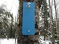
Blue blazes, where allowed, mark the path of the North Country Trail
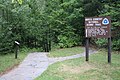
Sign in Wisconsin

Trail bridge crossing the Baltimore River at O Kun de Kun Falls in Michigan


See also[]
- Michigan Shore-to-Shore Trail
- Ohio River Trail
- North Coast Inland Trail
References[]
- ^ "2018 North Country Trail Progress Report". 2018. Retrieved February 11, 2019.
- ^ "Public Law 96-119" (PDF). US Government Publishing Office. March 5, 1980. Retrieved March 4, 2017.
- ^ "NCNST Route Adjustment Act Advocacy Update". North Country Trail Association. 14 February 2017. Retrieved March 5, 2017.
- ^ Murkowski, Lisa (2019-03-12). "Text - S.47 - 116th Congress (2019-2020): John D. Dingell, Jr. Conservation, Management, and Recreation Act". www.congress.gov. Retrieved 2019-04-02.
- ^ Associated Press (June 25, 2012). "Efforts under way to link Appalachian Trail with 4,600-mile trail to ND, nation's longest". Washington Post. Retrieved 25 June 2012.[dead link]
- ^ "Welcome to Wabash Cannonball Trail". Retrieved April 3, 2016.
- ^ "National Park Service, North Country Trail". Retrieved April 3, 2016.
- ^ "Buckeye Trail Association - Hike Ohio". Retrieved October 1, 2020.
- ^ "Explore the Trail - North Country Trail Association". Retrieved October 1, 2020.
External links[]
| Wikimedia Commons has media related to North Country Trail. |
- North Country Trail Association
- The North Country Trail on the National Park Service's website
- Journals from the North Country Trail
- North Country Trail Video produced by Wisconsin Public Television
| show Articles relating to North Country Trail |
|---|
| Authority control: National libraries |
|---|
- National Scenic Trails of the United States
- Long-distance trails in the United States
- Great Eastern Trail
- Hiking trails in New York (state)
- Hiking trails in Pennsylvania
- Hiking trails in Ohio
- Hiking trails in Michigan
- Hiking trails in Wisconsin
- Hiking trails in Minnesota
- Hiking trails in North Dakota
- Protected areas established in 1980