Budiná
Budiná | |
|---|---|
Municipality | |
 | |
 Budiná Location of Budiná in the Banská Bystrica Region | |
| Coordinates: 48°28′N 19°29′E / 48.467°N 19.483°ECoordinates: 48°28′N 19°29′E / 48.467°N 19.483°E | |
| Country | |
| Region | Banská Bystrica |
| District | Lučenec |
| First mentioned | 1393 |
| Area | |
| • Total | 17.3 km2 (6.7 sq mi) |
| Elevation | 629 m (2,064 ft) |
| Time zone | UTC+1 (CET) |
| • Summer (DST) | UTC+2 (CEST) |
| Postal code | 985 12 (pošta Tuhár) |
| Area code(s) | +421-47 |
| Car plate | LC |


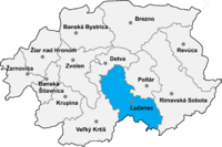
Location of Lučenec District in the Banská Bystrica Region
Budiná (Hungarian: Budaszállás) is a village and municipality in the Lučenec District in the Banská Bystrica Region of Slovakia.
History[]
In historical records, the village was first mentioned in 1393 (1393 Brtolehutaya, 1467 Budalehotha). It belonged to Divín castle. From 1554 to 1595 it suffered Turkish occupation.
External links[]
 Media related to Budiná at Wikimedia Commons
- https://web.archive.org/web/20071217080336/http://www.statistics.sk/mosmis/eng/run.html
- http://www.e-obce.sk/obec/budina/budina.html
| Authority control: National libraries |
|---|
This Banská Bystrica Region geography article is a stub. You can help Wikipedia by . |
Categories:
- Villages and municipalities in Lučenec District
- Banská Bystrica Region geography stubs