Bueng Kum district
This article needs additional citations for verification. (September 2018) |
Bueng Kum
บึงกุ่ม | |
|---|---|
 | |
 Khet location in Bangkok | |
| Coordinates: 13°47′7″N 100°40′9″E / 13.78528°N 100.66917°ECoordinates: 13°47′7″N 100°40′9″E / 13.78528°N 100.66917°E | |
| Country | Thailand |
| Province | Bangkok |
| Seat | Khlong Kum |
| Khwaeng | 3 |
| Khet established | 4 September 1989 |
| Area | |
| • Total | 24.311 km2 (9.387 sq mi) |
| Population (2017) | |
| • Total | 143,835[1] |
| • Density | 5,916.45/km2 (15,323.5/sq mi) |
| Time zone | UTC+7 (ICT) |
| Postal code | 10240 except Mu 9-12 Khwaeng Khlong Kum: 10230 |
| Geocode | 1027 |

Bueng Kum (Thai: บึงกุ่ม, pronounced [bɯ̄ŋ kùm]) is one of the 50 districts (Khet) of Bangkok, Thailand. From north clockwise, it is bounded by Bang Khen, Khan Na Yao, Saphan Sung, Bang Kapi, and Lat Phrao.
History[]
Bueng Kum was separated from Bang Kapi on 4 September 1989. It consisted of three sub-districts: Khlong Kum, Khan Na Yao, and Saphan Sung. On 14 October 1997, Khan Na Yao and Saphan Sung were elevated to districts, leaving Bueng Kum with a sole sub-district, Khlong Kum.
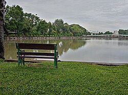
Bueng Kum was named so because of a lake ("bueng" means 'lake') used as water reservoir for flood prevention. There are also plants called "kum" (Crataeva sp.) around the lake. The lake is part of Seri Thai Park.
Administration[]
The district is divided into three sub-districts (khwaeng).
| 1. | Khlong Kum | คลองกุ่ม | |
| 2. | Nawamin | นวมินทร์ | |
| 3. | Nuan Chan | นวลจันทร์ |
District council[]
The District Council for Bueng Kum has seven members, who each serve four-year terms. Elections were last held on 6 June 2010. The results were:
- Democrat Party - Seven seats
Places[]
- , a public park
- Seri Thai Memorial Hall and Museum in Seri Thai Park
- Nawamin Phirom Park
References[]
- ^ "Population and House Report for Year 2017 (see page 2 for data of this district)". Department of Provincial Administration, Ministry of Internal Affairs. Retrieved 2018-04-01. (Search page)
External links[]

- Bueng Kum District
- Districts of Bangkok
- Bangkok stubs