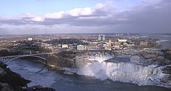
Buffalo Niagara Region
Buffalo Niagara Region | ||||
|---|---|---|---|---|
Eight-county region | ||||
| ||||
 Buffalo Niagara Region within New York State | ||||
| Country | United States | |||
| State | New York | |||
| Major cities | ||||
| Area | ||||
| • Metro | 5,413 sq mi (14,020 km2) | |||
| Highest elevation at Alma Hill | 2,548 ft (777 m) | |||
| Population (July 1, 2016 estimate) | ||||
| • Eight-county region | 1.54 million | |||
| • Density | 284/sq mi (110/km2) | |||
| Time zone | UTC−5 (Eastern) | |||
| • Summer (DST) | UTC−4 (EDT) | |||


The Buffalo Niagara Region is an economic region that is part of the Great Lakes region of North America, comprising much of Western New York in the United States. The Regional Institute of the University at Buffalo has defined the region as including the eight westernmost counties in New York.
The 8 counties in the region, as defined by Invest Buffalo Niagara, are:[1]
- Allegany County, New York
- Cattaraugus County, New York
- Chautauqua County, New York
- Erie County, New York
- Genesee County, New York
- Niagara County, New York
- Orleans County, New York
- Wyoming County, New York
See also[]
- Western New York
- Southern Ontario
- Niagara Peninsula
- Holland Purchase
- Finger Lakes
- Southern Tier
- Central New York
- Golden Horseshoe
References[]
- ^ "Buffalo Niagara - Buffalo Niagara Region". www.buffaloniagara.org. Retrieved 2017-09-08.
Coordinates: 43°00′N 79°00′W / 43.000°N 79.000°W

This New York state location article is a stub. You can help Wikipedia by . |
Categories:
- Regions of New York (state)
- Great Lakes
- New York (state) geography stubs