Buru Regency
Buru Regency
Kabupaten Buru | |
|---|---|
 Coat of arms | |
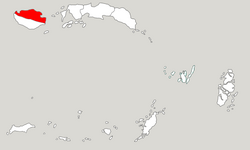 Location within Maluku | |
| Coordinates: 3°19′40″S 126°41′03″E / 3.3277°S 126.6841°ECoordinates: 3°19′40″S 126°41′03″E / 3.3277°S 126.6841°E | |
| Country | |
| Province | |
| Capital | Namlea |
| Government | |
| • Regent | Ramly I. Umasugi |
| • Vice Regent | Amustofa Besan |
| Area | |
| • Total | 7,595.58 km2 (2,932.67 sq mi) |
| Population (2020 Census)[1] | |
| • Total | 135,238 |
| • Density | 18/km2 (46/sq mi) |
| Time zone | UTC+9 (IEST) |
| Area code | (+62) 913 |
| Website | burukab |


Buru Regency is a regency of Maluku province, Indonesia. When created the regency encompassed the entire island (plus outlying islands, of which is the largest); but in 2008 the southern 40% of the island was split off to form a separate Buru Selatan (South Buru) Regency. The residual Buru Regency comprises the northern half of the island of Buru and covers an area of 7,595.58 km2. The population at the 2010 Census was 108,445[2] and at the 2020 Census this had increased to 135,238.[3] The principal town lies at Namlea.
Administrative Districts[]
At the time of the 2010 Census the Buru Regency was divided into five districts (kecamatan), but subsequently this has been increased to ten districts by the splitting of the existing districts. The ten districts are tabulated below with their areas and their populations at the 2010 Census[4] and the 2020 Census.[5] The table also includes the location of the district headquarters, the number of administrative villages (rural desa and urban kelurahan) in each district, and its postal codes.
| District Name |
Area in km2 |
Pop'n Census 2010 |
Pop'n Census 2020 |
Admin centre |
Number of villages |
Post codes |
|---|---|---|---|---|---|---|
| Namlea | 951.15 | 37,218 | 36,680 | Namlea | 7 | 97571 |
| Waeapo (a) | 102.50 | 34,153 | 12,040 | Waenetat | 7 | 97578 |
| Waplau | 585.23 | 10,000 | 12,698 | Waplau | 10 | 97573 |
| Bata Bual (b) | 108.60 | 8,147 | 9,439 | Ilath | 5 | 97574 |
| Teluk Kaiely (Kaiely Bay) |
141.08 | (c) | 3,998 | Kaiely | 5 | 97577 |
| Waelata | 234.50 | (c) | 13,581 | Basakale | 10 | 97579 |
| Lolong Guba | 457.02 | (c) | 12,465 | Kubalahin | 10 | 97576 |
| Lilialy | 481.50 | (c) | 11,208 | Sawa | 5 | 97570 |
| Air Buaya | 1,702.35 | 18,927 | 12,019 | Air Buaya | 10 | 97572 |
| Fena Leisela | 2,831.65 | (c) | 11,190 | Wainlana | 13 | 97575 |
| Totals | 7,595.58 | 108,445 | 135,238 | 82 |
Notes: (a) including the offshore islands of Pulau Nirwana Besar and Pulau Nirwana Kecil. (b) including the offshore island of Pulau Batukapal. (c) the 2010 populations of these new districts are included in the figures for the districts from which they were split away.
References[]
This article about a location in Maluku Province is a stub. You can help Wikipedia by . |
- Regencies of Maluku (province)
- Maluku (province) geography stubs