West Seram Regency
West Seram Regency
Kabupaten Seram Bagian Barat | |
|---|---|
 Coat of arms | |
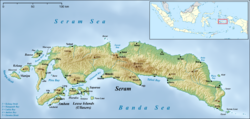
 Location within Maluku | |
| Coordinates: 3°06′10″S 128°25′48″E / 3.1027°S 128.4300°ECoordinates: 3°06′10″S 128°25′48″E / 3.1027°S 128.4300°E | |
| Country | Indonesia |
| Province | Maluku |
| Capital | Piru |
| Government | |
| • Regent | Jacobus F. Puttileihalat |
| • Vice Regent | Timotius Akerina |
| Area | |
| • Total | 6,948.4 km2 (2,682.8 sq mi) |
| Population (2020 Census)[1] | |
| • Total | 212,393 |
| • Density | 31/km2 (79/sq mi) |
| Time zone | UTC+9 (IEST) |
| Area code | (+62) 911 |
| Website | sbbkab |


West Seram Regency is a regency of Maluku, Indonesia. It is mainly located on the island of Seram, but includes various islands lying to the west of Seram - Manipa, Kelang, Boano and the smaller Babi, Pua and Marsegu. It covers a land area of 6,948.40 km2, and had a population of 164,654 at the 2010 Census[2] and 212,393 at the 2020 Census.[3] The principal town lies at Piru.
Administrative districts[]
At the time of the 2010 Census the regency was divided into four districts (kecamatan). Subsequent to 2010, seven additional districts have been created by the division of the original four districts, so that the regency is now divided into eleven districts. These are tabulated below with their areas and populations at the 2010 Census and 2020 Census.[4] The table also includes the location of the district headquarters.
| Name | Area in km2 |
Population Census 2010 |
Population Census 2020 |
Admin centre |
|---|---|---|---|---|
| Huamual Belakang | 409.65 | 25,629 | 33,132 | Waesah |
| Kepulauan Manipa (Manipa Islands) |
159.71 | 5,810 | 7,165 | Masawoi |
| Seram Barat (West Seram) |
503.33 | 27,311 | 35,045 | Piru |
| Huamual | 1,162.99 | 34,919 | 49,097 | Luhu |
| Kairatu | 329.65 | 23,240 | 27,040 | Kairatu |
| Kairatu Barat (West Kairatu) |
132.25 | 13,146 | 14,478 | Kamal |
| Inamosol | 504.61 | 5,311 | 6,422 | Honitetu |
| Amalatu | 665.35 | 10,979 | 12,537 | Latu |
| Elpaputih | 1,165.74 | 1,453 | 5,233 | Elpaputih |
| Taniwel | 1,181.32 | 12,133 | 15,448 | Taniwel |
| Taniwel Timur (East Taniwel) |
733.80 | 5,375 | 6,796 | Uwen Pantai |
| Totals | 6,948.40 | 164,654 | 212,393 |
References[]
External links[]
| Wikimedia Commons has media related to West Seram Regency. |
| show Authority control |
|---|
- West Seram Regency