Byram River
| Byram River | |
|---|---|
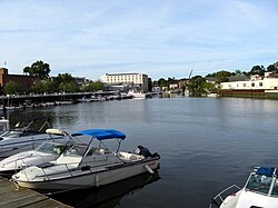 The harbor | |
| Location | |
| Country | United States |
| State | Connecticut, New York |
| County | Westchester County, Fairfield County |
| Physical characteristics | |
| Source | |
| • location | North Castle, New York |
| • coordinates | 41°09′19″N 73°41′33″W / 41.1554°N 73.6925°W |
| • elevation | 750 feet (230 m) |
| Mouth | |
• location | Port Chester, New York, Greenwich, Connecticut |
• coordinates | 40°59′18″N 73°39′37″W / 40.9884°N 73.6604°WCoordinates: 40°59′18″N 73°39′37″W / 40.9884°N 73.6604°W |
• elevation | 0 feet (0 m) |
| Length | 13.9 miles (22.4 km) |
| Basin size | 29 square miles (75 km2) |


The Byram River is a river approximately 13.9 miles (22.4 km) in length,[1] in southeast New York and southwestern Connecticut in the United States.
The river has an elevation of 750 feet (230 m) at its headwaters at Byram Lake in Westchester County, New York, and flows in a southward direction, crossing the New York-Connecticut border and eventually reaching sea level at Port Chester Harbor, where it empties into the Long Island Sound. The lower portion of the river is paralleled by the Merritt Parkway in Connecticut and eventually forms the southernmost portion of the New York-Connecticut border.
The river has a 29-square-mile (75 km2) drainage basin.[2]
There are several dams on the river which are controlled by the Town of Greenwich.[2]
Several bridges cross the river. As of the summer of 2007, three of the bridges in northwest Greenwich had been identified by state inspectors as in critical need of repair, and all were scheduled for work:[3]
- Bailiwick Road — already in poor shape, the bridge was further damaged by the nor'easter of April 15, 2007. In May emergency repairs were made. A redesign of the bridge may be needed to better protect against future flooding, town officials said.[3]
- Riversville Road — Greenwich officials imposed weight restrictions on the bridge which were in effect in the summer of 2007. Dump trucks are prohibited from using it, but 10-ton box trucks and 15-ton semis are allowed.[3]
- Sherwood Avenue — Greenwich officials imposed weight restrictions on the bridge which were in effect in the summer of 2007. Only 15-ton box trucks and 26-ton semis are allowed.[3]
History[]
The Byram River was once a center of economic activity where shipbuilding and fishing were major industries. The Byram section of Greenwich is at the southern end of the river, on the Connecticut side.
On April 15, 2007, a nor'easter flooded areas near the river on both the Connecticut and New York sides. In July 2007, Greenwich town officials gave initial approval for spending $250,000 to study drainage improvement in flood-prone areas near the river, including the idea of dredging the river.[2]
See also[]
References[]
- ^ U.S. Geological Survey. National Hydrography Dataset high-resolution flowline data. The National Map Archived 2012-04-05 at WebCite, accessed April 1, 2011
- ^ a b c Vigdor, Neil, "Car dealership: Greenwich should pay flood bills: Town officials reviewing claim concerning damage from nor'easter", article in The Advocate of Stamford, Connecticut, August 7, 2007, p A3, Stamford edition, the article likely also appeared the same day in the Greenwich Time newspaper, owned by the same company
- ^ a b c d Nguyen, Hoa, "Greenwich plans repairs on three bridges that cross the Byram River", article in The Advocate of Stamford, Connecticut, August 7, 2007, page A6; the article probably appeared the same day in the Greenwich Time, a newspaper owned by the same company
External links[]
- Rivers of Westchester County, New York
- Port Chester, New York
- Greenwich, Connecticut
- Rivers of Fairfield County, Connecticut
- Rivers of Connecticut
- Rivers of New York (state)
- Borders of New York (state)
- Borders of Connecticut