Camuñas
This article does not cite any sources. (December 2017) |
Camuñas, Spain | |
|---|---|
 Seal | |
 | |
| Country | Spain |
| Autonomous community | Castile-La Mancha |
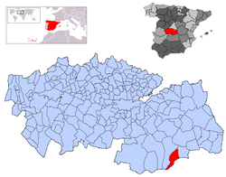
| Province | Toledo |
| Municipality | Camuñas |
| Area | |
| • Total | 102.03 km2 (39.39 sq mi) |
| Elevation | 674 m (2,211 ft) |
| Population (2018)[1] | |
| • Total | 1,740 |
| • Density | 17/km2 (44/sq mi) |
| Time zone | UTC+1 (CET) |
| • Summer (DST) | UTC+2 (CEST) |
Camuñas is a municipality located in the province of Toledo, Castile-La Mancha, Spain. According to the 2006 census (INE), the municipality had a population of 1856 inhabitants.
Toponymy[]
The noun "Camuñas" is said to come from the Arabic word kammuniya which has two meanings: one is "similar to cumin" and the other "all species of seed which is neither cereal nor legume". The name is probably taken as an anthropological nickname from the repopulator of the area during the Reconquista.
Geography[]
The village is located in the hillside of the mountain Cabeza-gorda (literally fat head), in the left bank of Amarguillo river in La Mancha region. It borders with the villages of Puerto Lápice and Herencia, in the province of Ciudad Real, and Madridejos and Villafranca de los Caballeros, in the Toledo one.
The municipality consists on a wide meseta. The southern part is less plain, with precipices, gorges and mountains that reach 1,000 meters high. In the west can be found a meadow that reaches Amarguillo river, and the hill called Cañada de las Vacas, extended in both sides of the expressway autovía del Sur. In the right side of the road there is a hill in whose top there are three entrances to old mines, one of them of huge depth.
References[]
- ^ Municipal Register of Spain 2018. National Statistics Institute.
Coordinates: 39°25′N 3°27′W / 39.417°N 3.450°W

| show Municipalities in the province of Toledo |
|---|
| show Authority control |
|---|
This article about a location in the autonomous community of Castilla–La Mancha, Spain is a stub. You can help Wikipedia by . |
- Municipalities in the Province of Toledo
- Castilla–La Mancha geography stubs