Capannori
Capannori | |
|---|---|
| Comune di Capannori | |
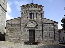 Pieve of San Gennaro. | |
 Coat of arms | |
 Capannori within the Province of Lucca | |
show Location of Capannori | |
 Capannori Location of Capannori in Italy | |
| Coordinates: 43°51′N 10°34′E / 43.850°N 10.567°ECoordinates: 43°51′N 10°34′E / 43.850°N 10.567°E | |
| Country | Italy |
| Region | Tuscany |
| Province | Lucca (LU) |
| Frazioni | see list |
| Government | |
| • Mayor | Luca Menesini |
| Area | |
| • Total | 155.96 km2 (60.22 sq mi) |
| Elevation | 15 m (49 ft) |
| Population (31 March 2017)[3] | |
| • Total | 46,177 |
| • Density | 300/km2 (770/sq mi) |
| Demonym(s) | Capannoresi |
| Time zone | UTC+1 (CET) |
| • Summer (DST) | UTC+2 (CEST) |
| Postal code | 55012 |
| Dialing code | 0583 |
| Website | Official website |


Capannori (Italian pronunciation: [kaˈpannori]) is an Italian town and comune in the province of Lucca, in northern Tuscany.
History[]
The 40 hamlets of Capannori are located on the lands that once corresponded to the eastern territories of the Republic of Lucca. Most of those hamlets date back to medieval times.
Colognora di Compito was featured in the 2008 film Miracle at St. Anna.
Geography[]
Overview[]
Located in south of its province, next to the provinces of Pisa and Pistoia, the municipality borders with Altopascio, Bientina, Borgo a Mozzano, Buti, Calci, Lucca, Montecarlo, Pescia, Porcari, San Giuliano Terme, and Villa Basilica.
Frazioni[]

Capannori counts 40 hamlets (frazioni).
The most populated village is not the town of Capannori, but the hamlet of Marlia (5,000 inhabitants).
The hamlets of Capannori are: Badia di Cantignano, Camigliano, Carraia, Castelvecchio di Compito, (de:Colle di Compito; the site of prisoner-of-war camp PG 60 during World War II), Colognora di Compito, Coselli, Gragnano, Guamo, Lammari, Lappato, Lunata, Marlia, Massa Macinaia, Matraia, Paganico, Parezzana, Petrognano, Pieve di Compito, Pieve San Paolo, Ruota, Sant'Andrea di Compito (pop. 250), Sant'Andrea in Caprile, San Colombano, San Gennaro, San Ginese di Compito, San Giusto di Compito, San Leonardo in Treponzio, Santa Margherita, San Martino in Colle, San Pietro a Marcigliano, Segromigno in Monte, Segromigno in Piano, , Toringo, Tofori, Valgiano, Verciano, Vorno, and Zone.
Main sights[]
The area is characterized by the number of distinctive towers (once used to communicate). Main sights include:
- Aqueduct of Nottolini, Lucca
- Oasi WWF del Bottaccio[4]
- Quercia delle Streghe[5]
- Villa Reale di Marlia
- Villa Torrigiani
- Villa Mansi
- Villa Grabau
- Santi Quirico e Giulitta—12th-century church

Villa Reale, in the frazione of Marlia.

Castelvecchio di Compito


Twin cities[]
References[]
- ^ "Superficie di Comuni Province e Regioni italiane al 9 ottobre 2011". Istat. Retrieved 16 March 2019.
- ^ "Popolazione Residente al 1° Gennaio 2018". Istat. Retrieved 16 March 2019.
- ^ (in Italian) Source: Istat 2011
- ^ Oasi WWF del Bottaccio
- ^ Quercia delle Streghe
- ^ https://www.youtube.com/watch?v=mVTHujvw-x8
External links[]
- Capannori official website (in Italian)
- The Tourism Portal of Capannori (in English)
| show Authority control |
|---|
- Cities and towns in Tuscany
- Municipalities of the Province of Lucca