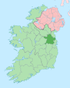
Carlanstown
Carlanstown
Droichead Chearbhalláin | |
|---|---|
Village | |
 Carlanstown Location in Ireland | |
| Coordinates: 53°45′34″N 6°50′27″W / 53.75944°N 6.84083°WCoordinates: 53°45′34″N 6°50′27″W / 53.75944°N 6.84083°W | |
| Country | Ireland |
| Province | Leinster |
| County | County Meath |
| Population (2016)[1] | 664 |
| Time zone | UTC+0 (WET) |
| • Summer (DST) | UTC-1 (IST (WEST)) |
Carlanstown (Irish: Droichead Chearbhalláin)[2] is a village and townland in County Meath, Ireland.[3] It is located approximately 4 km northeast of the larger town of Kells, County Meath on the N52 road. As of the 2016 census, there were 664 people living in the village.[1]
The Moynalty River, which flows to the south of the village, is spanned by Carlanstown Bridge which dates to c.1800.[4] The local national (primary) school, Scoil Mhuire Carlanstown, was built in the mid-1940s.[5]
References[]
- ^ a b "Sapmap Area - Settlements - Carlanstown". Census 2016. Central Statistics Office. April 2016. Retrieved 11 February 2020.
- ^ "Droichead Chearbhalláin / Carlanstown". logainm.ie. Irish Placenames Commission. Retrieved 12 February 2020.
- ^ "Carlanstown Townland, Co. Meath". townlands.ie. Townlands Ireland. Retrieved 12 February 2020.
- ^ "Carlanstown Bridge, Carlanstown, County Meath". buildingsofireland.ie. National Inventory of Architectural Heritage. Retrieved 12 February 2020.
- ^ "Carlanstown National School, Carlanstown, County Meath". buildingsofireland.ie. National Inventory of Architectural Heritage. Retrieved 12 February 2020.
Categories:
- Towns and villages in County Meath
- Ireland geography stubs

