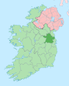
Kildalkey
Kildalkey
Cill Dealga | |
|---|---|
 St Dympna's Church, Kildalkey | |
 Kildalkey Location in Ireland | |
| Coordinates: 53°34′13″N 6°54′11″W / 53.5703°N 6.9031°WCoordinates: 53°34′13″N 6°54′11″W / 53.5703°N 6.9031°W | |
| Country | Ireland |
| Province | Leinster |
| County | County Meath |
| Population (2016)[1] | 708 |
| Time zone | UTC+0 (WET) |
| • Summer (DST) | UTC-1 (IST (WEST)) |
| Irish Grid Reference | N724586 |
Kildalkey or Kildalky (Irish: Cill Dealga, meaning 'Dealga's church')[2] is a village and a parish in the Barony of Lune, county and diocese of Meath, Ireland.
Population[]
The population of the village was 149 at the time of the 1996 Census. By the time of the 2002 census, the village had grown significantly, more than tripling in population to 518 inhabitants. The population recorded in the 2011 census shows Kildalkey then had a population of 663, a 28% increase from 2006.[3] The census of 2016 showed a further rise in the population to 708.[4]
History[]
The patron saint is Saint Dymphna, to whom the Catholic church is dedicated. Designed by the architect , it was consecrated in 1898. The Protestant church, by the architect Joseph Welland (1798-1860), was consecrated in 1856 and was situated at , 2 miles west of the village. It was demolished in the 1960s. Christianity came to Kildalkey in the 5th century when St Mo-Luog founded a monastery there and the parish is mentioned in the Book of Kells. A section of the Pale runs through the parish.
A castle (or tower-house) dating from c.1430, which was built by the Nugent family, is at Moyrath. There are twenty-one townlands, all of which are listed with their residents in Griffith's Valuation of 1854. These are: Balaghtalion, Ballynadrimna, Baskinagh Lower, Baskinagh Upper, Cloncarneel, Clonmore, Clonylogan, Corballis, Kildalkey Town, Lady Island, Moat Town, Moyrath, Neillstown, Portanab, Pubblestown, Rathcormick, Rathkeena, Shanco, Woodtown Abbot and Woodtown West.[5] The following families are historically associated with the parish: Barnewall, Nangle, Nugent, and Potterton. The principal landlords in the parish were the Earls of Darnley although William Conolly (commonly known as Speaker Conolly) and later Henry Grattan held Moyrath.
Education[]
As of 2016 there is only a primary school in Kildalkey, meaning children have to go to the next towns of Athboy and Trim or further afield to attend secondary school. The primary school is on the main street of Kildalkey and is split into two buildings, informally dubbed 'School One' and 'School Two'.[citation needed]
Further reading[]
- Samuel Lewis, 'A Topographical Dictionary of Ireland' (1837), vol 2, p. 79
- O Falsey, 'Kildalkey: a Parish History' (2001)
- H Potterton, 'Rathcormick: a childhood recalled' (2001)
- H Potterton, 'Potterton People and Places: three centuries of an Irish family' (2006).
References[]
- ^ "Sapmap Area - Settlements - Kildalkey". Census 2016. Central Statistics Office. April 2016. Retrieved 16 February 2020.
- ^ "Cill Dealga / Kildalkey". logainm.ie. Irish Placenames Commission. Retrieved 16 February 2020.
- ^ "CSO - Census 2011 Vol 1 and Profile 1 - Table5" (PDF).
- ^ "Kildalkey (Ireland) Census Town". citypopulation.de. Retrieved 16 February 2020.
- ^ "Kildalkey civil parish, Meath - Records". johngrenham.com.
- Towns and villages in County Meath


