Carnide
Carnide | |
|---|---|
      | |
 Coat of arms | |
 | |
| Coordinates: 38°45′36″N 9°11′20″W / 38.760°N 9.189°WCoordinates: 38°45′36″N 9°11′20″W / 38.760°N 9.189°W | |
| Country | |
| Region | Lisboa |
| Metropolitan area | Lisbon |
| District | Lisbon |
| Municipality | Lisbon |
| Area | |
| • Total | 3.69 km2 (1.42 sq mi) |
| Population (2011) | |
| • Total | 19,218 |
| • Density | 5,200/km2 (13,000/sq mi) |
| Time zone | UTC±00:00 (WET) |
| • Summer (DST) | UTC+01:00 (WEST) |
| Website | http://www.jf-carnide.pt/ |

Carnide (Portuguese pronunciation: [kɐɾˈniðɨ]) is a freguesia (civil parish) and district of Lisbon, the capital of Portugal. Located in northern Lisbon, Carnide is north of São Domingos de Benfica and Benfica, east of Lumiar, and directly south of Lisbon's border with Odivelas. The population in 2011 was 19,218,[1][2]
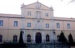
Landmarks[]
References[]
- ^ Instituto Nacional de Estatística (INE), Census 2011 results according to the 2013 administrative division of Portugal
- ^ "Áreas das freguesias, concelhos, distritos e país". Archived from the original on 2018-11-05. Retrieved 2018-11-05.
| show Freguesias (Civil Parishes) of Lisbon |
|---|
| Authority control |
|
|---|
This Lisbon location article is a stub. You can help Wikipedia by . |
Categories:
- Parishes of Lisbon
- Lisbon geography stubs