Carter Lake (Iowa–Nebraska)
| Carter Lake | |
|---|---|
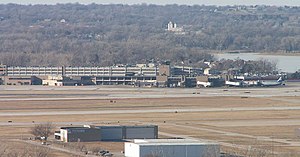
 Carter Lake, as viewed from Nebraska | |
 Carter Lake | |
| Location | Omaha, Nebraska / Carter Lake, Iowa, United States |
| Coordinates | 41°18′6.8″N 95°54′53.7″W / 41.301889°N 95.914917°WCoordinates: 41°18′6.8″N 95°54′53.7″W / 41.301889°N 95.914917°W |
| Type | Oxbow lake |
| Basin countries | United States |
| Surface area | 32 acres (13 ha) |
| Average depth | 6 ft (2 m) |
| Max. depth | 24 ft (7 m) |
| Surface elevation | 977 ft (298 m) |
| Settlements | Carter Lake, Iowa Omaha, Nebraska |


Carter Lake is a shallow oxbow lake in Nebraska and Iowa, located next to Omaha and Carter Lake in the United States. Soon after its formation the lake was called the East Omaha Lake, and then Lake Nakoma.
History[]
Carter Lake is a former channel of the Missouri River and was formed in the summer of 1877. The city of Carter Lake, Iowa takes its name from the lake. The lake was formed from the Saratoga Bend in the Missouri River.
The Saratoga Bend was the impetus for the creation of the town of Saratoga, Nebraska Territory, a short mile from the river. However, the Bend was cut off from the river after a flood in 1877. A beach resort with a large boathouse and two-story pavilion, a Rod and Gun Club, and a YMCA camp had all settled on the shores of Lake Nakoma by 1906.[1]
The Carter Lake and Levi Carter Park at 3100 Abbott Drive were named after one of Omaha's original industrialists named , who ran a white lead smelter in the area.
See also[]
- East Omaha, Nebraska
- Carter Lake, Iowa
- Saratoga, Nebraska Territory
- History of North Omaha, Nebraska
References[]
- ^ "Levi Carter Park". City of Omaha Parks and Recreation. Archived from the original on April 10, 2009. Retrieved December 30, 2008.
External links[]
- History of Carter Lake with pictures and maps
- Historical photo of canoeing and of the Omaha Rod & Gun Club Cabins at Lake Nakoma (Carter Lake)
- U.S. Geological Survey Geographic Names Information System: Carter Lake (Iowa–Nebraska)
This Douglas County, Nebraska state location article is a stub. You can help Wikipedia by . |
This article about the geography of Pottawattamie County, Iowa is a stub. You can help Wikipedia by . |
This article related to a lake in the United States is a stub. You can help Wikipedia by . |
- Geography of Omaha, Nebraska
- Bodies of water of Pottawattamie County, Iowa
- Bodies of water of Douglas County, Nebraska
- Landmarks in North Omaha, Nebraska
- Oxbow lakes of the United States
- Lakes of Iowa
- Lakes of Nebraska
- Parks in Omaha, Nebraska
- Missouri River
- Defunct resorts
- Borders of Iowa
- Borders of Nebraska
- Eastern Nebraska geography stubs
- South Iowa geography stubs
- United States geography stubs
- Lake stubs