Cartwright, Oklahoma
Cartwright, Oklahoma | |
|---|---|
Rural Community | |
Top to bottom, left to right: Viewing east on Oklahoma State Highway 91 in Cartwright, the city's United States Postal Service post office, and the Texoma Inn | |
| Coordinates: 33°51′10.41″N 96°33′42.448″W / 33.8528917°N 96.56179111°WCoordinates: 33°51′10.41″N 96°33′42.448″W / 33.8528917°N 96.56179111°W | |
| Country | |
| State | |
| County | Bryan |
| Area | |
| • Total | 2.371 sq mi (6.14 km2) |
| • Land | 2.37 sq mi (6.1 km2) |
| • Water | 0.01 sq mi (0.03 km2) |
| Population (2010) | |
| • Total | 609 |
| Time zone | UTC-6 (Central (CST)) |
| • Summer (DST) | UTC-5 (CDT) |
| ZIP code | 74731 |
| Area code(s) | 580 |
Cartwright is an unincorporated rural community and census-designated place in Bryan County, Oklahoma, United States. As of the 2010 census it had a population of 609.[1] The post office opened April 25, 1940, and it is one of the newest communities in Bryan County. The ZIP code is 74731.
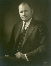
It is named for Congressman Wilburn Cartwright. Cartwright was established because of the construction of Denison Dam when a community of shelters for workmen was erected.

Overview[]
In Cartwright for the years 2010–2014, the median household income is $27,212 and the median house value is $101,500. The median year that a house in Cartwright was built is 1983. Cartwright's population density is 267.77 inhabitants per square mile (103.39/km2); whites make up 78.49% of the total population. The average temperature of Cartwright is 62.50 °F (16.94 °C).[2]
References[]
- ^ "Geographic Identifiers: 2010 Demographic Profile Data (G001): Cartwright CDP, Oklahoma". U.S. Census Bureau, American Factfinder. Archived from the original on February 12, 2020. Retrieved February 24, 2014.
- ^ "USA.com Basic Information about Cartwright, Oklahoma". USA.com. Retrieved January 24, 2018.
Further reading[]
- Shirk, George H. Oklahoma Place Names. Norman: University of Oklahoma Press, 1987. ISBN 0-8061-2028-2.
- Census-designated places in Bryan County, Oklahoma
- Census-designated places in Oklahoma
- Oklahoma geography stubs


