Cass Township, Dubois County, Indiana
Cass Township | |
|---|---|
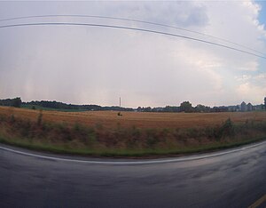 Countryside from U.S. 231 in Cass Township | |
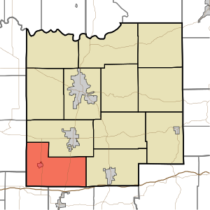 Location of Cass Township in Dubois County | |
| Coordinates: 38°14′31″N 87°00′20″W / 38.24194°N 87.00556°WCoordinates: 38°14′31″N 87°00′20″W / 38.24194°N 87.00556°W | |
| Country | United States |
| State | Indiana |
| County | Dubois |
| Government | |
| • Type | Indiana township |
| Area | |
| • Total | 38.87 sq mi (100.7 km2) |
| • Land | 38.54 sq mi (99.8 km2) |
| • Water | 0.33 sq mi (0.9 km2) |
| Elevation | 561 ft (171 m) |
| Population (2010) | |
| • Total | 2,115 |
| • Density | 54.9/sq mi (21.2/km2) |
| FIPS code | 18-10684[2] |
| GNIS feature ID | 453163 |

Cass Township is one of twelve townships in Dubois County, Indiana. As of the 2010 census, its population was 2,115 and it contained 873 housing units.[3]
History[]
Cass Township was created from land given by Patoka Township.[4]
Geography[]
According to the 2010 census, the township has a total area of 38.87 square miles (100.7 km2), of which 38.54 square miles (99.8 km2) (or 99.15%) is land and 0.33 square miles (0.85 km2) (or 0.85%) is water.[3]
Cities and towns[]
Unincorporated towns[]
(This list is based on USGS data and may include former settlements.)
Adjacent townships[]
- Patoka Township (north)
- Ferdinand Township (east)
- Carter Township, Spencer County (southeast)
- Pigeon Township, Warrick County (southwest)
- Lockhart Township, Pike County (west)
Major highways[]
Cemeteries[]
The township contains eleven cemeteries: Augustana, Holland Methodist, Mount Vernon, Mount Zion, Saint Henry, Saint James (East and West), Saint Paul United Church of Christ, Stone Family Cemetery, Wibbeler Family Cemetery, Zoar Methodist (partially in Pike County).
References[]
- "Cass Township, Dubois County, Indiana". Geographic Names Information System. United States Geological Survey. Retrieved 2009-09-24.
- United States Census Bureau cartographic boundary files
- ^ "US Board on Geographic Names". United States Geological Survey. 2007-10-25. Retrieved 2008-01-31.
- ^ "U.S. Census website". United States Census Bureau. Retrieved 2008-01-31.
- ^ a b "Population, Housing Units, Area, and Density: 2010 - County -- County Subdivision and Place -- 2010 Census Summary File 1". United States Census. Archived from the original on 2020-02-12. Retrieved 2013-05-10.
- ^ Wilson, George R. (1910). History of Dubois County from Its Primitive Days to 1910. Windmill Publications. pp. 368.
External links[]
Municipalities and communities of Dubois County, Indiana, United States | ||
|---|---|---|
| Cities | ||
| Towns | ||
| Townships | ||
| CDP | ||
| Other unincorporated communities | ||
| Ghost town | ||
| Footnotes | ‡This populated place also has portions in an adjacent county or counties | |
| ||
- Townships in Dubois County, Indiana
- Jasper, Indiana micropolitan area
- Townships in Indiana