Castelar
Castelar | |
|---|---|
City | |
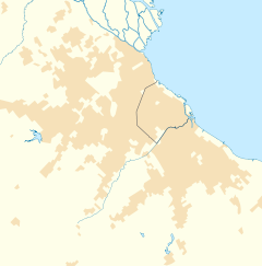 Castelar Location in Greater Buenos Aires | |
| Coordinates: 34°40′S 58°40′W / 34.667°S 58.667°WCoordinates: 34°40′S 58°40′W / 34.667°S 58.667°W | |
| Country | |
| Province | |
| Partido | |
| Declared city | 1971 |
| Elevation | 28 m (92 ft) |
| Population | |
| • Total | 104,019 |
| CPA Base | B 1712 |
| Area code(s) | +54 11 |

Castelar is a city in Morón Partido (county), Buenos Aires Province, Argentina, some 30 km west of the nation's capital, the autonomous city of Buenos Aires. It forms part of the Greater Buenos Aires metropolitan area.
Castelar is the westernmost city of the Morón Partido, and borders on Ituzaingó Partido.
Climate[]
| hideClimate data for Castelar | |||||||||||||
|---|---|---|---|---|---|---|---|---|---|---|---|---|---|
| Month | Jan | Feb | Mar | Apr | May | Jun | Jul | Aug | Sep | Oct | Nov | Dec | Year |
| Record high °C (°F) | 38.0 (100.4) |
38.1 (100.6) |
38.3 (100.9) |
33.0 (91.4) |
29.7 (85.5) |
26.5 (79.7) |
31.1 (88.0) |
34.0 (93.2) |
31.7 (89.1) |
32.6 (90.7) |
35.2 (95.4) |
40.0 (104.0) |
40.0 (104.0) |
| Average high °C (°F) | 29.8 (85.6) |
29.1 (84.4) |
26.2 (79.2) |
22.6 (72.7) |
19.3 (66.7) |
15.4 (59.7) |
15.4 (59.7) |
16.8 (62.2) |
19.0 (66.2) |
21.3 (70.3) |
25.0 (77.0) |
28.1 (82.6) |
22.3 (72.1) |
| Daily mean °C (°F) | 23.5 (74.3) |
22.8 (73.0) |
20.1 (68.2) |
16.5 (61.7) |
13.4 (56.1) |
10.0 (50.0) |
10.2 (50.4) |
11.2 (52.2) |
13.5 (56.3) |
15.9 (60.6) |
19.5 (67.1) |
21.9 (71.4) |
16.5 (61.7) |
| Average low °C (°F) | 16.9 (62.4) |
16.8 (62.2) |
14.5 (58.1) |
11.1 (52.0) |
8.3 (46.9) |
5.9 (42.6) |
5.9 (42.6) |
5.9 (42.6) |
8.0 (46.4) |
10.5 (50.9) |
13.7 (56.7) |
15.7 (60.3) |
11.1 (52.0) |
| Record low °C (°F) | 6.5 (43.7) |
6.0 (42.8) |
3.3 (37.9) |
0.9 (33.6) |
−3.7 (25.3) |
−5.5 (22.1) |
−6.2 (20.8) |
−4.8 (23.4) |
−3.0 (26.6) |
−2.0 (28.4) |
1.5 (34.7) |
3.6 (38.5) |
−6.2 (20.8) |
| Average precipitation mm (inches) | 86 (3.4) |
84 (3.3) |
135 (5.3) |
99 (3.9) |
66 (2.6) |
49 (1.9) |
49 (1.9) |
67 (2.6) |
51 (2.0) |
109 (4.3) |
86 (3.4) |
114 (4.5) |
995 (39.2) |
| Average relative humidity (%) | 62 | 65 | 71 | 77 | 79 | 81 | 80 | 74 | 71 | 71 | 69 | 65 | 72 |
| Mean monthly sunshine hours | 310.0 | 265.6 | 248.0 | 216.0 | 189.1 | 135.0 | 151.9 | 186.0 | 204.0 | 229.4 | 273.0 | 291.4 | 2,699.4 |
| Percent possible sunshine | 70 | 71 | 66 | 64 | 59 | 46 | 48 | 55 | 58 | 57 | 64 | 65 | 60 |
| Source 1: UNLP[1][2] | |||||||||||||
| Source 2: Oficina de Riesgo Agropecuario (record highs and lows)[3] | |||||||||||||
See also[]
- 2013 Castelar train crash
References[]
- ^ "Resumen datos bioclimáticos–Castelar" (PDF) (in Spanish). Universidad Nacional de La Plata. Retrieved June 15, 2015.
- ^ "Datos bioclimáticos de 173 localidades argentinas". Atlas Bioclimáticos (in Spanish). Universidad Nacional de La Plata. Retrieved July 4, 2016.
- ^ "Castelar, Buenos Aires". Estadísticas meteorológicas decadiales (in Spanish). Oficina de Riesgo Agropecuario. Retrieved June 15, 2015.
External links[]
| Wikimedia Commons has media related to Castelar. |
- (in Spanish) Castelar railway station on Google Maps
- (in Spanish) Castelar Digital
- (in Spanish) Historia y actualidad de Moron, Argentina
| Authority control |
|
|---|
This article about a place in Buenos Aires Province, Argentina is a stub. You can help Wikipedia by . |
Categories:
- Morón Partido
- Populated places in Buenos Aires Province
- Cities in Argentina
- Buenos Aires Province geography stubs